Bunorica, Čižići (Krk) Beach, Croatia
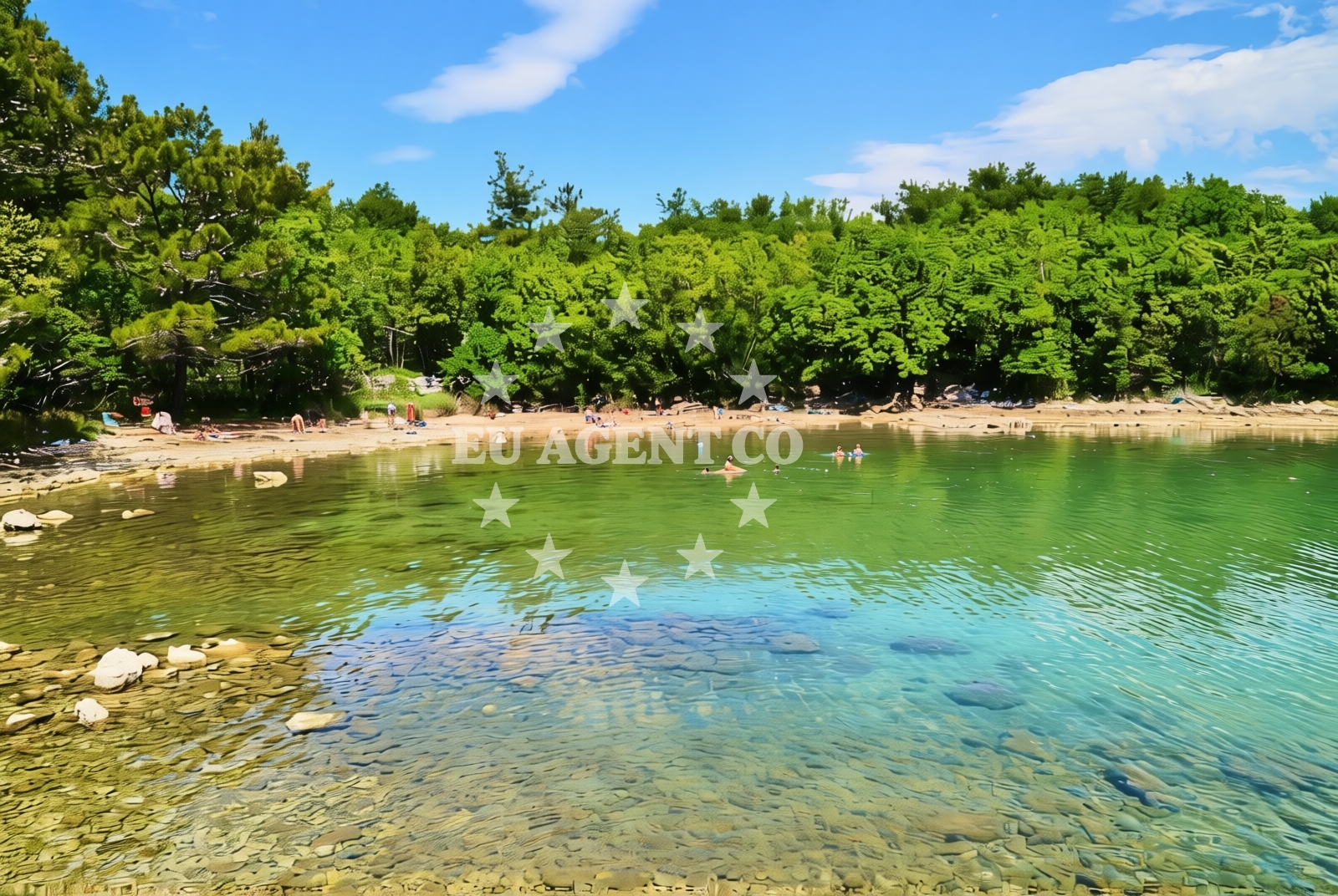
About this beach
Bunorica, Čižići (Krk)
Beach: Bunorica
Location: Čižići (Krk)
Characteristics and facilities
Gravel, concrete / stone slabs, rocks
100 m
Natural shade
Beach character
The beach surface consists primarily of gravel, concrete slabs, and rocky formations, reflecting its coastal positioning on Krk's northern shore. The 100-meter stretch is characterized by uneven terrain, with no designated seating or umbrellas. Natural shade is available in localized patches from low-lying vegetation, but visitors should expect direct sunlight exposure in most areas. The shoreline's rocky nature means swimming is limited to shallow, tide-dependent zones, with no marked entry points or lifeguard services.Swimming and shore
Swimming conditions at Bunorica are constrained by the rocky shoreline and shallow waters. The beach lacks designated swimming areas, and water depth decreases rapidly near the shore. The absence of marine infrastructure means visitors must navigate the uneven terrain to reach the water. The shore's gravel and stone composition make it unsuitable for prolonged sunbathing, though the natural rock formations create informal seating opportunities for those seeking a more rugged coastal experience.Facilities and activities
No formal facilities are present at Bunorica Beach. There are no changing rooms, showers, or beachside amenities. The shoreline's character precludes water sports or recreational activities typically associated with sandy beaches. The nearest infrastructure is located in Čižići village, approximately 1.5 kilometers inland, which includes basic services for visitors.Access and location
Bunorica Beach is accessible via a short path from the Čižići village road, approximately 800 meters from the main settlement. The beach lies on the northern coast of Krk Island, with the Adriatic Sea to the east and forested terrain to the west. The nearest major town is Krk Town (Općina Krk), located 12 kilometers southeast, which provides transportation links to the mainland via the Krk Bridge. The beach's remote location makes it less accessible for those without local transportation.What to expect
Visitors should anticipate a rugged, undeveloped shoreline with gravel and rocky surfaces. The beach offers limited swimming opportunities in shallow waters and no formal amenities. Natural shade is sporadic, requiring sun protection measures. The location is best suited for those seeking a secluded, low-impact coastal experience rather than a traditional beach resort environment.Practical tips
Wear sturdy footwear to navigate the gravel and rocky terrain. Sunscreen and a hat are essential due to limited shade. Check tide times before visiting, as water depth changes significantly. The beach's remoteness means visitors should carry sufficient supplies, as no on-site services are available.Exploring the coast by yacht
For yacht charter guests exploring the northern Adriatic, Bunorica Beach offers a vantage point to observe Krk Island's rugged coastline. The nearby port of Krk Town provides access to the Krk Bridge and ferry connections to the mainland. Sailors may anchor in the sheltered waters near Čižići, though formal marinas are located in Krk Town and the nearby village of Vrbnik. The beach's position along Krk's northern shore makes it a potential stop for those circumnavigating the island.Regional Context: Krk Island's Coastal Character
Krk Island's northern coast, where Bunorica Beach is located, features a mix of forested hills and rocky shorelines. The island's geography creates sheltered bays and exposed headlands, influencing local sailing conditions. The nearby village of Vrbnik, 7 kilometers west of Čižići, is a traditional sailing hub with a small marina. The region's maritime history is evident in the coastal architecture and fishing infrastructure.Anchorages in the surrounding area
Anchorages near Čižići (Krk) provide mooring options in the surrounding waters of Krk.
- Klimno — krk — 0.4 NM from beach
- Anchorage — krk — 1.4 NM from beach
- Anchorage — njivice — krk — 3.0 NM from beach
- Anchorage — silo — krk — 3.1 NM from beach
- Anchorage — kacjak — 3.2 NM from beach
- Anchorage — kacjak — 3.2 NM from beach
- Anchorage — dramalj — 3.3 NM from beach
- Anchorage — krk — 3.4 NM from beach
Distances are straight-line geographic distances, not sailing routes.
Mooring buoys in the surrounding area
Mooring buoys and jetties in Kacjak, Dramalj, and Omisalj support access to coastal areas near Bunorica Beach.
- Jetty — kacjak — 3.3 NM from beach
- Jetty — dramalj — 3.3 NM from beach
- Jetty — dramalj — 3.3 NM from beach
- Buoy field — omisalj — krk — 3.6 NM from beach
- Buoy field — crikvenica — 3.7 NM from beach
Distances are straight-line geographic distances, not sailing routes.
Marine fuel stations
Fuel stations in Crikvenica and Novi Vinodolski serve vessels navigating the Krk region.
- Fuel station — crikvenica — 3.9 NM from beach
- INA — novi vinodolski — 8.1 NM from beach
- Flash — krk — 8.3 NM from beach
- Ina — krk — 8.3 NM from beach
Distances are straight-line geographic distances, not sailing routes.
Harbours in the surrounding area
- Čižići — cizici — krk — 0.3 NM from beach
- Klimno — krk — 0.8 NM from beach
- Slivanjska — rudine — krk — 1.7 NM from beach
- Njivice — krk — 2.6 NM from beach
- Šilo — silo — krk — 2.7 NM from beach
- Podvorska — crikvenica — 3.5 NM from beach
Distances are straight-line geographic distances, not sailing routes.
Marinas in the surrounding area
Marinas in Silo, Omišalj, and Punat are located within reach of Bunorica Beach on Krk.
- Šilo — silo — krk — 2.9 NM from beach
- Omišalj Docks — omisalj — krk — 3.7 NM from beach
- Marina Punat — krk — 7.9 NM from beach
- Marina Novi — novi vinodolski — 8.1 NM from beach
- Mitan Marina — novi vinodolski — 9.0 NM from beach
Distances are straight-line geographic distances, not sailing routes.
Restaurants near the beach
Restaurants in Čižići and Klimno are situated near Bunorica Beach, offering dining options for visitors.
- Restaurant — cizici — krk — 0.3 NM from beach
- Restaurant — cizici — krk — 0.3 NM from beach
- Restaurant — cizici — krk — 0.4 NM from beach
- Zal — klimno — krk — 0.8 NM from beach
- Val — klimno — krk — 0.8 NM from beach
- Oleander — klimno — krk — 0.8 NM from beach
- Rivica — njivice — krk — 2.6 NM from beach
Distances are straight-line geographic distances, not sailing routes.
Navigation guides for the surrounding area
- Njivice — 2.4 NM from beach
- Luka Kijac — 2.9 NM from beach
- Uvala Stipanja {Silo) — 3.1 NM from beach
- Uvala Sapan — 3.5 NM from beach
- Crikvenica — 4.0 NM from beach
Distances are straight-line geographic distances, not sailing routes.
Yachts from nearby departure bases
Yachts departing from Crikvenica City Port and Krk Marina Punat provide access to Bunorica Beach and surrounding waters.
Sailing yachts
- Sun Odyssey 29.2 (Mirabai) — Malinska Hotel Malin port — 4.2 NM from departure base to beach
- Bavaria 36 (Tamra) — Kraljevica Port Porto — 7.1 NM from departure base to beach
- Bavaria 32 (Andromeda) — Kraljevica Port Porto — 7.1 NM from departure base to beach
- Bavaria 46 Cruiser (SIRIUS I) — Krk Marina Punat — 7.9 NM from departure base to beach
- Gib Sea 43 (AMUN RE) — Krk Marina Punat — 7.9 NM from departure base to beach
Catamarans
- Elba 45 (Balu) — Krk Marina Punat — 7.9 NM from departure base to beach
Motor yachts
- Ferretti 460 (Summertime) — Krk Marina Punat — 7.9 NM from departure base to beach
Motor boats
- Barracuda 590 (Barracuda 12) — Crikvenica City Port — 4.0 NM from departure base to beach
- Barracuda 590 (Solta) — Crikvenica City Port — 4.0 NM from departure base to beach
- Cranchi Zaffiro 36 (Snoopy) — Krk Marina Punat — 7.9 NM from departure base to beach
Distances are straight-line geographic distances, not sailing routes.