Bunarići istok, Maslenica Beach, Croatia
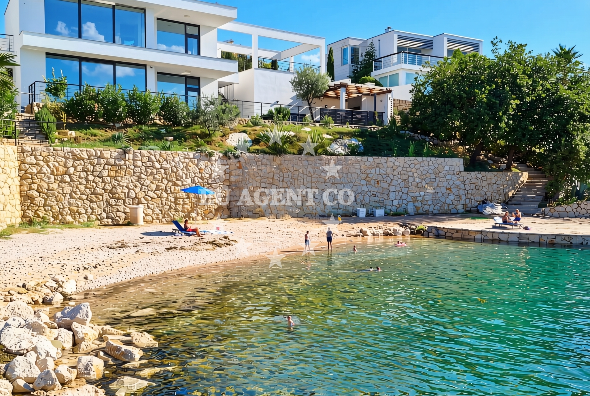
About this beach
Bunarići istok, Maslenica
Beach: Bunarići istok
Location: Maslenica
Characteristics and facilities
Gravel, concrete / stone slabs
80 m
Beach character
The beach's surface is primarily composed of gravel and concrete/stone slabs, a feature that distinguishes it from more conventional sandy or pebbled shores. This composition suggests a utilitarian or transitional character, possibly serving as a landing point or access route rather than a primary recreational beach. The 80-meter length indicates a compact shoreline, which may influence the types of activities feasible here.Swimming and shore
Swimming conditions at Bunarići istok are not explicitly detailed in available records, but the gravel and concrete substrate implies that the beach may not be ideal for wading or extended water activities. The shore's composition could affect water clarity and accessibility, though no specific data on water depth or safety is provided.Facilities and activities
No structured facilities or activities are listed for this beach. The absence of detailed amenities suggests it may not be a primary destination for leisure or tourism, though its location could serve functional purposes such as access points for nearby settlements or maritime operations.Access and location
Located in Bunarići istok, Maslenica, the beach is part of the broader coastal network of Croatia's Adriatic shoreline. Its proximity to Maslenica, a region known for its natural bridges and coastal geography, may offer contextual relevance for visitors exploring the area's maritime features.What to expect
Visitors should anticipate a shoreline defined by gravel and concrete/stone slabs, with limited recreational infrastructure. The beach's brevity (80 meters) means it is not suited for large gatherings or extended stays. Its location in Maslenica positions it within a region characterized by dramatic coastal landscapes, including the famous Maslenica Bridge, which connects the mainland to the island of Šolta.Practical tips
Given the gravel and concrete surface, appropriate footwear is recommended. The beach's short length means it is best suited for brief visits. Those interested in exploring the surrounding area may find the nearby Maslenica Bridge and coastal trails of interest.Exploring the coast by yacht
For yacht charter guests, the proximity of Bunarići istok to Maslenica and the broader Adriatic coast offers opportunities to explore nearby islands such as Šolta, Hvar, and Brač. The region is known for its sheltered bays and scenic anchorages, making it a popular route for sailing excursions along the Croatian coast.Regional Context
Maslenica, where this beach is located, is part of the Split-Dalmatia County in Croatia. The area is renowned for its natural landmarks, including the Maslenica Bridge, a dramatic viaduct that spans the channel between the mainland and Šolta. The surrounding coastline features a mix of rugged cliffs, secluded coves, and historic settlements, reflecting the region's rich maritime heritage.Anchorages in the surrounding area
- Anchorage — maslenica — 1.1 NM from beach
- Anchorage — novigrad — 2.9 NM from beach
- Anchorage — vinjerac — 4.6 NM from beach
- Anchorage — karin — 5.5 NM from beach
- Karin dock — 5.8 NM from beach
- Anchorage — ljubac — 11.1 NM from beach
- Anchorage — ljubac — 11.2 NM from beach
- Anchorage — rtina — 11.6 NM from beach
Distances are straight-line geographic distances, not sailing routes.
Mooring buoys in the surrounding area
Mooring buoys at Ljubac Jetty and Sibuljina Point provide options for securing vessels near the beach.
- Jetty — ljubac — 11.4 NM from beach
- Šibuljina Point — sibuljina point — 11.6 NM from beach
- Buoy field — sukosan — 14.5 NM from beach
- Buoy field — sukosan — 14.6 NM from beach
Distances are straight-line geographic distances, not sailing routes.
Marine fuel stations
- Fuel station — sukosan — 14.7 NM from beach
- Ina — zadar — 15.1 NM from beach
- Ina — biograd na moru — 17.3 NM from beach
- Ina — preko — ugljan — 17.5 NM from beach
Distances are straight-line geographic distances, not sailing routes.
Harbours in the surrounding area
- Maslenica — 0.5 NM from beach
- Vinjerac — 4.6 NM from beach
- Seline — 4.9 NM from beach
- Obrovac — 5.8 NM from beach
- Starigrad Paklenica — 6.8 NM from beach
- Ražanac — razanac — 9.7 NM from beach
Distances are straight-line geographic distances, not sailing routes.
Marinas in the surrounding area
Marinas in Sukosan, Zadar, and Biograd na Moru are located at distances ranging from 14.5 to 16.1 nautical miles from Bunarići istok, Maslenica Beach.
- Marina Dalmacija — sukosan — 14.5 NM from beach
- Marina Zadar — 15.1 NM from beach
- Vitrenjak Zadar — 15.4 NM from beach
- Marina Borik — zadar — 15.6 NM from beach
- Dry dock marina Biograd — biograd na moru — 16.1 NM from beach
Distances are straight-line geographic distances, not sailing routes.
Restaurants near the beach
Restaurants in Seline provide dining options near the beach.
- Gostionica Ivan — seline — 4.6 NM from beach
- Restaurant — seline — 4.8 NM from beach
Distances are straight-line geographic distances, not sailing routes.
Navigation guides for the surrounding area
Navigation guides for Posedarje, Starigrad-Paklenica, and the Velesitski Kanal offer route information for the surrounding area.
- Posedarje (Novigradsko More) — 3.1 NM from beach
- Starigrad-Paklenica {Velebitski Kanai) — 6.6 NM from beach
- VELESITSKI KANAL (S) — 10.1 NM from beach
- KrusCica and Uvala KrusCica Duboka — 12.7 NM from beach
Distances are straight-line geographic distances, not sailing routes.
Yachts from nearby departure bases
Sailing yachts
- Oceanis 45 (Vesna) — Sukošan Marina Dalmacija — 14.5 NM from departure base to beach
Catamarans
- Lagoon 46 (WHY NOT) — Sukošan Marina Dalmacija — 14.5 NM from departure base to beach
Motor yachts
- Cranchi Mediterranee 47 (La Vita) — Sukošan Marina Dalmacija — 14.5 NM from departure base to beach
Motor boats
- Merry Fisher 795 () — Novigrad Dalmatia — 2.1 NM from departure base to beach
- Merry Fisher 695 — Sukošan Brodogradilište Filipi — 14.4 NM from departure base to beach
- Zar 57 WD — Sukošan Brodogradilište Filipi — 14.4 NM from departure base to beach
- Quicksilver Activ 555 — Sukošan Brodogradilište Filipi — 14.4 NM from departure base to beach
- Zar 65 Suite — Sukošan Brodogradilište Filipi — 14.4 NM from departure base to beach
- Zar 61 Suite (Tucepi) — Sukošan Brodogradilište Filipi — 14.4 NM from departure base to beach
- Elan 650 (Biokovo) — Sukošan Brodogradilište Filipi — 14.4 NM from departure base to beach
Distances are straight-line geographic distances, not sailing routes.