Budim Zapad Beach, Podgradina (Posedarje): A Rocky Shoreline in the Adriatic, Croatia
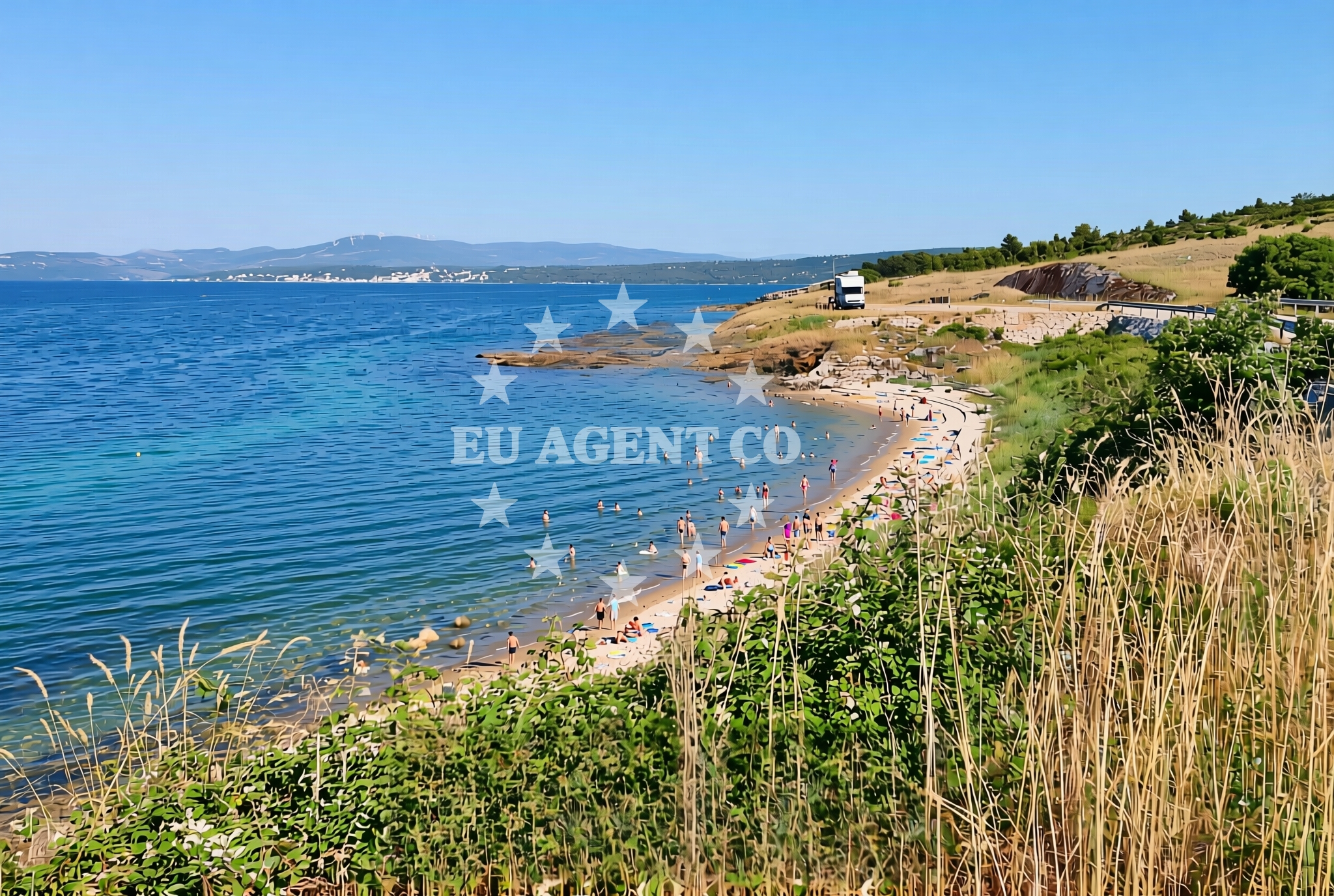
Budim Zapad Beach lies along the western shore of Budim, a small islet near the village of Podgradina on the island of Posedarje. The beach stretches 140 meters along a rocky coastline, characterized by its natural terrain and unspoiled setting. While lacking formal amenities, its location within the Adriatic's sailing-rich waters makes it a point of interest for those exploring the region's coast by sea.
About this beach
Budim zapad, Podgradina (Posedarje)
Beach: Budim zapad
Location: Podgradina (Posedarje)
Characteristics and facilities
Rocks
140 m
Beach character
The beach's defining feature is its rocky shoreline, which extends along the islet's western edge. The terrain consists of uneven stones and shallow water, creating a rugged yet scenic environment. The absence of sandy areas means the beach is more suited to those seeking a natural, untamed coastline rather than a traditional sunbathing spot. The surrounding waters are typically clear, reflecting the Adriatic's reputation for transparency, though the rocky bottom may limit swimming to calmer sections.
Swimming and shore
Swimming conditions at Budim Zapad are influenced by the rocky seabed and the beach's orientation. The shoreline's uneven surface makes it less ideal for families with young children but offers opportunities for exploring tidal pools and rocky crevices. The water depth near the shore is shallow, with gradual increases further out. Visitors should be mindful of slippery rocks and changing tides when navigating the area.
Facilities and activities
No formal facilities such as showers, parking, or seating are listed for Budim Zapad Beach. The lack of infrastructure aligns with its status as a natural, undeveloped shoreline. Activities here are limited to coastal walking, rock exploration, and photography. The beach's isolation and rugged terrain make it a quiet spot, though its proximity to Posedarje's settlements may offer opportunities for local cultural exploration.
Access and location
Access to Budim Zapad is via the village of Podgradina on Posedarje, a small island in Croatia's central Dalmatian coast. The beach is reachable by foot from the island's main road, though no dedicated parking or pathways are indicated. Its location places it within the broader sailing areas of the Adriatic, where motor yachts and sailboats frequently navigate between islands like Hvar, Brac, and Vis. The nearby village of Podgradina serves as a minor hub for regional travel and fishing activities.
What to expect
Visitors to Budim Zapad should expect a rugged, undeveloped shoreline with a focus on natural landscapes. The beach is best suited for those seeking solitude and a connection to the Adriatic's raw coastal character. While there are no amenities, the area's isolation offers a tranquil environment. The rocky terrain may pose challenges for some, but it also provides opportunities for exploring the intertidal zone and enjoying panoramic views of the open sea.
Practical tips
Wear sturdy footwear to navigate the rocky shoreline safely. Bring water and snacks, as there are no facilities nearby. Check tide times before visiting, as the beach's character changes with the sea level. The area is ideal for short walks and photography but not for extended stays without provisions.
Exploring the coast by yacht
Budim Zapad's location within the Adriatic's sailing corridors makes it a minor reference point for yachts navigating between Posedarje and larger islands like Hvar. While not a marina or anchorage, its proximity to the island's main settlements means it may appear on coastal charts as a natural landmark. Yacht charter guests exploring the region may pass by the area, though it is not typically included in formal sailing itineraries due to its limited facilities.
Regional Context and Nearby Settlements
The island of Posedarje, where Budim Zapad is located, is part of the Split-Dalmatia County. Its settlements, including Podgradina, are small and primarily focused on fishing and agriculture. The island's coastline is characterized by rocky inlets and shallow bays, with Budim Zapad representing one of its more exposed sections. Nearby, the larger island of Hvar lies approximately 20 nautical miles to the south, offering more developed marinas and yacht charter options.
Anchorages in the surrounding area
- Anchorage — vinjerac — 3.5 NM from beach
- Anchorage — maslenica — 4.0 NM from beach
- Anchorage — novigrad — 5.4 NM from beach
- Anchorage — karin — 7.3 NM from beach
- Karin dock — 7.4 NM from beach
- Anchorage — ljubac — 8.4 NM from beach
- Anchorage — ljubac — 8.6 NM from beach
- Anchorage — rtina — 9.3 NM from beach
Distances are straight-line geographic distances, not sailing routes.
Mooring buoys in the surrounding area
Mooring buoys in the vicinity feature Ljubac Jetty and Sibuljina Point, offering options along the north Dalmatian shoreline.
- Jetty — ljubac — 8.8 NM from beach
- Šibuljina Point — sibuljina point — 10.2 NM from beach
- Buoy field — sukosan — 11.7 NM from beach
- Buoy field — sukosan — 11.8 NM from beach
- Jetty — zadar — 12.1 NM from beach
Distances are straight-line geographic distances, not sailing routes.
Marine fuel stations
- Fuel station — sukosan — 11.9 NM from beach
- Ina — zadar — 11.9 NM from beach
- Ina — preko — ugljan — 14.4 NM from beach
- Ina — biograd na moru — 15.8 NM from beach
Distances are straight-line geographic distances, not sailing routes.
Harbours in the surrounding area
- Maslenica — 2.8 NM from beach
- Vinjerac — 3.5 NM from beach
- Seline — 4.6 NM from beach
- Starigrad Paklenica — 5.9 NM from beach
- Ražanac — razanac — 7.6 NM from beach
- Obrovac — 8.7 NM from beach
Distances are straight-line geographic distances, not sailing routes.
Marinas in the surrounding area
- Marina Dalmacija — sukosan — 11.7 NM from beach
- Marina Zadar — 11.9 NM from beach
- Vitrenjak Zadar — 12.2 NM from beach
- Marina Borik — zadar — 12.4 NM from beach
- Kukljica — ugljan — 14.1 NM from beach
Distances are straight-line geographic distances, not sailing routes.
Restaurants near the beach
- Gostionica Ivan — seline — 4.4 NM from beach
- Restaurant — seline — 4.5 NM from beach
Distances are straight-line geographic distances, not sailing routes.
Navigation guides for the surrounding area
- Posedarje (Novigradsko More) — 0.5 NM from beach
- Starigrad-Paklenica {Velebitski Kanai) — 5.8 NM from beach
- VELESITSKI KANAL (S) — 8.6 NM from beach
- KrusCica and Uvala KrusCica Duboka — 11.2 NM from beach
- Zdrelac (Uvala Sv. Luka) — 14.1 NM from beach
Distances are straight-line geographic distances, not sailing routes.
Yachts from nearby departure bases
Yachts depart from bases such as Novigrad Dalmatia and Sukošan Brodogradilište Filipi, offering access to the Budim zapad, Podgradina (Posedarje) Beach area.
Sailing yachts
- Bavaria Cruiser 37 (AMALIA) — Sukošan Marina Dalmacija — 11.7 NM from departure base to beach
Catamarans
- Lagoon 43 (MALI NIKO) — Sukošan Marina Dalmacija — 11.7 NM from departure base to beach
Motor yachts
- Prestige 46 Fly (ANIMA MARIS) — Sukošan Marina Dalmacija — 11.7 NM from departure base to beach
Motor boats
- Merry Fisher 795 () — Novigrad Dalmatia — 3.1 NM from departure base to beach
- Merry Fisher 695 — Sukošan Brodogradilište Filipi — 11.6 NM from departure base to beach
- Elan 650 (Biokovo) — Sukošan Brodogradilište Filipi — 11.6 NM from departure base to beach
- Zar 65 Suite — Sukošan Brodogradilište Filipi — 11.6 NM from departure base to beach
- Zar 61 Suite (Tucepi) — Sukošan Brodogradilište Filipi — 11.6 NM from departure base to beach
- Quicksilver Activ 555 — Sukošan Brodogradilište Filipi — 11.6 NM from departure base to beach
- Zar 57 WD — Sukošan Brodogradilište Filipi — 11.6 NM from departure base to beach
Distances are straight-line geographic distances, not sailing routes.