Budihovac Beach - Vis, Croatia
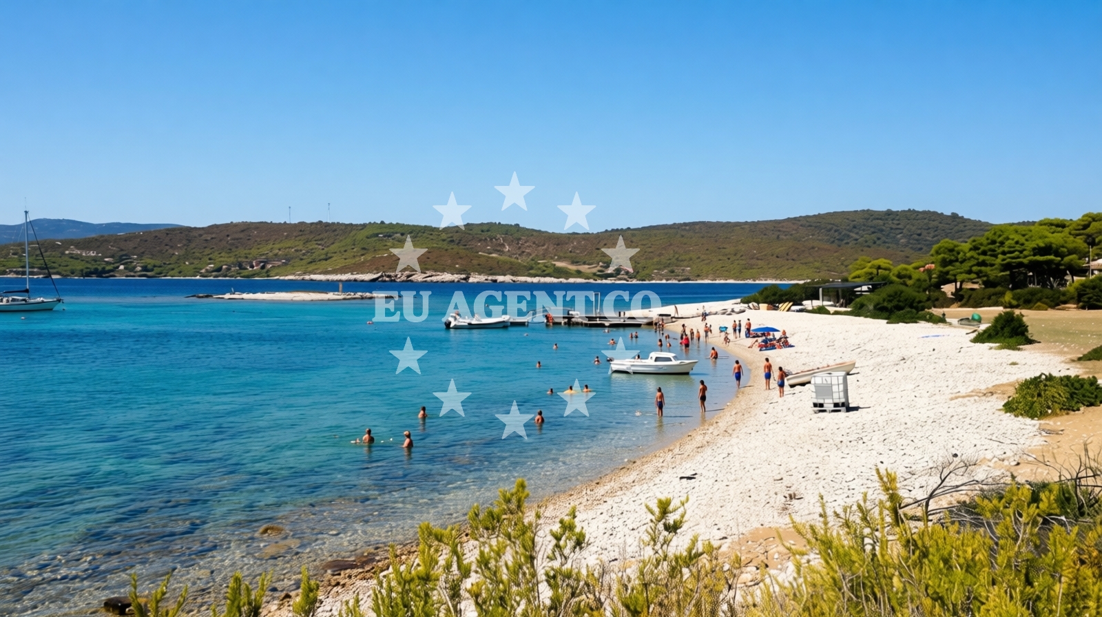
Budihovac Beach lies along the southeastern coast of Vis, a historic island in Croatia's Adriatic Sea. This 220-meter-long shoreline features a distinctive landscape of beige pebbles, creating a stark contrast to the deep blue waters of the surrounding sea. While its natural character is undeniably unique, visitors should be prepared for the realities of its conditions, which include limited amenities and challenges related to cleanliness during peak seasons.
Beach character
The beach's defining feature is its composition of beige pebbles, which cover most of the shore. These medium-sized stones create a firm surface that may be uncomfortable for barefoot walking or for visitors with sensitive skin. The seabed extends gradually from the shore, with a moderate increase in depth that makes it unsuitable for young children or those unaccustomed to rocky underwater terrain. Despite these characteristics, the beach maintains a natural appeal for those seeking a more rugged coastal experience.
Swimming and shore
Swimming conditions at Budihovac are influenced by the pebbly seabed. While the water is generally accessible, the rocky bottom may make standing difficult for some swimmers. The beach's depth increases gradually, creating a transitional zone that could pose challenges for inexperienced swimmers. The beach's high crowd index during peak season means visitors should expect busy conditions, though the lack of formal amenities means there are no designated areas for sunbathing or shade.
Facilities and activities
No formal amenities are listed for Budihovac Beach, including restrooms, showers, or parking facilities. Visitors should plan accordingly, as the beach does not provide infrastructure for overnight stays or extended use. However, the area supports several water-based activities, including kayaking and snorkeling, which take advantage of the clear waters and rocky underwater terrain. These activities are likely best suited for experienced participants given the beach's natural conditions.
Access and location
Located on the island of Vis, Budihovac Beach is part of a region known for its rugged coastline and maritime history. The island is accessible via ferry services from nearby mainland ports, though visitors should check schedules in advance. The beach's position on Vis places it within a broader network of Adriatic sailing routes, making it a potential stop for those exploring the island's perimeter by boat. However, there are no formal docking facilities or marinas directly associated with the beach itself.
What to expect
Visitors to Budihovac Beach should expect a natural, minimally developed shoreline characterized by beige pebbles. The beach is best suited for those seeking a rugged coastal experience rather than a traditional sandy beach. While the area supports water activities like kayaking and snorkeling, these are likely to be more challenging due to the rocky seabed. The beach's high crowd index during peak season means visitors should anticipate busy conditions, though the lack of formal amenities means there are no designated areas for sunbathing or shade.
Practical tips
Given the beach's pebbly surface, visitors are advised to wear appropriate footwear for walking on the shore. The lack of formal amenities means bringing personal items like towels, water, and waste bags is essential. For those planning water activities, equipment rental options are not listed, so visitors should verify availability in advance. The beach's cleanliness conditions during peak season suggest bringing additional supplies for hygiene purposes.
Exploring the coast by yacht
Vis is a popular destination for sailors exploring the Adriatic, with its sheltered bays and historic maritime routes. While Budihovac Beach itself does not have formal docking facilities, the island's surrounding waters offer opportunities for anchoring and exploring. Charter guests navigating the area may find the beach an interesting stop, though the lack of nearby marinas means planning for alternative docking arrangements. The island's position within the Adriatic makes it a strategic point for longer sailing excursions along the Dalmatian coast.
Historical Context of Vis
Vis has a rich history as a fortress island, with remnants of medieval fortifications and a legacy as a wartime refuge. This historical significance contributes to the island's unique character, which visitors may appreciate alongside its natural landscapes. The island's development has remained relatively low-key compared to other Adriatic destinations, preserving its traditional charm.
Anchorages in the surrounding area
Anchorages in the surrounding area include nearby options on Budikovac and Vis, with some located within 0.15 nautical miles of Budihovac Beach.
- Budikovac — budikovac veli — 0.1 NM from beach
- Budikovac — budikovac veli — 0.1 NM from beach
- Zaglav — vis — 0.6 NM from beach
- Anchorage — vis — 0.8 NM from beach
- Anchorage — vis — 1.2 NM from beach
- Anchorage — vis — 1.6 NM from beach
- Smokova Vela — vis — 2.0 NM from beach
- Anchorage — vis — 2.4 NM from beach
Distances are straight-line geographic distances, not sailing routes.
Mooring buoys in the surrounding area
- Konoba Budikovac buoys — budikovac veli — 0.1 NM from beach
- Konoba Dalmatino buoys — vis — 1.2 NM from beach
- Buoy field Diamond Restaurant Bar — vis — 1.2 NM from beach
- Konoba Stončica jetty — vis — 2.3 NM from beach
- Stončica — stoncica — vis — 2.4 NM from beach
Distances are straight-line geographic distances, not sailing routes.
Marine fuel stations
Marine fuel stations are located on Vis, Hvar, and Brac, with the nearest station in Vis approximately 3.23 nautical miles from Budihovac Beach.
- Petrol station Ina — vis — 3.2 NM from beach
- Fuel station — hvar — 12.2 NM from beach
- Ina — milna brac — 20.1 NM from beach
- Ina — vrboska — hvar — 21.1 NM from beach
Distances are straight-line geographic distances, not sailing routes.
Harbours in the surrounding area
Harbours in the surrounding area include Kut and Luka on Vis, as well as Rogačić and Komiža, with some harbours located within 3.1 nautical miles of the beach.
- Kut — vis — 2.7 NM from beach
- Luka — vis — 3.1 NM from beach
- Rogačić — vis — 3.9 NM from beach
- Komiža — komiza — vis — 6.8 NM from beach
- Hvar — 12.4 NM from beach
- Vira — hvar — 12.8 NM from beach
Distances are straight-line geographic distances, not sailing routes.
Marinas in the surrounding area
Marinas in the surrounding area are found on Brac, Korcula, and other islands, with the closest marinas situated approximately 20 nautical miles from Budihovac Beach.
- ACI Marina Palmižana — aci marina palmizana — st klement — 10.6 NM from beach
- Marina Milna Kanarija — milna brac — 20.1 NM from beach
- ACI Marina Milna — milna brac — 20.2 NM from beach
- Marina Vlaška — milna brac — 20.2 NM from beach
- Marina Korkyra — vela luka — korcula — 21.1 NM from beach
Distances are straight-line geographic distances, not sailing routes.
Restaurants near the beach
Restaurants near the beach include Konoba Budikovac on Budikovac Veli and other dining options on Vis, with the closest restaurant located just 0.03 nautical miles away.
- Konoba Budikovac — budikovac veli — 0.0 NM from beach
- Konoba Ferol — vis — 1.2 NM from beach
- Konoba Dalmatino — vis — 1.2 NM from beach
- Konoba Le Terraze — vis — 1.3 NM from beach
- Stončica — vis — 2.3 NM from beach
- Pojoda — kut — vis — 2.6 NM from beach
- Val — vis — 2.6 NM from beach
Distances are straight-line geographic distances, not sailing routes.
Navigation guides for the surrounding area
Navigation guides for the surrounding area cover locations such as Uvala Stoncica, Komiža, and Luka Soline, providing context for sailing near Budihovac Beach.
- Uvala Stoncica — 2.4 NM from beach
- Komiža — 6.6 NM from beach
- Luka Soline — 9.6 NM from beach
- Uvala Stari Stani — 10.0 NM from beach
- Uvala Tarsce — 10.0 NM from beach
Distances are straight-line geographic distances, not sailing routes.
Yachts from nearby departure bases
Yachts from nearby departure bases include sail boats and catamarans based in Milna Marina Vlaška and Šolta Rogač, with some bases located approximately 20 nautical miles from the beach.
Sailing yachts
- Hanse 455 (AURUM 1) — Milna Marina Vlaška — 20.2 NM from departure base to beach
- Bavaria 46 Cruiser (MO) — Milna Marina Vlaška — 20.2 NM from departure base to beach
- Hanse 388 (BANJO) — Milna Marina Vlaška — 20.2 NM from departure base to beach
- Hanse 505 (AVALON) — Milna Marina Vlaška — 20.2 NM from departure base to beach
- Oceanis 46.1 (Everest) — Šolta Rogač — 22.3 NM from departure base to beach
- Sun Odyssey 349 (Siberia) — Šolta Rogač — 22.3 NM from departure base to beach
- Oceanis 41.1 (Goa) — Šolta Rogač — 22.3 NM from departure base to beach
Catamarans
- Lagoon 400 (Greenland) — Šolta Rogač — 22.3 NM from departure base to beach
- Lagoon 42 (Galapagos) — Šolta Rogač — 22.3 NM from departure base to beach
- Lagoon 450 (Madagascar) — Šolta Rogač — 22.3 NM from departure base to beach
Distances are straight-line geographic distances, not sailing routes.