Brzet jug, Omiš Beach, Croatia
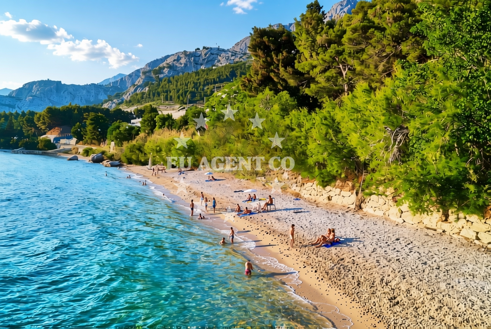
Brzet jug, Omiš Beach lies along the southern coast of Omiš, a historic town in the Split-Dalmatia County of Croatia. This gravel shoreline stretches approximately 350 meters, offering a unique contrast to the region’s more common pebbled or sandy beaches. The beach’s natural shade, provided by the surrounding landscape, makes it a distinctive spot for visitors seeking a different coastal experience.
About this beach
Brzet jug, Omiš
Beach: Brzet jug
Location: Omiš
Characteristics and facilities
Gravel
350 m
Natural shade
Beach character
The beach’s gravel composition creates a textured walking surface, ideal for those who prefer a firm ground underfoot. While not traditionally suited for swimming, the shoreline’s character invites exploration of the rocky outcrops and coastal flora that define the area. The natural shade, likely originating from the hills and vegetation to the north of the beach, offers respite from the sun during peak hours. This feature is particularly notable in a region where open, sun-exposed beaches dominate the coastline.
Swimming and shore
Swimming from Brzet jug is not typically recommended due to the gravelly seabed, which can make entry and navigation challenging. The shore itself is marked by a mix of gravel and scattered rocks, creating a rugged yet scenic environment. The beach’s orientation along the coast means it benefits from the Adriatic’s moderate waves, though swimmers should exercise caution near the water’s edge where the terrain becomes uneven.
Facilities and activities
No formal facilities such as showers, restrooms, or umbrellas are present at Brzet jug. The beach’s character is defined by its natural elements, with no structured amenities to enhance visitor comfort. Activities are limited to walking along the shoreline, exploring the rocky terrain, and enjoying the unspoiled coastal views. The absence of commercial infrastructure makes it a quiet, low-impact destination compared to more developed beaches in the area.
Access and location
Brzet jug is located within the town of Omiš, a coastal settlement known for its medieval fortifications and proximity to the Cetina River canyon. Access to the beach is via local roads leading to the southern outskirts of Omiš. The beach’s position near the town center means visitors can combine a visit with exploring Omiš’s historic sites, including the fortress and the river’s scenic hiking trails. The coordinates (43.427724, 16.707348) place it within the broader Adriatic sailing region, a popular route for motor yachts and sailing boats.
What to expect
Visitors to Brzet jug should expect a gravelly shoreline with natural shade, suitable for leisurely walks rather than sunbathing. The beach’s lack of amenities means it is best suited for those seeking solitude and a connection to the raw coastal landscape. The surrounding area of Omiš offers additional opportunities for exploration, including its historic architecture and the Cetina River’s recreational routes. Due to the beach’s character, it is advisable to bring sturdy footwear and sun protection, even in shaded areas.
Practical tips
Given the gravel terrain, visitors may wish to wear closed-toe shoes for comfort. The natural shade is a key feature, but it is advisable to carry sunscreen for exposed skin. As there are no formal facilities, bringing water and snacks is recommended for extended stays. The beach’s proximity to Omiš allows for easy access to local services, though its remote character means it is less frequented than other coastal spots.
Exploring the coast by yacht
Brzet jug’s location in Omiš places it within a well-established sailing region of the Adriatic. Motor yachts and sailing boats often pass through this area, utilizing nearby marinas in Omiš and the surrounding coastline. For those interested in chartering a vessel, Euro-Agent offers access to a range of boats operating in this part of Croatia. The beach’s proximity to the Cetina River and the open sea provides a strategic vantage point for sailors exploring the region’s coastal routes.
Omiš: A Coastal Town of Contrasts
Omiš, the town near Brzet jug, is a blend of medieval history and modern coastal living. Its fortress, built in the 13th century, overlooks the Cetina River and the Adriatic Sea. The town’s economy is driven by tourism, with activities ranging from river rafting to yacht charter services. The nearby Cetina River canyon offers hiking and cycling trails, making Omiš a hub for both land and sea-based recreation.
Anchorages in the surrounding area
Anchorages in the surrounding area include Konopjikova and Tri luke near Postira and Povlja on Brac.
- Konopjikova — postira — brac — 3.8 NM from beach
- Anchorage — postira — brac — 3.8 NM from beach
- Anchorage — postira — brac — 4.8 NM from beach
- Anchorage — splitska — brac — 5.5 NM from beach
- Tri luke — povlja — brac — 6.6 NM from beach
- Anchorage — povlja — brac — 7.2 NM from beach
- Anchorage — povlja — brac — 7.3 NM from beach
- Anchorage — povlja — brac — 7.4 NM from beach
Distances are straight-line geographic distances, not sailing routes.
Mooring buoys in the surrounding area
Mooring buoys in the surrounding area are located near Postira, Povlja, and Podstrana.
- Quay — postira — brac — 3.8 NM from beach
- Restaurant Pipo buoys — povlja — brac — 6.5 NM from beach
- Restaurant Pipo jetty — povlja — brac — 6.6 NM from beach
- Konoba Rojen jetty — povlja — brac — 6.6 NM from beach
- Jetty — podstrana — 6.7 NM from beach
Distances are straight-line geographic distances, not sailing routes.
Marine fuel stations
- Fuel station — bol — brac — 10.3 NM from beach
- Fuel station — sumartin — brac — 10.8 NM from beach
- Ina — split — 12.9 NM from beach
- Ina — milna brac — 13.0 NM from beach
Distances are straight-line geographic distances, not sailing routes.
Harbours in the surrounding area
Harbours in the surrounding area include Omiš harbour and Dugi Rat, both within a few nautical miles.
- Omiš — omis — 1.0 NM from beach
- Dugi Rat — 3.1 NM from beach
- Sumpetar — dugi rat — 3.8 NM from beach
- Mimice — 4.6 NM from beach
- Postira — brac — 4.6 NM from beach
- Pučišća harbour — pucisca — brac — 5.0 NM from beach
Distances are straight-line geographic distances, not sailing routes.
Marinas in the surrounding area
Marinas in the surrounding area are situated in Podstrana, Baska Voda, and Milna on Brac.
- Marina Lav — podstrana — 8.3 NM from beach
- Marina Baška Voda — marina baska voda — 11.3 NM from beach
- ACI Marina Milna — milna brac — 12.9 NM from beach
- ACI Marina Split — 12.9 NM from beach
- Marina Milna Kanarija — milna brac — 13.0 NM from beach
Distances are straight-line geographic distances, not sailing routes.
Restaurants near the beach
Restaurants near the beach include Konoba Milo in Omiš and Galija in Postira.
- Konoba Milo — omis — 1.2 NM from beach
- Restaurant — postira — brac — 3.9 NM from beach
- Galija — postira — brac — 4.6 NM from beach
- Lado — pucisca — brac — 4.9 NM from beach
- Pizzeria Marin — pucisca — brac — 5.0 NM from beach
Distances are straight-line geographic distances, not sailing routes.
Navigation guides for the surrounding area
Navigation guides for the surrounding area cover Omis, Dugi Rat, and Postira.
- Omis — 0.8 NM from beach
- Dugi Rat (Uvala Orisac) — 2.9 NM from beach
- Postire — 4.5 NM from beach
- Mi mice — 4.8 NM from beach
- Pucisca — 5.0 NM from beach
Distances are straight-line geographic distances, not sailing routes.
Yachts from nearby departure bases
Yachts from nearby departure bases include Omiš City Port, Sumpetar Port, and Podstrana Marina Lav.
Sailing yachts
- Jeanneau 53 (Win Win) — Podstrana Marina Lav — 8.3 NM from departure base to beach
Catamarans
- Lagoon 450 Fly (Falco) — Sumpetar Port — 3.8 NM from departure base to beach
Motor yachts
- Ferretti 460 — Podstrana Marina Lav — 8.3 NM from departure base to beach
Gulets / Cruisers
- Gulet (Trebenna) — Omiš City Port — 1.0 NM from departure base to beach
- Gulet (Primorac) — Omiš City Port — 1.0 NM from departure base to beach
- Gulet (PATRONICE) — Omiš City Port — 1.2 NM from departure base to beach
- Gulet (Altair) — Sumpetar Port — 3.8 NM from departure base to beach
- Gulet (Cataleya) — Sumpetar Port — 3.8 NM from departure base to beach
- Gulet cruiser (AGORA) — Dugi Rat Luka Krilo — 5.1 NM from departure base to beach
Motor boats
- Sessa Fly 42 (Jupika II) — Podstrana Marina Lav — 8.3 NM from departure base to beach
Distances are straight-line geographic distances, not sailing routes.