Brzac Beach - Krk Island, Croatia
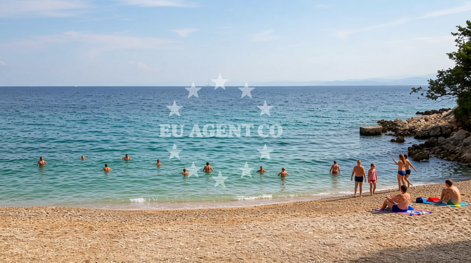
Beach character
The beach measures approximately 40 meters in length and 10 meters in width, forming a narrow cove with gently sloping sides. The seabed consists of small beige pebbles that extend outward before transitioning to deeper waters. Depth increases moderately as one moves away from the shore, creating conditions suitable for snorkeling and light water activities. Natural rock formations along the beach’s edges contribute to its sheltered character, though the area remains exposed to prevailing winds.Swimming and shore
The pebble composition of Brzac Beach makes it more suitable for wading and snorkeling than sunbathing. The moderate depth increase allows for safe exploration of the seabed, where small marine life can often be observed. The lack of artificial structures or amenities means visitors should bring their own equipment for water activities. The beach’s orientation faces northeast, offering views of the open sea and the broader Krk coastline.Facilities and activities
No permanent facilities are available at Brzac Beach. However, the beach is associated with three primary water-based activities: stand-up paddleboarding (SUP), surfing, and snorkeling. The pebble shore and moderate wave action make it a viable spot for beginners in surfing and paddle sports. Snorkeling is particularly popular due to the clear waters and accessible underwater terrain.Access and location
Brzac Beach is located in Glavotok, a coastal settlement on Krk Island’s western coast. The nearest major town is Krk City, approximately 8 kilometers to the south. The beach is accessible via a short walk from the village road, with no formal parking or vehicular access points. Krk Island itself is connected to the mainland via a bridge and is a common stop for Adriatic cruises and yacht charters exploring the northern Dalmatian coast.What to expect
Brzac Beach is best suited for visitors seeking a simple, unspoiled coastal experience. The beach’s small size and pebble composition make it ideal for short visits rather than extended stays. The area is typically busy during peak season, with visitors often seen engaging in water sports or enjoying the sea from the shore. The beach’s natural setting and proximity to Krk’s historic sites make it a convenient base for exploring the island’s cultural and natural attractions.Practical tips
Visitors should be prepared for the pebble surface, which may be uncomfortable for prolonged sunbathing. The beach’s sheltered position means it can be windier than larger, more exposed beaches. Due to its popularity for water activities, arriving early in the day may improve access to the best snorkeling and paddleboarding spots.Exploring the coast by yacht
For yacht charter guests, Brzac Beach lies within the broader sailing area of Krk Island, a region known for its sheltered bays and historic maritime routes. The nearby port of Krk offers access to the Adriatic’s northern waters, with sailing routes extending to the Istrian Peninsula and the Kvarner Gulf. Yacht charterers interested in exploring this area can use the Euro-Agent Yacht Search page to find available vessels and confirm marina availability in the region.Krk Island Context
Krk Island, where Brzac Beach is located, is the largest island in the Adriatic Sea and a key stop for Adriatic cruises. The island’s northern coast features a mix of rugged cliffs and gentle bays, with Krk City serving as a hub for cultural attractions, including the Krk Fortress and the Church of St. Vitus. The island’s strategic position makes it a gateway to both the Istrian Peninsula and the mainland.Anchorages in the surrounding area
Anchorages near Glavotok include Camp Glavotok and several others within a few nautical miles of Brzac beach.
- Camp Glavotok — krk — 0.2 NM from beach
- Anchorage — krk — 0.4 NM from beach
- Anchorage — krk — 1.1 NM from beach
- Anchorage — krk — 2.1 NM from beach
- Anchorage — krk — 2.4 NM from beach
- Anchorage — porat — krk — 2.5 NM from beach
- Anchorage — malinska — krk — 3.0 NM from beach
- Anchorage — pinezici — krk — 3.3 NM from beach
Distances are straight-line geographic distances, not sailing routes.
Mooring buoys in the surrounding area
A mooring buoy at Camp Glavotok lies just 0.1 nautical miles from Brzac beach.
- Camp Glavotok — krk — 0.1 NM from beach
- Jetty — pinezici — krk — 3.2 NM from beach
- Jetty — pinezici — krk — 3.2 NM from beach
- Buoy field — pinezici — krk — 3.7 NM from beach
- Jetty — pinezici — krk — 3.7 NM from beach
Distances are straight-line geographic distances, not sailing routes.
Marine fuel stations
- OMV — krk — 4.6 NM from beach
- Ina — krk — 6.9 NM from beach
- Flash — krk — 7.0 NM from beach
- Fuel station — cres — 8.3 NM from beach
Distances are straight-line geographic distances, not sailing routes.
Harbours in the surrounding area
The Glavotok harbor is situated 0.5 nautical miles from Brzac beach.
- Glavotok — krk — 0.5 NM from beach
- Club Harbour — krk — 2.1 NM from beach
- Porat — krk — 2.8 NM from beach
- Vantačić — vantacic — vantacici — 2.9 NM from beach
- Beli — cres — 3.6 NM from beach
- Haludovo — malinska — krk — 4.2 NM from beach
Distances are straight-line geographic distances, not sailing routes.
Marinas in the surrounding area
Marinas in Omišalj, Punat, and Cres are located up to 10 nautical miles from Brzac beach.
- Omišalj Docks — omisalj — krk — 8.2 NM from beach
- Marina Punat — krk — 8.7 NM from beach
- ACI Marina Cres — 9.0 NM from beach
- Šilo — silo — krk — 10.1 NM from beach
- ACI Marina Opatija — 14.6 NM from beach
Distances are straight-line geographic distances, not sailing routes.
Restaurants near the beach
Restaurants in Porat, Malinska, and Beli offer dining options within 4 nautical miles of Brzac beach.
- Gostiona Sidro — porat — krk — 2.7 NM from beach
- Picolla Venezia — porat — krk — 2.7 NM from beach
- Porat — krk — 2.7 NM from beach
- Restaurant — pinezici — krk — 3.6 NM from beach
- Restaurant — beli — cres — 3.7 NM from beach
- Restaurant Obala — malinska — krk — 4.0 NM from beach
- Restaurant — malinska — krk — 4.3 NM from beach
Distances are straight-line geographic distances, not sailing routes.
Navigation guides for the surrounding area
- Uvala Cavlena — 1.2 NM from beach
- Uvala Vala Jana — 2.1 NM from beach
- Luka Torkul — 3.2 NM from beach
- Uvala Sv. Fuska — 3.8 NM from beach
- Luka Kijac — 5.2 NM from beach
Distances are straight-line geographic distances, not sailing routes.
Yachts from nearby departure bases
Sailing yachts
- Sun Odyssey 29.2 (Mirabai) — Malinska Hotel Malin port — 3.6 NM from departure base to beach
- Bavaria 34 (Theia) — Krk Marina Punat — 8.7 NM from departure base to beach
- Bavaria 44 (Gin) — Krk Marina Punat — 8.7 NM from departure base to beach
- Dufour 460 Grand (Gabriel II) — Krk Marina Punat — 8.7 NM from departure base to beach
Catamarans
- Lagoon 380 S2 (RELAX) — Krk Marina Punat — 8.7 NM from departure base to beach
- Athena 38 (SWAN) — Krk Marina Punat — 8.7 NM from departure base to beach
Motor yachts
- Elegance 60 Fly (LIFESTYLE 1) — Krk Marina Punat — 8.7 NM from departure base to beach
- Sunseeker 64 (MARITA) — Krk Marina Punat — 8.7 NM from departure base to beach
Motor boats
- Antares 42 (Santin) — Krk Marina Punat — 8.7 NM from departure base to beach
- Beneteau Flyer 8 SUNdeck — Krk Marina Punat — 8.7 NM from departure base to beach
Distances are straight-line geographic distances, not sailing routes.