Broce sredina, Broce Beach, Croatia
3 photos
About this beach
Broce sredina, Broce
Beach: Broce sredina
Location: Broce
Characteristics and facilities
Gravel, concrete / stone slabs
30 m
Beach character
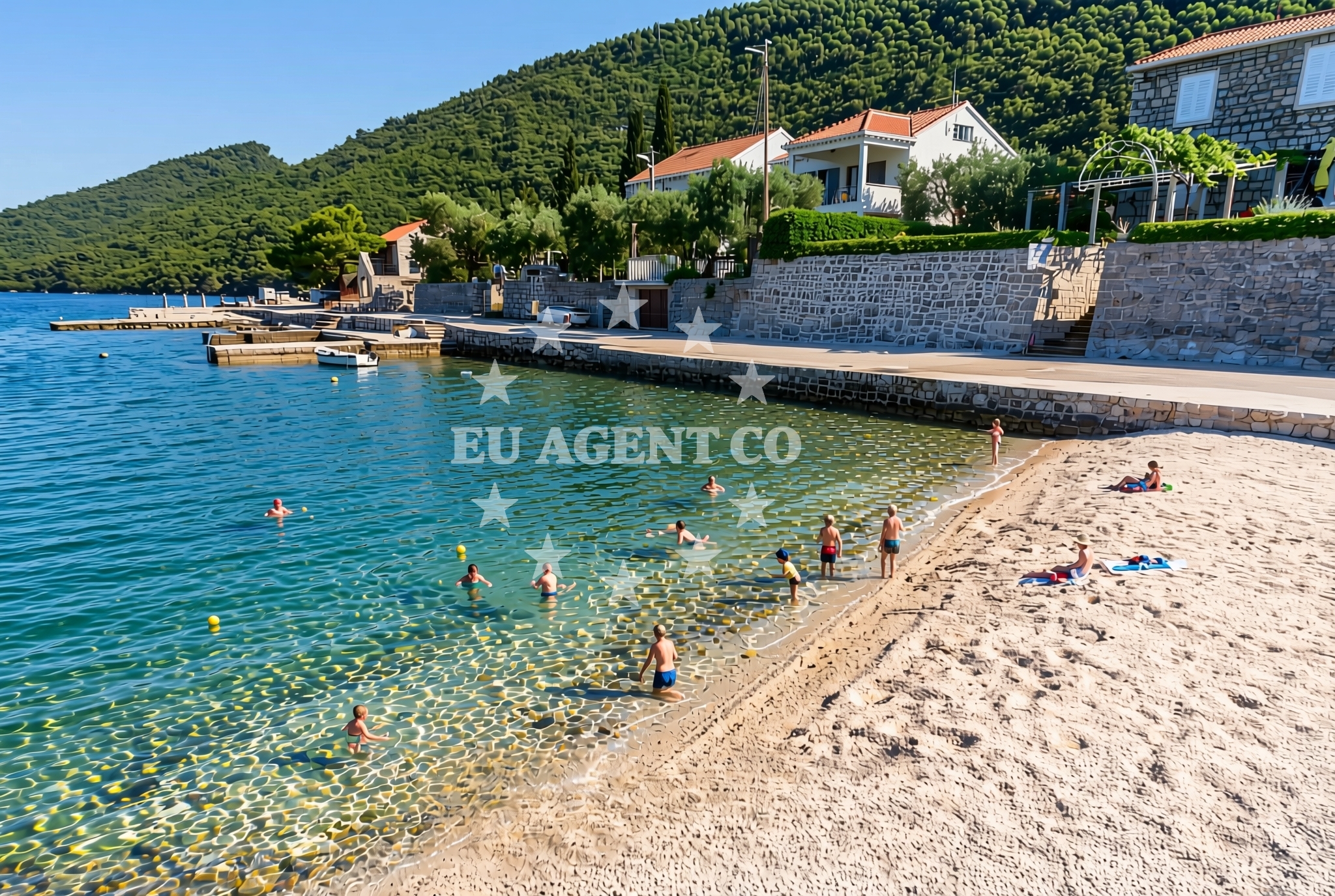
The beach's surface consists primarily of gravel and concrete/stone slabs, which suggests a more utilitarian or transitional shoreline rather than a recreational sandy beach. Its length of 30 meters indicates a modest footprint, likely serving as a minor access point or landing area. The absence of detailed natural features in the catalog means further specifics about water clarity, seabed composition, or tidal patterns are not available.Swimming and shore
There is no explicit information in the catalog about swimming conditions or water quality at Broce sredina, Broce Beach. The shore's gravel and slab composition may make it less suitable for traditional sunbathing or leisurely water activities, though this remains unconfirmed. Visitors should consider the beach's physical characteristics when planning their visit.Facilities and activities
The beach does not list any specific facilities or amenities in the catalog. No structured activities are associated with the site, and there is no mention of infrastructure such as parking, restrooms, or changing rooms. The lack of detailed amenities means the beach may be better suited for passing access rather than extended stays.Access and location
Located in Broce sredina, the beach is part of the coastal settlement of Broce, which lies along Croatia's eastern Adriatic coastline. While the exact road access or proximity to nearby towns is not specified in the catalog, Broce itself is likely connected to regional transport networks. The beach's coordinates (42.81982, 17.71765) place it in an area that may be of interest to sailors exploring the broader Adriatic sailing routes.What to expect
Broce sredina, Broce Beach is a modest coastal site with a gravel and stone slab shoreline. Its short length (30 meters) and lack of detailed amenities suggest it may serve as a functional access point rather than a primary recreational destination. The beach's characteristics align with a transitional or utilitarian shoreline, and visitors should approach with realistic expectations about its scale and features.Practical tips
Given the beach's gravel and slab composition, visitors may wish to wear appropriate footwear for walking along the shore. The absence of detailed amenities means preparation for minimal infrastructure is advisable. As with any coastal site, checking local conditions and respecting environmental guidelines is recommended.Exploring the coast by yacht
The Adriatic coast near Broce is a region that attracts yacht charter guests due to its scenic routes and coastal towns. While Broce sredina, Broce Beach itself does not appear to be a major anchorage or marina, its location may be of interest to sailors exploring the broader area. Yacht charter guests navigating this part of Croatia may find the surrounding coastline and settlements of Broce to be worth visiting as part of a larger itinerary.Regional Context and Broce Settlement
Broce is a small settlement along Croatia's eastern Adriatic coast, part of the wider region known for its historical significance and maritime traditions. While specific details about Broce's cultural or economic profile are not included in the catalog, its coastal location suggests it may be connected to regional sailing routes and tourism infrastructure. The beach's proximity to Broce implies it could be one of several minor coastal sites in the area.Anchorages in the surrounding area
- Ribnja — broce — 1.2 NM from beach
- Anchorage — broce — 1.2 NM from beach
- Anchorage — broce — 1.5 NM from beach
- Anchorage — mali ston — 1.8 NM from beach
- Anchorage — prapratno — 1.8 NM from beach
- Anchorage — broce — 1.9 NM from beach
- Anchorage — broce — 3.1 NM from beach
- Anchorage — olipa — 4.1 NM from beach
Distances are straight-line geographic distances, not sailing routes.
Mooring buoys in the surrounding area
- Quay — kobas — 1.4 NM from beach
- Lukas Taverna jetty — kobas — 1.5 NM from beach
- Konoba Nico jetty — kobas — 1.5 NM from beach
- Quay — prapratno — 1.9 NM from beach
- Restaurant Maran quay — okuklje — mljet — 5.9 NM from beach
Distances are straight-line geographic distances, not sailing routes.
Marine fuel stations
- Fuel station — sobra — mljet — 6.5 NM from beach
- Ina — dubrovnik — 18.7 NM from beach
- Fuel station — ploce — 18.7 NM from beach
- Ina — dubrovnik — 20.1 NM from beach
Distances are straight-line geographic distances, not sailing routes.
Harbours in the surrounding area
- Ston — 1.2 NM from beach
- Mali Ston — 1.8 NM from beach
- Prapranto Ferry Harbour — prapratno — 1.8 NM from beach
- Hodilje — 2.6 NM from beach
- Doli — 3.5 NM from beach
- Okuklje — mljet — 6.0 NM from beach
Distances are straight-line geographic distances, not sailing routes.
Marinas in the surrounding area
- ACI Marina Slano — 7.9 NM from beach
- Marina Frapa Dubrovnik — 18.7 NM from beach
- ACI Marina Dubrovnik — 20.1 NM from beach
- Marina Lumbarda — korcula — 24.8 NM from beach
- ACI Marina Korčula — korcula — 26.9 NM from beach
Distances are straight-line geographic distances, not sailing routes.
Restaurants near the beach
- Gastro Mare — kobas — 1.4 NM from beach
- Luka's Taverna — lukas taverna — kobas — 1.5 NM from beach
- Nico — kobas — 1.5 NM from beach
- Bota Sare — mali ston — 1.7 NM from beach
- Restaurant — prapratno — 1.8 NM from beach
Distances are straight-line geographic distances, not sailing routes.
Navigation guides for the surrounding area
- Broce — 0.2 NM from beach
- Excursions — 1.2 NM from beach
- Mali Ston — 1.6 NM from beach
- Hodilje — 2.5 NM from beach
- Luka — 2.9 NM from beach
Distances are straight-line geographic distances, not sailing routes.
Yachts from nearby departure bases
Sailing yachts
- Elan 45 Impression (Skyfall) — Slano ACI Marina — 7.9 NM from departure base to beach
- Oceanis 45 (Cancan) — Slano ACI Marina — 7.9 NM from departure base to beach
- Elan 50 Impression (Timeless) — Slano ACI Marina — 7.9 NM from departure base to beach
- Oceanis 45 (Mambo 1) — Slano ACI Marina — 7.9 NM from departure base to beach
- Oceanis 45 (Soul) — Slano ACI Marina — 7.9 NM from departure base to beach
Catamarans
- Lagoon 42 (ALMA SOFIA) — Slano ACI Marina — 7.9 NM from departure base to beach
- Lagoon 50 (TWIN JOY) — Slano ACI Marina — 7.9 NM from departure base to beach
- Lagoon 42 (MALA KATE I) — Slano ACI Marina — 7.9 NM from departure base to beach
- Lagoon 40 (SAILOR MOON) — Slano ACI Marina — 7.9 NM from departure base to beach
- MY 37 (Jam) — Slano ACI Marina — 7.9 NM from departure base to beach
Distances are straight-line geographic distances, not sailing routes.
Frequently asked questions
Is Broce sredina, Broce Beach suitable for swimming?
The beach's gravel and stone slab composition suggests it may not be ideal for swimming or leisurely water activities. No specific information about water quality or swimming conditions is available in the catalog.Are there facilities or amenities at the beach?
The catalog does not list any facilities or amenities at Broce sredina, Broce Beach. Visitors should expect minimal infrastructure and prepare accordingly.Nearby beaches
Broce jug, Broce Beach
Broce jug
0.1 km
Broce: beaches and coves (7)
Broce
0.1 km
Broce sjever, Broce Beach
Broce sjever
0.2 km
Lukobran, Broce Beach
Lukobran
0.2 km
Marinica istok, Ston Beach
Marinica istok
0.4 km
Marinica sredina, Ston Beach
Marinica sredina
0.4 km
Marinica zapad, Ston Beach
Marinica zapad
0.5 km
Maslina, Zamaslina Beach
Maslina
1.1 km