Brna Zapad Beach, Smokvica (Korčula): A Natural Stone Shore Experience, Croatia
About this beach
Brna zapad, Smokvica (Korčula)
Beach: Brna zapad
Location: Smokvica (Korčula)
Characteristics and facilities
Concrete / stone slabs, rocks
Beach character
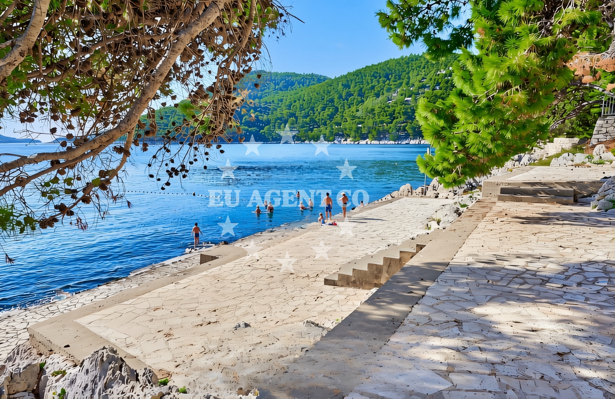
The beach is composed of concrete slabs and jagged rocks, remnants of historical coastal structures and natural formations. The shoreline slopes gently into the Adriatic Sea, with water clarity typical of the region’s protected waters. The rocky surface creates a unique environment for exploration, though it may not be ideal for families with young children. The area is surrounded by low-lying vegetation, with minimal human development, preserving its natural character. The beach’s orientation faces west, offering sunset views over the open sea.Swimming and shore
Swimming conditions at Brna Zapad are influenced by the rocky shoreline. While the water is generally calm and clear, the uneven seabed makes it unsuitable for swimming in deeper sections. Shallow areas near the shore are accessible via stepping stones, but caution is advised due to the uneven terrain. The beach is more suited for those who enjoy wading or exploring the intertidal zone, where marine life such as sea urchins and small fish can be observed.Facilities and activities
There are no official facilities at Brna Zapad Beach, including restrooms, showers, or parking. Visitors are advised to bring their own supplies, as nearby settlements like Smokvica offer limited services. The beach’s natural setting makes it ideal for solitary relaxation, photography, or brief excursions by foot along the coastline. No structured activities are available, though the area’s historical significance—linked to Korčula’s medieval past—may interest culturally curious visitors.Access and location
Brna Zapad Beach is located in Smokvica, a village on the island of Korčula, approximately 15 kilometers from the town of Korčula. Access requires a vehicle, as local roads are narrow and winding. The beach is not marked on standard maps, necessitating GPS navigation or local guidance. For those arriving by boat, the nearest marinas are in Korčula Town and the nearby island of Mljet, both accessible via short yacht trips.What to expect
Brna Zapad Beach is a quiet, unassuming shore with no formal amenities. Visitors should expect a rocky, uneven surface and limited infrastructure. The beach is best suited for those seeking solitude or a connection to the island’s natural and historical landscape. Its location on Korčula’s southern coast means it is less frequented than other beaches, offering a sense of seclusion. The surrounding area provides minimal services, so self-sufficiency is recommended.Practical tips
Wear sturdy footwear to navigate the rocky shoreline. Bring water and snacks, as there are no nearby vendors. Check local road conditions before traveling, as Smokvica’s access roads can be challenging. For boat visitors, anchorages near Korčula Town are recommended for easier access to the beach.Exploring the coast by yacht
For yacht charter guests, Brna Zapad’s location on Korčula’s southern coast offers a strategic base for exploring the Dalmatian Coast. The nearby marina in Korčula Town provides provisioning and maintenance services, while the surrounding waters are ideal for sailing to nearby islands like Mljet and Šipan. Charterers may enjoy the beach’s seclusion for private landings or as a scenic stop during longer voyages along the Adriatic. For availability and bookings, visit Euro-Agent’s Yacht Search page.Historical Context of Smokvica
Smokvica, where Brna Zapad Beach is located, has historical ties to Korčula’s medieval trade routes. The village’s name derives from the smokva (fig) trees that once thrived in the area. While no major landmarks remain, the beach’s proximity to Korčula’s UNESCO-listed Old Town highlights the island’s rich heritage.Anchorages in the surrounding area
- Anchorage — brna — korcula — 0.2 NM from beach
- Istruga — brna — korcula — 0.2 NM from beach
- Grahova — brna — korcula — 1.2 NM from beach
- Anchorage — korcula — 2.4 NM from beach
- Anchorage — prizba — korcula — 2.5 NM from beach
- Anchorage — prizba — korcula — 2.8 NM from beach
- Anchorage — vela luka — korcula — 3.6 NM from beach
- Anchorage — vela luka — korcula — 3.7 NM from beach
Distances are straight-line geographic distances, not sailing routes.
Mooring buoys in the surrounding area
Mooring buoys in Vela Luka and Lastovo provide nearby anchoring points for vessels approaching Brna zapad, Smokvica (Korčula).
- Quay — vela luka — korcula — 3.5 NM from beach
- Buoy field — vela luka — korcula — 7.1 NM from beach
- Public quay — lastovo — 7.9 NM from beach
- Konoba Aragosta dock — lastovo — 7.9 NM from beach
- Konoba Santor Jetty — lastovo — 7.9 NM from beach
Distances are straight-line geographic distances, not sailing routes.
Marine fuel stations
Marine fuel stations in Vela Luka and Lastovo serve boats navigating the waters near Brna zapad, Smokvica (Korčula).
- Ina — vela luka — korcula — 7.1 NM from beach
- Ina — ubli — lastovo — 9.7 NM from beach
- Fuel station — korcula — 13.2 NM from beach
- Ina — vrboska — hvar — 18.4 NM from beach
Distances are straight-line geographic distances, not sailing routes.
Harbours in the surrounding area
- Brna — korcula — 0.2 NM from beach
- Zavalatica — korcula — 3.6 NM from beach
- Prigradica — korcula — 4.2 NM from beach
- Vela Luka — korcula — 7.1 NM from beach
- Račišće — racisce — korcula — 8.4 NM from beach
- Ubli — lastovo — 9.6 NM from beach
Distances are straight-line geographic distances, not sailing routes.
Marinas in the surrounding area
- Marina Korkyra — vela luka — korcula — 7.1 NM from beach
- Marina Solitudo — lastovo — 8.5 NM from beach
- ACI Marina Korčula — korcula — 12.8 NM from beach
- Marina Lumbarda — korcula — 14.0 NM from beach
- ACI Marina Vrboska — hvar — 18.3 NM from beach
Distances are straight-line geographic distances, not sailing routes.
Restaurants near the beach
- Galeb — brna — korcula — 0.1 NM from beach
- Dragan — brna — korcula — 0.1 NM from beach
- Restaurant — prizba — korcula — 2.7 NM from beach
- Restaurant — vela luka — korcula — 3.5 NM from beach
- Bistro Prigradica — korcula — 4.2 NM from beach
Distances are straight-line geographic distances, not sailing routes.
Navigation guides for the surrounding area
Navigation guides for Brna, Uvala Prizba, and surrounding areas assist in planning routes to Brna zapad, Smokvica (Korčula).
- Brna — 0.3 NM from beach
- Uvala Prizba Mali — 2.7 NM from beach
- Uvala Grscica — 3.4 NM from beach
- Uvala Zavalatica — 3.8 NM from beach
- Luka Karbuni — 5.2 NM from beach
Distances are straight-line geographic distances, not sailing routes.
Yachts from nearby departure bases
Yachts departing from Tučepi Port, Makarska Port, and Ploče City Port offer access to Brna zapad, Smokvica (Korčula).
Sailing yachts
- Bavaria 40 Cruiser (LADY BUTTERFLY) — Tučepi Port — 23.3 NM from departure base to beach
- Elan 40 Impression (Karleta) — Ploče City Port — 26.9 NM from departure base to beach
- Sun Odyssey 349 (Porto Tolero) — Ploče City Port — 26.9 NM from departure base to beach
- Sun Odyssey 419 (Luka Ploce) — Ploče City Port — 26.9 NM from departure base to beach
Catamarans
- Lagoon 450 Fly (Alba Mouse) — Ploče City Port — 26.9 NM from departure base to beach
Motor yachts
- Princess V53 (Chablis) — Makarska Port — 24.4 NM from departure base to beach
Motor boats
- Jeanneau NC 37 (Black Pearl) — Makarska Port — 24.4 NM from departure base to beach
- Galeon 430 Skydeck (Bellagio) — Makarska Port — 24.4 NM from departure base to beach
- Jeanneau NC 37 (Black Pearl) — Makarska Port — 24.4 NM from departure base to beach
- Galeon 430 Skydeck (BELLAGIO) — Makarska Port — 24.4 NM from departure base to beach
Distances are straight-line geographic distances, not sailing routes.