Bratin sjever, Zverinac (Zverinac) Beach, Croatia
Bratin sjever, Zverinac (Zverinac) Beach lies along the eastern Adriatic coast, positioned near the settlement of Zverinac. This shoreline forms part of a rugged coastal stretch characterized by limestone cliffs and shallow, pebbled beaches typical of the region. While the beach itself lacks formal amenities, its proximity to nearby coastal towns and maritime routes makes it a point of interest for those exploring the Croatian coastline by land or sea.
About this beach
Bratin sjever, Zverinac (Zverinac)
Beach: Bratin sjever
Location: Zverinac (Zverinac)
Beach character
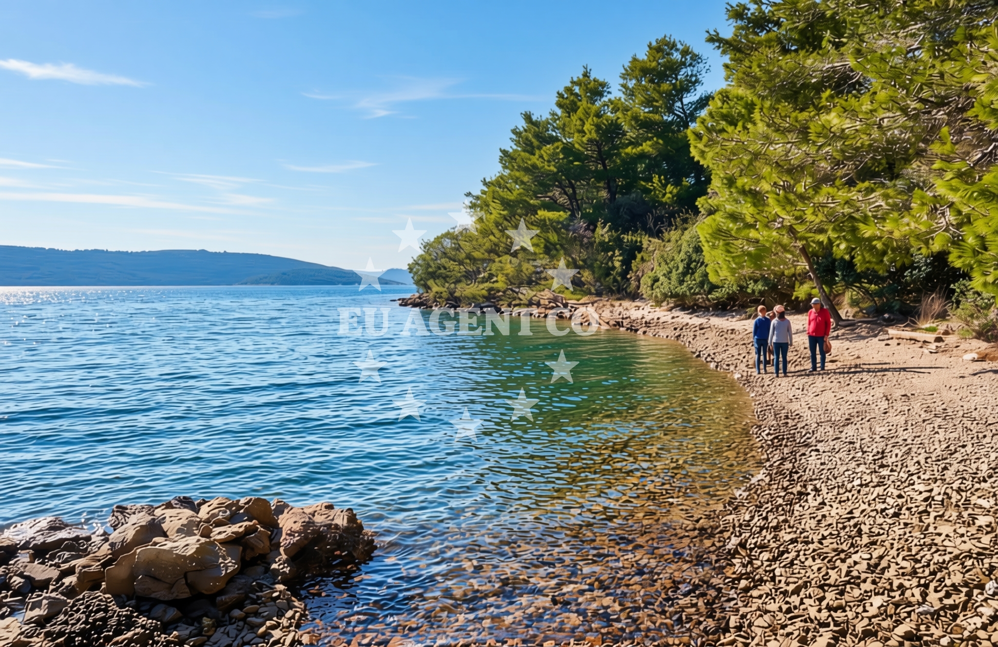
The beach's character is defined by its natural contours, with the shoreline extending along a narrow strip of land between the sea and inland terrain. The surrounding landscape features low-lying hills and scattered vegetation, offering limited shade for visitors. The water's edge is marked by a mix of pebbles and small stones, with no significant sand deposits. The absence of structured facilities means the beach remains largely undeveloped, preserving its raw coastal appearance.
Swimming and shore
Swimming conditions at Bratin sjever are influenced by the immediate coastal topography. The shallow waters near the shore create a gentle entry point for swimmers, though the pebbled seabed may make prolonged immersion uncomfortable. The sea's clarity varies with seasonal currents, but the general transparency of the Adriatic in this region suggests moderate visibility. The shore itself offers minimal flat areas for sunbathing, with most usable space concentrated along the beach's narrower sections.
Facilities and activities
No formal facilities are documented for Bratin sjever, Zverinac (Zverinac) Beach. The lack of infrastructure means visitors must rely on personal provisions for comfort. The beach's undeveloped state aligns with its role as a natural coastal feature rather than a tourist destination. While no structured activities are listed, the surrounding area's maritime orientation suggests potential for informal water-based pursuits, provided local conditions permit.
Access and location
Access to Bratin sjever is via local roads connecting to Zverinac, a small coastal settlement. The beach's position along the coast places it within reach of broader regional networks, though specific transportation details are not cataloged. Its coordinates (44.165°N, 14.901°E) situate it near the northern reaches of the Adriatic's eastern coast, within sailing distance of larger coastal hubs and maritime routes.
What to expect
Visitors to Bratin sjever, Zverinac (Zverinac) Beach should anticipate an unspoiled coastal experience. The beach's undeveloped nature means there are no restaurants, changing rooms, or parking facilities. The shoreline's pebbled composition and limited flat areas suggest it is better suited for brief visits rather than extended stays. The surrounding landscape offers limited shade, so sun protection is advisable. The beach's positioning near Zverinac implies proximity to nearby settlements that may provide additional services.
Practical tips
Given the beach's minimal infrastructure, visitors are encouraged to bring personal items such as sunscreen, water, and shade solutions. The pebbled shoreline may require sturdy footwear for safe access. Those planning extended stays should consider nearby settlements for accommodation and amenities.
Exploring the coast by yacht
Bratin sjever's location along the Adriatic coast places it within a region popular with yacht charter operators. The nearby waters are part of a larger sailing area that includes the islands of Brač, Hvar, and Šolta, all accessible via short maritime routes. While the beach itself is not a designated anchorage, its proximity to coastal passages makes it a potential waypoint for sailors exploring the eastern Adriatic. Yacht charter guests navigating this area may find the surrounding coastline offers opportunities for anchoring, exploring nearby islands, and accessing marinas in larger settlements.
Regional Context and Coastal Orientation
The beach's location in Zverinac situates it within a coastal stretch that transitions between the mainland and the islands of the central Dalmatian coast. The area's geography includes a mix of cliffs, caves, and shallow bays, reflecting the Adriatic's typical geological formations. Nearby, the town of Supetar on Brac Island offers a contrast to Bratin sjever's undeveloped state, with its marinas and tourist infrastructure. The region's sailing routes often pass through these coastal points, connecting to the broader Adriatic network.
Anchorages in the surrounding area
Anchorages in the surrounding area include Zverinac North and multiple sites on Dugi Otok, providing mooring options near Bratin sjever.
- Zverinac North — 0.2 NM from beach
- Anchorage — dugi otok — 0.8 NM from beach
- Anchorage — dugi otok — 1.3 NM from beach
- Anchorage — zverinac — 1.4 NM from beach
- Anchorage — soline — dugi otok — 1.8 NM from beach
- Lučica — soline — dugi otok — 2.1 NM from beach
- Anchorage — dugi otok — 2.2 NM from beach
- Anchorage — molat — 2.3 NM from beach
Distances are straight-line geographic distances, not sailing routes.
Mooring buoys in the surrounding area
Mooring buoys in the surrounding area are clustered on Dugi Otok, with fields and jetties at Verunic and Slatine Cove.
- Buoy field Sakarun — soline — dugi otok — 2.3 NM from beach
- Buoy field — verunic — dugi otok — 2.3 NM from beach
- Jetty — verunic — dugi otok — 2.3 NM from beach
- Jetty — verunic — dugi otok — 2.5 NM from beach
- Slatine cove — dugi otok — 2.9 NM from beach
Distances are straight-line geographic distances, not sailing routes.
Marine fuel stations
- Ina — preko — ugljan — 13.7 NM from beach
- Ina — zadar — 14.4 NM from beach
- Ina — zaglav — dugi otok — 16.7 NM from beach
- Fuel station — sukosan — 18.4 NM from beach
Distances are straight-line geographic distances, not sailing routes.
Harbours in the surrounding area
- Zverinac — 0.7 NM from beach
- Božava — bozava — dugi otok — 1.5 NM from beach
- Veli Rat — dugi otok — 2.5 NM from beach
- Harbour Marina Molat — 3.1 NM from beach
- Hrvatin — sestrunj — 4.1 NM from beach
- Brgulje — molat — 4.5 NM from beach
Distances are straight-line geographic distances, not sailing routes.
Marinas in the surrounding area
Marinas in the surrounding area range from Veli Rat on Dugi Otok to larger ports in Ugljan and Zadar.
- Marina Veli Rat — dugi otok — 2.6 NM from beach
- Marina Veli Iž — iz veli — 11.3 NM from beach
- Olive Island Marina — sutomiscica — ugljan — 12.3 NM from beach
- Marina Preko — ugljan — 13.4 NM from beach
- Marina Borik — zadar — 13.5 NM from beach
Distances are straight-line geographic distances, not sailing routes.
Restaurants near the beach
Restaurants near the beach include Ristorante Zverinac and several dining options on Dugi Otok.
- Ristorante Zverinac — 0.7 NM from beach
- Gostionica Oleander — bozava — dugi otok — 1.5 NM from beach
- Restaurant — bozava — dugi otok — 1.5 NM from beach
- Veli Kamik — bozava — dugi otok — 1.5 NM from beach
- Boxavia — bozava — dugi otok — 1.5 NM from beach
- Restaurant Konoba Kadulja — bozava — dugi otok — 1.6 NM from beach
- DiM — verunic — dugi otok — 2.3 NM from beach
Distances are straight-line geographic distances, not sailing routes.
Navigation guides for the surrounding area
Navigation guides for the surrounding area cover Zverinac, Božava, and Luka Soliscica, with references to Dugi Otok and Molat.
- Zverinac — 0.8 NM from beach
- Božava — 1.6 NM from beach
- Luka Soliscica — 1.6 NM from beach
- Dugi Otok -Bozava — 1.7 NM from beach
- Uvala Lucina (Molat) Fl.R.3s6m4M — 3.4 NM from beach
Distances are straight-line geographic distances, not sailing routes.
Yachts from nearby departure bases
Yachts from nearby departure bases include motor boats and sailboats based in Brbinj, Ugljan, and Zadar ports.
Sailing yachts
- Elan Impression 40 (Val) — Ugljan Sutomišćica Olive Island — 12.3 NM from departure base to beach
- Sun Odyssey 410 (Vague) — Zadar Marina Borik — 13.5 NM from departure base to beach
Catamarans
- Leopard 50 (Solaia) — Zadar Marina Borik — 13.5 NM from departure base to beach
Motor yachts
- Ferretti 780 (TESORO) — Zadar Marina Borik — 13.5 NM from departure base to beach
Motor boats
- Adria 28 Luxus (Ana) — Brbinj Marina — 6.3 NM from departure base to beach
- Quicksilver Activ 905 (Galeb) — Ugljan Sutomišćica Olive — 12.3 NM from departure base to beach
- Rancraft RM19 (Daycruiser) — Zadar Diklo Port — 13.0 NM from departure base to beach
- Rancraft RS Cinque.5 — Zadar Diklo Port — 13.0 NM from departure base to beach
- Rancraft RM21 (Dugi otok) — Zadar Diklo Port — 13.0 NM from departure base to beach
- Merry Fisher 895 (Bepo) — Zadar Marina Borik — 13.5 NM from departure base to beach
Distances are straight-line geographic distances, not sailing routes.