Borik (Žalić) Beach, Mali Lošinj, Croatia
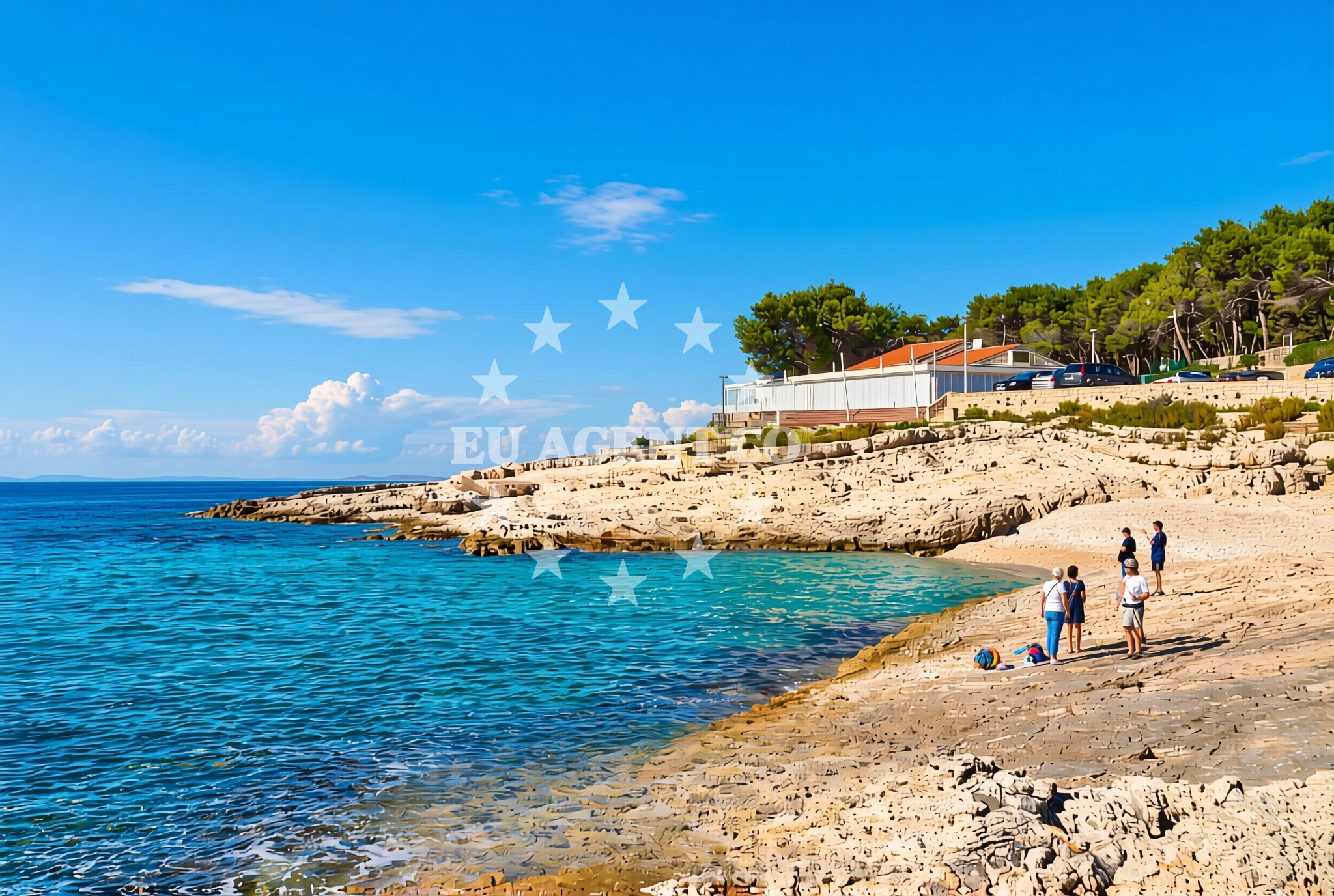
Borik (Žalić) Beach lies on the northern coast of Mali Lošinj, an island in the Adriatic Sea known for its unspoiled natural landscapes and strategic position along Croatia's sailing routes. The beach stretches along a rocky shoreline composed of pebbles, gravel, and exposed rock formations, offering a rugged alternative to the island’s more sheltered coves. On-site amenities include a restaurant and café bar, making it a convenient stop for visitors seeking refreshments after exploring the surrounding area.
About this beach
Borik (Žalić), Mali Lošinj (Lošinj)
Beach: Borik (Žalić)
Location: Mali Lošinj (Lošinj)
Characteristics and facilities
Pebbles, gravel, rocks
Restaurant / snack bar
Caffe bar / Drinks stand
Beach character
The beach’s composition of pebbles and gravel creates a distinct contrast to the soft sands of Mali Lošinj’s other shores. While this terrain may not be ideal for young children, it provides a stable surface for sunbathing and offers a unique vantage point for observing the interplay between land and sea. The rocky sections near the water’s edge are interspersed with patches of gravel, creating a varied walking surface. The beach’s exposure to the open sea means it is subject to stronger waves than the island’s more protected bays, though the Adriatic’s generally calm conditions make it accessible for most visitors.
Swimming and shore
Swimming is possible along the shallower sections of the beach, where the gravel gives way to clearer waters. The rocky outcrops near the shoreline create natural pools that may retain water during low tide, offering small, sheltered areas for wading. The beach’s orientation faces the open Adriatic, meaning swimmers should be mindful of currents, particularly during strong winds. The absence of artificial structures or breakwaters means the beach remains a natural extension of the island’s coastline, preserving its untouched character.
Facilities and activities
The beach is equipped with a restaurant and café bar, both of which are integrated into the surrounding landscape. The restaurant offers meals that reflect local Croatian cuisine, while the café bar provides drinks and light snacks. These amenities are particularly useful for visitors who prefer not to carry provisions during a day at the beach. No formal activities are listed for the beach itself, though its proximity to Mali Lošinj’s hiking trails and coastal roads makes it a potential starting point for exploring the island’s interior or neighboring areas.
Access and location
Borik (Žalić) Beach is located on the northern coast of Mali Lošinj, a small island in the Adriatic Sea that lies between the mainland of Croatia and the Kvarner Gulf. The island is part of the Istrian Peninsula and is accessible by ferry from the mainland town of Lošinj, as well as by boat from nearby islands such as Cres and Pag. The beach’s position on the island’s northern shore places it within reach of the main settlement of Lošinj, which serves as a hub for local services, accommodations, and maritime connections. The Adriatic’s clear waters and mild climate make this region a popular destination for both leisure travelers and sailors.
What to expect
Visitors to Borik (Žalić) Beach should expect a naturalistic setting defined by its rocky shoreline and on-site dining options. The beach is not enclosed by artificial structures, so it is best suited for those who appreciate a more rugged coastal experience. The restaurant and café bar provide essential services for those seeking meals or refreshments, though their availability may depend on seasonal operating hours. The beach’s exposure to the open sea means it is subject to the Adriatic’s natural conditions, including variable wave action and wind patterns. For those interested in exploring beyond the beach, the nearby settlement of Lošinj offers additional services and connections to the broader region.
Practical tips
Bring sturdy footwear to navigate the rocky and gravelly sections of the beach comfortably. The on-site restaurant and café bar are convenient for meals and drinks, but it is advisable to confirm their operating hours in advance. The beach’s position on Mali Lošinj makes it a good base for exploring the island’s hiking trails or taking boat trips to nearby islands. Due to its exposed location, visitors should be mindful of weather conditions, particularly during strong winds or high waves.
Exploring the coast by yacht
Mali Lošinj’s position in the Adriatic makes it a strategic location for yacht charter guests exploring the Croatian coast. The island lies along a popular sailing route that connects the Kvarner Gulf to the islands of Cres, Pag, and the mainland town of Rijeka. Yacht charter companies operating in the region often use Mali Lošinj as a base for trips to the northern Adriatic, where the calm waters and scenic coastlines are ideal for sailing. The nearby port of Lošinj provides access to marinas and fuel stations, making it a practical hub for both short-term stays and longer voyages. For those arriving by yacht, the beach’s proximity to the settlement of Lošinj ensures easy access to local amenities and services.
Mali Lošinj’s Natural and Cultural Context
Mali Lošinj is known for its unspoiled landscapes, including forests, caves, and coastal trails. The island’s interior features the Šunj Nature Park, a protected area with hiking routes that offer panoramic views of the Adriatic. The island’s history is marked by its role in the Austro-Hungarian Empire, with remnants of fortifications and old fishing villages still visible. Locally sourced products, such as honey and olive oil, are available in nearby settlements, adding to the island’s appeal for visitors seeking authentic experiences.
Anchorages in the surrounding area
Anchorages in the surrounding area include options near Mali Lošinj and Veli Lošinj.
- Anchorage — mali losinj — 1.1 NM from beach
- Anchorage — veli losinj — 1.4 NM from beach
- Anchorage — veli losinj — 2.0 NM from beach
- Anchorage — losinj — 2.3 NM from beach
- Anchorage — koludarc — 2.3 NM from beach
- Anchorage — veli losinj — 2.3 NM from beach
- Balvanida — veli losinj — 2.4 NM from beach
- Plijeski — veli losinj — 2.7 NM from beach
Distances are straight-line geographic distances, not sailing routes.
Mooring buoys in the surrounding area
Mooring buoys in the surrounding area are located at Marina Cikat and Jetty in Mali Lošinj.
- Marina Cikat — mali losinj — 0.8 NM from beach
- Jetty — mali losinj — 0.9 NM from beach
- Buoy — mali losinj — 1.1 NM from beach
- Luka Valdarke — mali losinj — 1.1 NM from beach
- Jetty — mali losinj — 1.1 NM from beach
Distances are straight-line geographic distances, not sailing routes.
Marine fuel stations
Marine fuel stations in the vicinity include Ina and Adria Oil in Mali Lošinj.
- Ina — mali losinj — 0.9 NM from beach
- Adria Oil — mali losinj — 1.6 NM from beach
- Tifon — nerezine — losinj — 9.6 NM from beach
- Ina — rab — 19.3 NM from beach
Distances are straight-line geographic distances, not sailing routes.
Harbours in the surrounding area
Harbours in the surrounding area include Mali Lošinj and Sveti Martin.
- Mali Lošinj — mali losinj — 1.0 NM from beach
- Sveti Martin — mali losinj — 1.1 NM from beach
- Rovenska — veli losinj — 2.0 NM from beach
- Rovenska — veli losinj — 2.0 NM from beach
- Za Osirom — cunski — losinj — 4.5 NM from beach
- Harbour Ilovik — 5.1 NM from beach
Distances are straight-line geographic distances, not sailing routes.
Marinas in the surrounding area
Marinas in the surrounding area include Y/C Marina Mali Lošinj and Marina Lošinj.
- Y/C Marina Mali Lošinj — mali losinj — 1.5 NM from beach
- Marina Lošinj — mali losinj — 1.6 NM from beach
- Marina Nerezine — losinj — 8.7 NM from beach
- ACI Marina Rab — 19.3 NM from beach
- ACI Marina Supetarska Draga — rab — 20.4 NM from beach
Distances are straight-line geographic distances, not sailing routes.
Restaurants near the beach
Restaurants near the beach include Sidro, Nostromo, and Konoba Cigale in Mali Lošinj.
- Sidro — mali losinj — 0.8 NM from beach
- Nostromo — mali losinj — 0.9 NM from beach
- Baracuda — mali losinj — 0.9 NM from beach
- Konoba Cigale — mali losinj — 0.9 NM from beach
- Corrado — mali losinj — 0.9 NM from beach
- Noštromo — nostromo — losinj — 0.9 NM from beach
- Diana — mali losinj — 0.9 NM from beach
Distances are straight-line geographic distances, not sailing routes.
Navigation guides for the surrounding area
Navigation guides for the surrounding area cover Mali Losinj and nearby islands.
- Mali Losinj — 1.1 NM from beach
- Luka Sv. Martin — 1.2 NM from beach
- Uvala Artaturi — 3.9 NM from beach
- OtociCi Orjule — 4.8 NM from beach
- Otok llovik and Otok Sv. Petar — 5.3 NM from beach
Distances are straight-line geographic distances, not sailing routes.
Yachts from nearby departure bases
Yachts from nearby departure bases in Mali Lošinj offer sail and motor boat options.
Sailing yachts
- First 31.7 (Ruta) — Mali Lošinj — 1.5 NM from departure base to beach
- Bavaria 46 Cruiser (DEA) — Mali Lošinj — 1.5 NM from departure base to beach
- Sun Odyssey 32i (Cikat) — Mali Lošinj — 1.5 NM from departure base to beach
- Elan 35 Impression (Essi) — Mali Lošinj — 1.5 NM from departure base to beach
- Elan 50 Impression (Vuschi) — Mali Lošinj — 1.5 NM from departure base to beach
Motor boats
- Atlantic Marine Sun Cruiser 690 — Mali Lošinj — 1.5 NM from departure base to beach
- Galeon Galia 630 (287670ML) — Mali Lošinj — 1.5 NM from departure base to beach
- Atlantic Sun Cruiser 730 — Mali Lošinj — 1.5 NM from departure base to beach
- Merry Fisher 795 (Posejdon) — Mali Lošinj — 1.5 NM from departure base to beach
- Antares 36 (JOIA) — Mali Lošinj — 1.5 NM from departure base to beach
Distances are straight-line geographic distances, not sailing routes.