Borak zapad, Marušići (Omiš) Beach, Croatia
7 photos
About this beach
Borak zapad, Marušići (Omiš)
Beach: Borak zapad
Location: Marušići (Omiš)
Characteristics and facilities
Gravel
40 m
Natural shade
Beach character
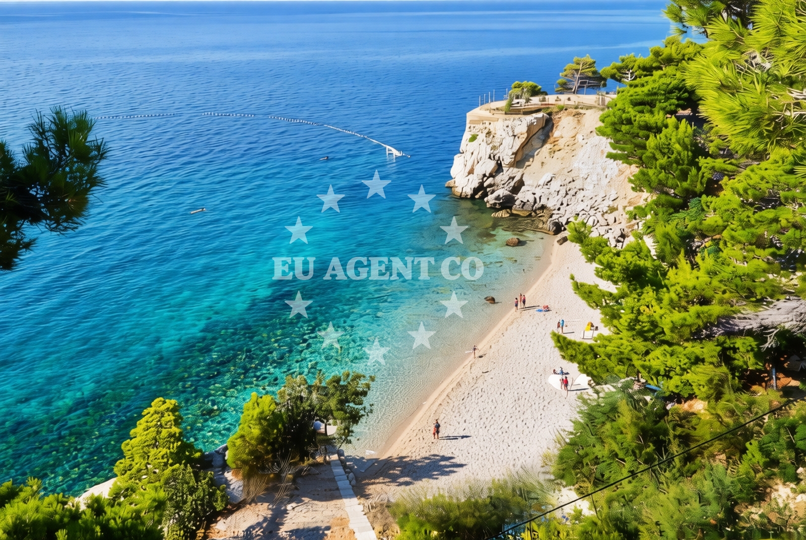
The beach consists of gravel, creating a firm surface that contrasts with typical sandy shores. Its short length (40 meters) makes it a secluded spot, though the natural shade provided by nearby rock formations offers respite from direct sunlight. The gravel composition may influence swimming conditions, with clearer water visibility compared to sandy beaches. The shoreline is marked by rocky outcrops, which contribute to the beach's distinct character.Swimming and shore
Swimming at Borak zapad is feasible, though the gravel substrate may make entry less smooth than at sandy beaches. The shore's rocky nature creates shallow, sheltered areas near the water's edge, which could be suitable for calm swimming conditions. The absence of artificial structures means the beach retains a natural, unaltered profile, with waves breaking gently against the gravel and rocks.Facilities and activities
No formal facilities are listed for Borak zapad, including showers, toilets, or parking. The beach's character suggests it is best suited for visitors seeking a minimalist coastal experience. Activities may include walking along the shore, exploring nearby rock formations, or simply enjoying the unspoiled landscape. The lack of amenities aligns with its description as a naturally shaded, gravel beach.Access and location
Borak zapad is situated in Marušići, a village within the municipality of Omiš on the central Dalmatian coast. The beach's coordinates (43.401433, 16.839845) place it near the southern end of Omiš Bay, close to the town of Omiš and the broader Adriatic coastline. Access likely involves local roads leading to Marušići, with the beach itself positioned along the rocky shoreline. Nearby, Omiš offers historical sites, restaurants, and connections to the surrounding coastal network.What to expect
Expect a short, gravel beach with natural shade provided by rock formations. The shoreline is rocky, with no formal amenities such as parking, restrooms, or changing facilities. The beach's character is defined by its firm substrate and proximity to Omiš, which offers additional services and cultural attractions. The area is suitable for those seeking a quiet, unaltered coastal environment rather than a fully developed beachfront.Practical tips
Visitors should consider the gravel surface when planning activities, as it may require sturdy footwear. The beach's natural shade can provide relief during peak sunlight hours, though sun protection is still advisable. Given the lack of amenities, bringing personal items such as water or snacks is recommended for extended stays.Exploring the coast by yacht
The Omiš region, including Borak zapad, lies within a sailing area popular among charter boats exploring the central Dalmatian coast. Yacht enthusiasts may find the nearby waters of Omiš Bay and the surrounding Adriatic coastline appealing for short cruises or anchoring opportunities. The area's proximity to Omiš, a town with maritime history and coastal infrastructure, offers a base for further exploration of the region's islands and coves.Regional Context and Coastal Connections
Borak zapad's location in Marušići places it within the broader Omiš municipality, known for its medieval fortifications and proximity to the Cetina River canyon. The area is part of a coastline that transitions from rocky shores to more developed beaches as one moves north toward Omiš town. Nearby, the Omiš Bay offers deeper waters and potential sailing routes, while the Cetina River provides inland access points for those combining land and sea travel.Anchorages in the surrounding area
- Anchorage — povlja — brac — 3.6 NM from beach
- Anchorage — povlja — brac — 3.7 NM from beach
- Anchorage — povlja — brac — 3.9 NM from beach
- Anchorage — povlja — brac — 3.9 NM from beach
- Anchorage — povlja — brac — 4.1 NM from beach
- Anchorage — povlja — brac — 4.1 NM from beach
- Anchorage — povlja — brac — 4.1 NM from beach
- Tri luke — povlja — brac — 4.1 NM from beach
Distances are straight-line geographic distances, not sailing routes.
Mooring buoys in the surrounding area
- Restaurant Pipo jetty — povlja — brac — 4.2 NM from beach
- Restaurant Pipo buoys — povlja — brac — 4.2 NM from beach
- Konoba Rojen jetty — povlja — brac — 4.2 NM from beach
- Baško Polje — basko polje — baska voda — 6.1 NM from beach
- Quay — postira — brac — 7.2 NM from beach
Distances are straight-line geographic distances, not sailing routes.
Marine fuel stations
- Fuel station — sumartin — brac — 6.9 NM from beach
- Ina — makarska — 10.0 NM from beach
- Fuel station — bol — brac — 11.7 NM from beach
- Ina — vrboska — hvar — 15.2 NM from beach
Distances are straight-line geographic distances, not sailing routes.
Harbours in the surrounding area
- Pisak — 0.9 NM from beach
- Mimice — 1.4 NM from beach
- Stomarica — 3.5 NM from beach
- Brela — 4.6 NM from beach
- Pučišća harbour — pucisca — brac — 5.6 NM from beach
- Omiš — omis — 6.8 NM from beach
Distances are straight-line geographic distances, not sailing routes.
Marinas in the surrounding area
- Marina Baška Voda — marina baska voda — 5.4 NM from beach
- Marina Ramova — krvavica — 7.8 NM from beach
- Marina Tučepi — marina tucepi — 12.6 NM from beach
- Marina Lav — podstrana — 14.2 NM from beach
- ACI Marina Vrboska — hvar — 15.2 NM from beach
Distances are straight-line geographic distances, not sailing routes.
Restaurants near the beach
- Kala — povlja — brac — 4.1 NM from beach
- Stara Uljara — povlja — brac — 4.1 NM from beach
- Hideaway Pipo — povlja — brac — 4.2 NM from beach
- Konoba Rojen — povlja — brac — 4.3 NM from beach
- Marko — brela — 4.5 NM from beach
- Konoba Feral — brela — 4.5 NM from beach
Distances are straight-line geographic distances, not sailing routes.
Navigation guides for the surrounding area
- Mi mice — 1.2 NM from beach
- Uvala Luka — 4.0 NM from beach
- Pucisca — 5.3 NM from beach
- Omis — 6.5 NM from beach
- Su martin — 7.2 NM from beach
Distances are straight-line geographic distances, not sailing routes.
Yachts from nearby departure bases
Sailing yachts
- Elan Impression 40 (KARLETA) — Baška Voda Port — 5.3 NM from departure base to beach
- Elan 384 Impression (Lissa) — Baška Voda — 5.4 NM from departure base to beach
- Bavaria 44 (TARISA ) — Baška Voda — 5.4 NM from departure base to beach
- Bavaria 46 Cruiser (Silvanac) — Baška Voda — 5.4 NM from departure base to beach
- Sun Odyssey 409 (ARIES) — Baška Voda — 5.4 NM from departure base to beach
- Sun Odyssey 439 (LADY LINDA) — Baška Voda — 5.4 NM from departure base to beach
- Bavaria 41 (Seagoll) — Baška Voda — 5.4 NM from departure base to beach
Catamarans
- Lagoon 450 (LAMANTIN) — Baška Voda — 5.4 NM from departure base to beach
Motor yachts
- Canados 86 (Karisma) — Baška Voda — 5.4 NM from departure base to beach
Motor boats
- Pearl Sea 31 Hard Top (Aero) — Baška Voda Port — 5.3 NM from departure base to beach
Distances are straight-line geographic distances, not sailing routes.
Frequently asked questions
Is there parking available at Borak zapad?
The beach does not list formal parking facilities. Visitors should check local road access and nearby areas in Marušići for potential parking options.What is the best way to reach Borak zapad?
The beach is accessible via local roads leading to Marušići. Omiš town, approximately 10 kilometers north, serves as a nearby hub with additional services and transport connections.Nearby beaches
Borka beach
Put Borka 20, Marusici
0.1 km
Borak istok, Marušići (Omiš) Beach
Borak istok
0.1 km
Plaza Punta
Punta 26, Marusici
0.6 km
Hidden beach
14 Gornji Fistonici, Pisak
0.8 km
Plaza Pasnjak
46 Put Porta, Pisak
1.2 km
Sveti Marko, Pisak
Sveti Marko
1.6 km
Pisak, Pisak Beach
Pisak
1.6 km
Pisak beach
Zapadnaulica 14A, Pisak
1.7 km