Borak Beach, Bol (Brač), Croatia
Borak Beach is a short walk from the heart of Bol, the largest town on Brač Island, offering a gravel shoreline that contrasts with the island’s more famous pebble beaches. Located on the northern coast of Brač, the beach stretches 250 meters along the shore, flanked by natural shade and basic amenities. While not the most secluded stretch of coastline on the island, Borak provides a convenient base for visitors exploring Bol’s historic sites, the island’s vineyards, and the broader Adriatic sailing routes.
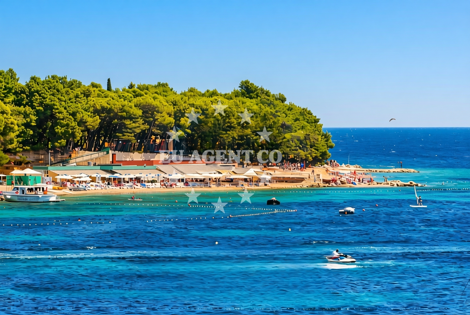
About this beach
Borak, Bol (Brač)
Beach: Borak
Location: Bol (Brač)
Characteristics and facilities
Gravel
250 m
Restaurant / snack bar
Caffe bar / Drinks stand
Natural shade
Changing cabin
Beach character
The beach’s gravel composition makes it distinct from the smooth pebble shores typical of Brač. This texture can be less comfortable for barefoot swimming but offers a stable surface for sunbathing. Facilities include a changing cabin, a restaurant/snack bar, and a café bar/drinks stand, catering to casual visitors. The beach’s proximity to Bol means it benefits from the town’s infrastructure, though it retains a quieter, more local character compared to busier spots like the town’s main harbor.
Swimming and shore
The shallow, clear waters near Borak are typical of the Adriatic coastline, though the gravel substrate may make swimming less ideal for those seeking soft sand. The shore’s gradient is gentle, allowing easy access to the water. While the beach lacks designated swimming zones or lifeguard services, the area is generally safe for short dips. The surrounding coastline of Brač is known for its calm waters and sheltered bays, making it a popular spot for both swimmers and sailors.
Facilities and activities
Borak Beach offers minimal but functional amenities: a single changing cabin, a restaurant/snack bar, and a café bar for drinks. These facilities are suitable for light meals and refreshments but do not include showers, toilets, or parking. The beach is not equipped for water sports, though the nearby village of Bol provides access to sailing, kayaking, and cycling. The gravel surface may limit the use of beach equipment like mats or loungers, but the natural shade from nearby rocks offers respite from the sun.
Access and location
Reaching Borak Beach requires a short walk from Bol’s main road, which runs along the northern shore of the island. The beach is within walking distance of Bol’s historic center, where visitors can explore the town’s medieval architecture, the Church of St. Nicholas, and the island’s renowned white stone buildings. Brač is accessible by ferry from Split, and the island’s road network connects Bol to other coastal villages. The beach’s location makes it a practical starting point for exploring Brač’s vineyards, the island’s inland trails, or nearby islands like Hvar and Vis.
What to expect
Expect a gravel shoreline with basic amenities, ideal for casual visitors seeking proximity to Bol rather than a secluded beach experience. The beach’s facilities are limited to a changing cabin, a restaurant/snack bar, and a café bar. The area is best suited for short stays, with no dedicated parking or shaded seating. The surrounding coastline of Brač is known for its clear waters and sheltered bays, which may appeal to sailors and swimmers exploring the Adriatic.
Practical tips
Bring a towel or mat for the gravel surface, as the beach lacks shaded seating. The changing cabin is the only facility for beachgoers, so consider bringing your own towel and toiletries. The café bar is a good spot for light meals, but arrive early to secure a seat. The beach’s proximity to Bol means it’s a convenient base for exploring the island’s cultural and natural attractions.
Exploring the coast by yacht
Brač is a popular sailing destination in the Adriatic, with its sheltered waters and numerous anchorages. While Borak Beach itself is not a primary anchorage, the island’s northern coast offers several safe mooring spots for yachts. The nearby harbor of Bol provides access to boat rentals and sailing tours, making it a practical starting point for charter guests. The Adriatic’s calm waters and scenic routes between Brač, Hvar, and Vis make this region a favored choice for motor yachts and sailing boats.
Brač Island Context
Brač is renowned for its white stone architecture, vineyards, and the famous Zlatni Rat beach. The island’s coastline is a mix of pebble and gravel shores, with Borak representing one of the more accessible beaches near Bol. The island’s road network connects to other coastal villages, and its inland trails offer hiking opportunities through olive groves and vineyards. For charter guests, Brač’s position in the Adriatic provides easy access to other Dalmatian islands and the mainland.
Anchorages in the surrounding area
Anchorages in Hvar, central Dalmatia, offer nearby options for mooring in the surrounding area.
- Anchorage — hvar — 2.8 NM from beach
- Anchorage — hvar — 2.8 NM from beach
- Anchorage — hvar — 2.8 NM from beach
- Anchorage — hvar — 2.9 NM from beach
- Anchorage — hvar — 3.0 NM from beach
- Uvala Basina — vrbanj — hvar — 3.7 NM from beach
- Anchorage — stari grad — hvar — 4.1 NM from beach
- Anchorage — stari grad — hvar — 4.2 NM from beach
Distances are straight-line geographic distances, not sailing routes.
Mooring buoys in the surrounding area
- Buoy field — bol — brac — 0.3 NM from beach
- Buoy field — bol — brac — 0.6 NM from beach
- Jetty — vrbanj — hvar — 3.5 NM from beach
- Jetty — vrbanj — hvar — 3.6 NM from beach
- Buoy field — stari grad — hvar — 4.5 NM from beach
Distances are straight-line geographic distances, not sailing routes.
Marine fuel stations
A fuel station in Bol, Brač, ensures convenient refueling near the beach.
- Fuel station — bol — brac — 0.5 NM from beach
- Ina — vrboska — hvar — 4.9 NM from beach
- Fuel station — sumartin — brac — 9.7 NM from beach
- Ina — milna brac — 9.7 NM from beach
Distances are straight-line geographic distances, not sailing routes.
Harbours in the surrounding area
The harbor in Bol, Brač, is within a short distance, offering a nearby port for vessels.
- Bol — brac — 0.6 NM from beach
- Vrboska — hvar — 4.9 NM from beach
- Stari Grad — hvar — 5.0 NM from beach
- Port Jelsa — hvar — 6.2 NM from beach
- Pučišća harbour — pucisca — brac — 6.7 NM from beach
- Postira — brac — 7.1 NM from beach
Distances are straight-line geographic distances, not sailing routes.
Marinas in the surrounding area
- ACI Marina Vrboska — hvar — 5.0 NM from beach
- ACI Marina Milna — milna brac — 9.5 NM from beach
- Marina Milna Kanarija — milna brac — 9.6 NM from beach
- Marina Vlaška — milna brac — 9.9 NM from beach
- ACI Marina Palmižana — aci marina palmizana — st klement — 12.4 NM from beach
Distances are straight-line geographic distances, not sailing routes.
Restaurants near the beach
Restaurants in Bol, Brač, including Taverna Riva, are located near the beach for convenient dining.
- Taverna Riva — bol — brac — 0.5 NM from beach
- Ribarska Kucica — bol — brac — 0.9 NM from beach
- Konoba Zavala — stari grad — hvar — 4.7 NM from beach
- Tavern Lavcevic — vrboska — hvar — 4.7 NM from beach
- Konoba Lem — vrboska — hvar — 4.8 NM from beach
- Restaurant Pizzeria Skojic — vrboska — hvar — 4.8 NM from beach
- Trica Gardelin — vrboska — hvar — 4.8 NM from beach
Distances are straight-line geographic distances, not sailing routes.
Navigation guides for the surrounding area
Navigation guides for Bol and surrounding areas, like Uvala Basina, assist in planning routes near the beach.
- Bol — 0.9 NM from beach
- Uvala Basina — 3.8 NM from beach
- Luka Vlaska — 3.8 NM from beach
- Luka Zavala — 4.6 NM from beach
- Otocic Zecevo — 4.8 NM from beach
Distances are straight-line geographic distances, not sailing routes.
Yachts from nearby departure bases
Sailing yachts
- Hanse 388 (BANJO) — Milna Marina Vlaška — 9.9 NM from departure base to beach
- Hanse 505 (AVALON) — Milna Marina Vlaška — 9.9 NM from departure base to beach
- Bavaria 46 Cruiser (MO) — Milna Marina Vlaška — 9.9 NM from departure base to beach
- Hanse 455 (AURUM 1) — Milna Marina Vlaška — 9.9 NM from departure base to beach
Catamarans
- Lagoon 450 Fly (Falco) — Sumpetar Port — 11.5 NM from departure base to beach
Gulets / Cruisers
- Gulet (Primorac) — Omiš City Port — 11.2 NM from departure base to beach
- Gulet (Trebenna) — Omiš City Port — 11.2 NM from departure base to beach
- Gulet (PATRONICE) — Omiš City Port — 11.4 NM from departure base to beach
- Gulet (Altair) — Sumpetar Port — 11.5 NM from departure base to beach
- Gulet (Cataleya) — Sumpetar Port — 11.5 NM from departure base to beach
Distances are straight-line geographic distances, not sailing routes.