Bol (Brač): Beaches and Coves, Croatia
About this beach
Bol (Brač): beaches and coves
Beach character
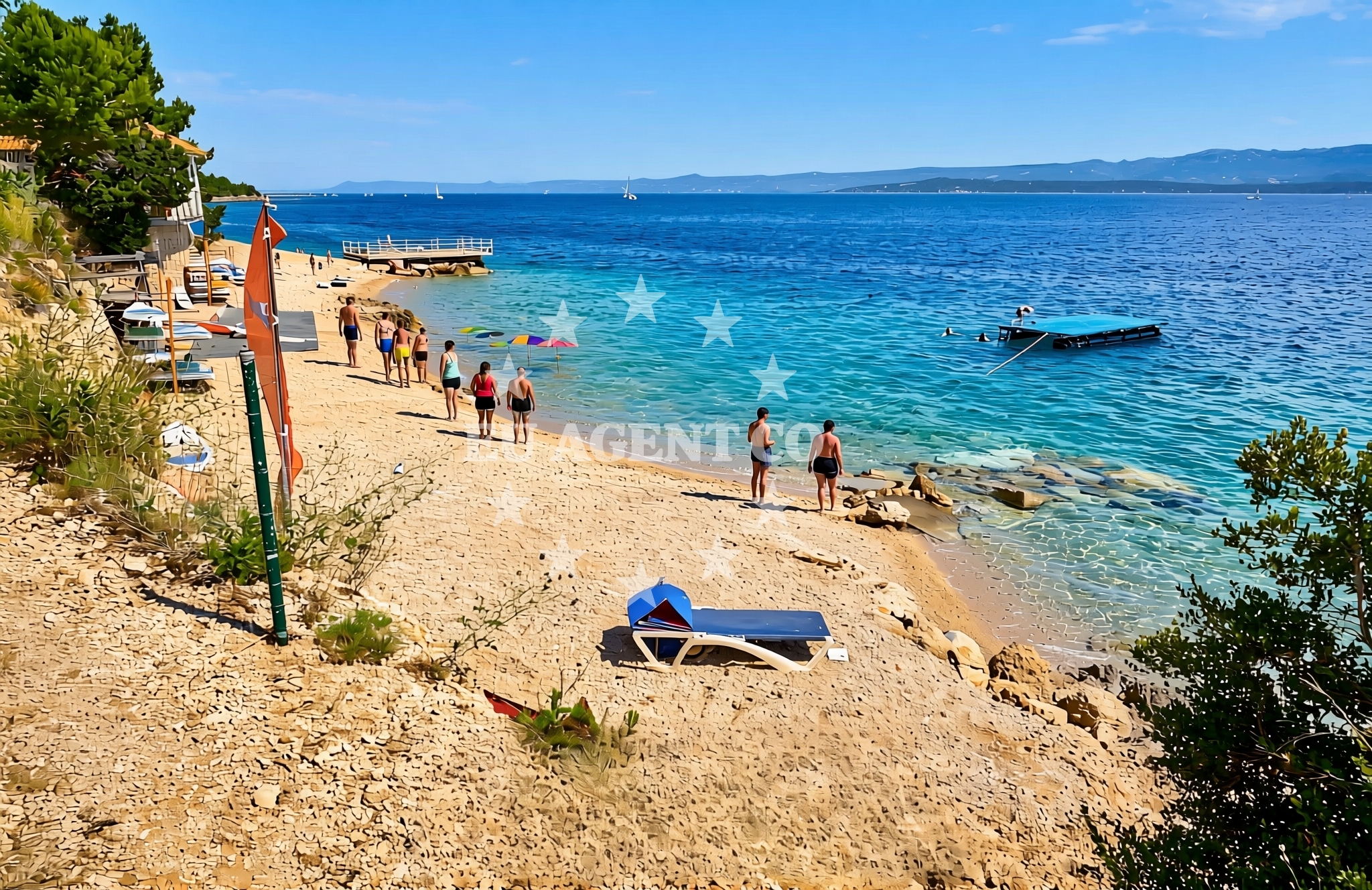
The beaches and coves of Bol are defined by the island’s geology, with limestone formations creating sheltered bays and more exposed stretches. Zlatni Rat, one of Croatia’s most famous beaches, is a prime example: its fan-shaped sandbar extends into the sea, surrounded by clear waters and flanked by pine forests. Other coves feature fine pebbles and shallow depths, ideal for snorkeling. The coastline is punctuated by rocky outcrops and small inlets, many of which are accessible only by boat, offering privacy and unspoiled natural beauty.Swimming and shore
The waters around Bol are typically calm and clear, with depths varying from shallow lagoons near the shore to deeper channels between islands. Swimming is popular at Zlatni Rat and along the western coast, where the sea is sheltered from strong winds. The shorelines vary from sandy beaches with gentle slopes to pebbled areas that require care when entering the water. Some coves are enclosed by cliffs, creating natural pools that are popular with swimmers and divers.Facilities and activities
While the beaches themselves lack direct facilities, Bol town provides amenities such as restaurants, cafes, and shops. The island’s cultural heritage includes historic sites like the Church of St. Nicholas and the Škripa Fortress, accessible via hiking trails. Activities include snorkeling, kayaking, and cycling along the island’s paths. Local vineyards, such as those producing Plavac Mali wine, offer tours and tastings.Access and location
Bol is accessible by ferry from Split (approx. 1 hour) and by air to nearby airports in Split or Dubrovnik. The town has a marina and boat rental services for exploring the surrounding coast. Driving to Brač requires a ferry transfer, as there is no road connection to the island. The beaches are reachable by foot from Bol’s center, with some coves requiring a boat or hike.What to expect
Visitors should expect a coastline shaped by the Adriatic’s natural forces, with beaches that range from crowded to secluded. The area is popular with both tourists and sailors, with yacht charter companies operating in the region. The waters are generally safe for swimming, but visitors should be aware of changing conditions, especially near cliffs. The island’s charm lies in its combination of natural beauty, cultural history, and proximity to other Dalmatian islands.Practical tips
Bring sturdy footwear for exploring rocky coves and cliffs. Sunscreen and a hat are essential, as the limestone terrain reflects sunlight. Consider renting a bike to explore the island’s trails. For those arriving by ferry, allow extra time for transfers and parking in Bol.Exploring the coast by yacht
Brač is a key stop for sailors exploring the Adriatic, with its sheltered bays and proximity to other islands like Hvar and Vis. Yacht charter companies in the region often include Brač in itineraries, allowing guests to anchor in secluded coves or dock at Bol’s marina. The surrounding waters are ideal for day trips, with opportunities to visit nearby islands, caves, and historic sites.Cultural Context of Brač
Brač has a long history of stone quarrying, with the island’s limestone used in ancient Roman architecture. The town of Bol retains medieval influences, with narrow streets and traditional stone buildings. Local festivals, such as the Bol Summer Festival, celebrate music, dance, and the island’s heritage.Sailing Routes from Brač
Sailors can explore routes to the islands of Hvar, Vis, and Korčula, as well as the mainland coast near Split. The Adriatic’s calm waters and well-marked channels make Brač a popular base for both short and extended charters.Anchorages in the surrounding area
Anchorages in Hvar, central Dalmatia, offer nearby options for mooring within 4 nautical miles of Bol (Brač).
- Anchorage — hvar — 2.9 NM from beach
- Anchorage — hvar — 2.9 NM from beach
- Anchorage — hvar — 3.0 NM from beach
- Anchorage — hvar — 3.3 NM from beach
- Anchorage — hvar — 3.4 NM from beach
- Uvala Basina — vrbanj — hvar — 3.8 NM from beach
- Anchorage — vrboska — hvar — 4.4 NM from beach
- Anchorage — stari grad — hvar — 4.6 NM from beach
Distances are straight-line geographic distances, not sailing routes.
Mooring buoys in the surrounding area
- Buoy field — bol — brac — 0.2 NM from beach
- Buoy field — bol — brac — 0.8 NM from beach
- Jetty — vrbanj — hvar — 3.7 NM from beach
- Jetty — vrbanj — hvar — 3.8 NM from beach
- Quay — hvar — 4.7 NM from beach
Distances are straight-line geographic distances, not sailing routes.
Marine fuel stations
Fuel stations in Bol, Brac, and Vrboska, Hvar, are located within 10 nautical miles of the beach.
- Fuel station — bol — brac — 0.1 NM from beach
- Ina — vrboska — hvar — 5.0 NM from beach
- Fuel station — sumartin — brac — 9.2 NM from beach
- Ina — milna brac — 10.0 NM from beach
Distances are straight-line geographic distances, not sailing routes.
Harbours in the surrounding area
Harbours in Bol, Brac, and Vrboska, Hvar, are situated within 7 nautical miles of the beach.
- Bol — brac — 0.1 NM from beach
- Vrboska — hvar — 4.9 NM from beach
- Stari Grad — hvar — 5.4 NM from beach
- Pučišća harbour — pucisca — brac — 6.2 NM from beach
- Port Jelsa — hvar — 6.3 NM from beach
- Postira — brac — 7.0 NM from beach
Distances are straight-line geographic distances, not sailing routes.
Marinas in the surrounding area
Marinas in Vrboska, Hvar, and Milna, Brac, are positioned within 10 nautical miles of Bol (Brač).
- ACI Marina Vrboska — hvar — 5.1 NM from beach
- ACI Marina Milna — milna brac — 9.8 NM from beach
- Marina Milna Kanarija — milna brac — 10.0 NM from beach
- Marina Vlaška — milna brac — 10.2 NM from beach
- ACI Marina Palmižana — aci marina palmizana — st klement — 12.9 NM from beach
Distances are straight-line geographic distances, not sailing routes.
Restaurants near the beach
Restaurants in Bol, Brac, and Vrboska, Hvar, are located within 5 nautical miles of the beach.
- Taverna Riva — bol — brac — 0.1 NM from beach
- Ribarska Kucica — bol — brac — 0.4 NM from beach
- Konoba Lem — vrboska — hvar — 4.9 NM from beach
- Tavern Lavcevic — vrboska — hvar — 4.9 NM from beach
- Restaurant Pizzeria Skojic — vrboska — hvar — 4.9 NM from beach
- Trica Gardelin — vrboska — hvar — 4.9 NM from beach
Distances are straight-line geographic distances, not sailing routes.
Navigation guides for the surrounding area
- Bol — 0.4 NM from beach
- Uvala Basina — 3.9 NM from beach
- Luka Vlaska — 4.3 NM from beach
- Otocic Zecevo — 4.7 NM from beach
- Luka Zavala — 5.0 NM from beach
Distances are straight-line geographic distances, not sailing routes.
Yachts from nearby departure bases
Yachts departing from Milna Marina Vlaška and Sumpetar Port are positioned within 11 nautical miles of Bol (Brač).
Sailing yachts
- Hanse 455 (AURUM 1) — Milna Marina Vlaška — 10.2 NM from departure base to beach
- Bavaria 46 Cruiser (MO) — Milna Marina Vlaška — 10.2 NM from departure base to beach
- Hanse 388 (BANJO) — Milna Marina Vlaška — 10.2 NM from departure base to beach
- Hanse 505 (AVALON) — Milna Marina Vlaška — 10.2 NM from departure base to beach
Catamarans
- Lagoon 450 Fly (Falco) — Sumpetar Port — 11.4 NM from departure base to beach
Gulets / Cruisers
- Gulet (Trebenna) — Omiš City Port — 10.9 NM from departure base to beach
- Gulet (Primorac) — Omiš City Port — 10.9 NM from departure base to beach
- Gulet (PATRONICE) — Omiš City Port — 11.1 NM from departure base to beach
- Gulet (Altair) — Sumpetar Port — 11.4 NM from departure base to beach
- Gulet (Cataleya) — Sumpetar Port — 11.4 NM from departure base to beach
Distances are straight-line geographic distances, not sailing routes.