Bok Zapad, Kolan (Pag) Beach, Croatia
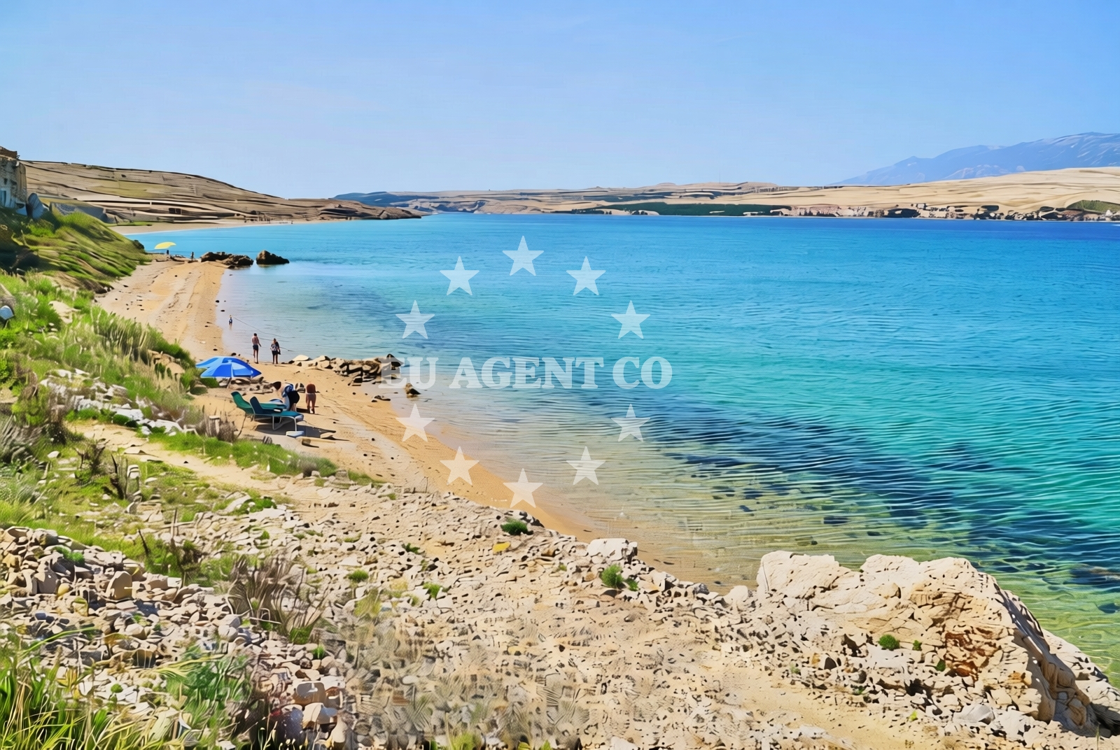
About this beach
Bok zapad, Kolan (Pag)
Beach: Bok zapad
Location: Kolan (Pag)
Characteristics and facilities
Gravel
120 m
Beach character
The beach's gravel composition makes it unsuitable for sunbathing but offers a stable surface for walking along the shore. The 120-meter length is modest, creating an intimate setting that contrasts with the island's larger beaches. The area is marked by the presence of salt pans to the north, which contribute to the region's unique ecology and provide a striking visual backdrop. The beach's orientation faces east, offering sunset views over the Adriatic, though the gravel substrate means it lacks the typical sand-and-rock mix found in many coastal areas.Swimming and shore
Swimming conditions at Bok Zapad are influenced by its exposed location. The gravel shore creates a steep drop-off into the sea, making it unsuitable for children or those seeking shallow waters. The beach is best suited for experienced swimmers who appreciate the open sea. The surrounding waters are generally clear, though the lack of natural shelter means conditions can be affected by wind and waves. The shore itself is composed entirely of gravel, with no sand or pebbles to soften the walking surface.Facilities and activities
There are no formal facilities at Bok Zapad, including showers, toilets, or umbrellas. The absence of infrastructure aligns with its status as a more remote coastal spot. Activities are limited to walking along the shore and enjoying the sea views. The nearby salt pans and agricultural fields provide a different kind of engagement with the landscape, though no organized tours or recreational programs are available directly at the beach.Access and location
Bok Zapad is accessible via local roads connecting Kolan to Pag's main settlements. The beach lies approximately 8 kilometers northeast of Pag Town, placing it within reach of the island's primary infrastructure while maintaining a degree of seclusion. Visitors arriving by car should note that parking is not explicitly marked near the beach, though roadside spaces may be available along the coastal road. The beach's location makes it a potential stop for those exploring Pag's northern coastline by car or boat.What to expect
Visitors should prepare for a beach experience defined by its gravel substrate and limited facilities. The 120-meter stretch offers a peaceful setting with minimal crowds, ideal for those seeking solitude. The eastern orientation provides sunset views, though the lack of sand means it's not suitable for sunbathing. The surrounding salt pans add to the area's distinct character, though there are no amenities for visitors beyond the natural landscape.Practical tips
Wear sturdy footwear for walking on the gravel shore. Bring a towel or mat for sitting, as the gravel can be uncomfortable for prolonged contact. Arrive early to secure a spot along the beach, as the area is small and can fill up during peak hours. The lack of facilities means bringing personal items like water and snacks is essential.Exploring the coast by yacht
For yacht charter guests exploring the Adriatic, Bok Zapad's location on Pag Island offers a strategic vantage point for sailing between the islands of Vis, Hvar, and the mainland coast. The nearby port of Pag provides access to the region's sailing routes, with the beach itself serving as a potential anchorage point for those seeking a quiet shore. The open waters around Pag are known for their consistent winds, making the area a popular choice for sailing enthusiasts.Regional Context and Surrounding Coast
Pag Island's northern coast is characterized by its salt pans, which have been in use for centuries. These expansive, shallow basins create a unique ecosystem and provide a striking contrast to the island's more rugged southern shores. The beach's proximity to these salt pans means visitors may observe traditional salt production methods or the migratory bird populations that the area supports. The surrounding coastline includes other gravel and pebble beaches, reflecting the region's geological profile.Anchorages in the surrounding area
Anchorages in Mandre and Novalja on Pag provide nearby mooring options.
- Anchorage — mandre — pag — 1.6 NM from beach
- Anchorage — mandre — pag — 1.8 NM from beach
- Anchorage — novalja — pag — 2.1 NM from beach
- Anchorage — mandre — pag — 2.2 NM from beach
- Straško — novalja — pag — 3.4 NM from beach
- Anchorage — cesarica — 3.8 NM from beach
- Anchorage — cesarica — 4.1 NM from beach
- Anchorage — cesarica — 4.2 NM from beach
Distances are straight-line geographic distances, not sailing routes.
Mooring buoys in the surrounding area
- Jetty — zubovici — pag — 1.2 NM from beach
- Jetty — zubovici — pag — 1.4 NM from beach
- Jetty — simuni — pag — 3.5 NM from beach
- Buoy field — novalja — pag — 4.0 NM from beach
- Drljanda — stara novalja — pag — 6.1 NM from beach
Distances are straight-line geographic distances, not sailing routes.
Marine fuel stations
- Ina — rab — 16.5 NM from beach
- Ina — mali losinj — 20.8 NM from beach
- Adria Oil — mali losinj — 21.2 NM from beach
- Tifon — nerezine — losinj — 25.4 NM from beach
Distances are straight-line geographic distances, not sailing routes.
Harbours in the surrounding area
Harbors in Žigljen, Novalja, and other nearby areas provide port facilities.
- Žigljen — zigljen — pag — 3.8 NM from beach
- Novalja — pag — 3.8 NM from beach
- Prizna — 5.1 NM from beach
- Karlobag — 5.2 NM from beach
- Stara Novalja — pag — 5.7 NM from beach
- Pag — 6.2 NM from beach
Distances are straight-line geographic distances, not sailing routes.
Marinas in the surrounding area
- ACI Marina Šimuni — simuni — pag — 2.8 NM from beach
- ACI Marina Rab — 16.4 NM from beach
- ACI Marina Supetarska Draga — rab — 19.6 NM from beach
- Y/C Marina Mali Lošinj — mali losinj — 20.9 NM from beach
- Marina Lošinj — mali losinj — 21.2 NM from beach
Distances are straight-line geographic distances, not sailing routes.
Restaurants near the beach
Restaurants in Simuni and Novalja are located near the beach, providing dining options.
- Maestral — simuni — pag — 2.8 NM from beach
- Bistro Šimuni — simuni — pag — 2.9 NM from beach
- Ribarska Koliba Šimuni — simuni — pag — 2.9 NM from beach
- Didova Kuča — simuni — pag — 3.0 NM from beach
- Pizzeria Villa Olea — simuni — pag — 3.1 NM from beach
- Margarita — novalja — pag — 3.2 NM from beach
- Restaurant — novalja — pag — 3.3 NM from beach
Distances are straight-line geographic distances, not sailing routes.
Navigation guides for the surrounding area
Navigation guides for Caska, Novalja, and other nearby areas assist in route planning.
- Caska — 2.0 NM from beach
- Novalja — 3.5 NM from beach
- Uvala Prizna — 5.1 NM from beach
- Uvala Bliznica — 8.5 NM from beach
- Uvala Jakisnica — 10.4 NM from beach
Distances are straight-line geographic distances, not sailing routes.
Yachts from nearby departure bases
Yachts departing from Šimuni, Novalja, and other nearby bases provide access to the beach.
Sailing yachts
- First 45 (Egeria) — Šimuni Kolan ACI Marina — 2.8 NM from departure base to beach
- Bavaria 46 Cruiser (DEA) — Mali Lošinj — 21.0 NM from departure base to beach
- Elan 40 Impression (Laali) — Mali Lošinj — 21.0 NM from departure base to beach
Motor yachts
- Absolute 50 Fly (Acrobat) — Rab ACI Marina — 16.4 NM from departure base to beach
Motor boats
- Balt 818 Titanium (Valentina 2) — Novalja — 3.7 NM from departure base to beach
- Balt 818 Titanium (Valentina) — Novalja — 3.7 NM from departure base to beach
- BWA Sport 22GT (BWA ) — Pag City Port — 6.3 NM from departure base to beach
- Merry Fisher 895 — Povljana Marina — 12.2 NM from departure base to beach
- Galeon Galia 630 — Mali Lošinj — 21.0 NM from departure base to beach
- Atlantic Marine Sun Cruiser 690 — Mali Lošinj — 21.0 NM from departure base to beach
Distances are straight-line geographic distances, not sailing routes.