Bok, Luka (Sali) (Dugi otok) Beach, Croatia
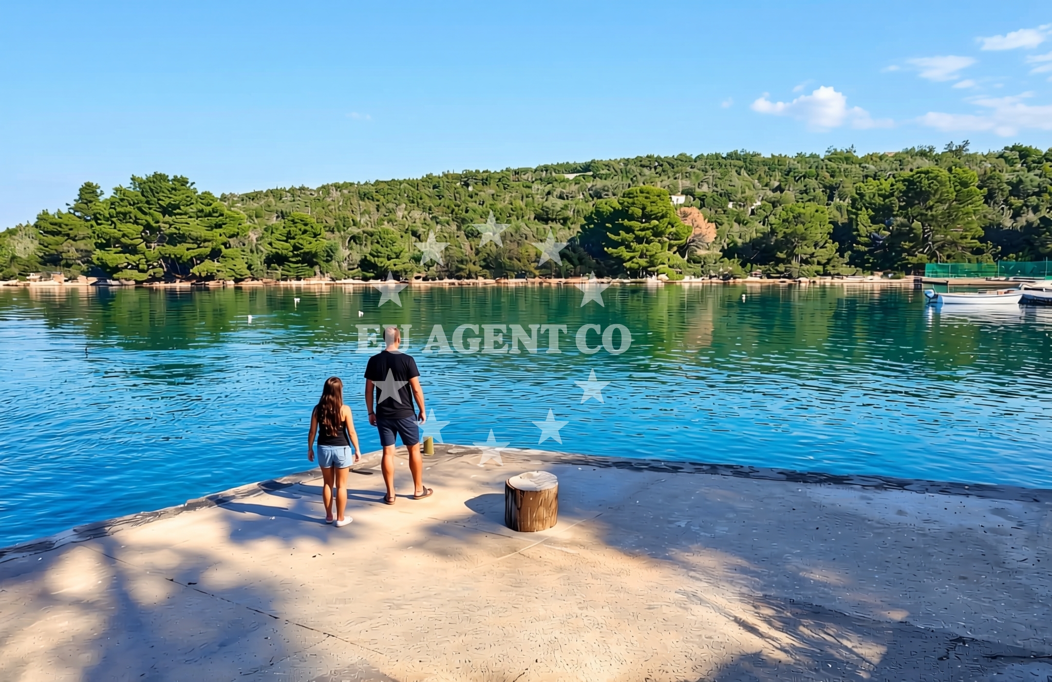
Bok, Luka (Sali) (Dugi otok) Beach lies on the northeastern coast of Dugi Otok, a serene island in Croatia's Adriatic Sea. This stretch of shoreline features concrete and stone slabs, providing a simple yet functional base for visitors. A café bar and shower facilities are available, catering to those seeking basic amenities during their stay. The beach's location within Luka (Sali) offers proximity to the island's natural landscapes and maritime routes, making it a point of interest for both local residents and visitors exploring the region.
About this beach
Bok, Luka (Sali) (Dugi otok)
Beach: Bok
Location: Luka (Sali) (Dugi otok)
Characteristics and facilities
Concrete / stone slabs
Caffe bar / Drinks stand
shower
Beach character
The beach's surface consists of concrete and stone slabs, a characteristic common to many coastal areas on Dugi Otok where natural rock formations have been utilized for accessibility. While not a traditional sandy beach, this configuration provides a stable platform for sunbathing and leisure. The presence of a café bar suggests that the area is frequented by visitors seeking refreshments, though the scale of the facility remains modest. A shower is available, indicating an effort to provide basic hygiene infrastructure for beachgoers.
Swimming and shore
The beach's shallow waters and proximity to the mainland make it a practical landing point for small boats and yachts. The absence of detailed natural features in the catalog suggests that the shoreline is primarily defined by its rocky and concrete elements, with no explicit mention of underwater topography or swimming conditions. The surrounding waters, however, benefit from Dugi Otok's position in the Adriatic, where generally calm seas and clear visibility are typical during the summer months.
Facilities and activities
Facilities at the beach are limited to the café bar and shower, as noted in the authoritative features. There is no indication of additional amenities such as umbrellas, loungers, or parking. The lack of structured activities in the catalog implies that the beach is not a hub for organized recreation, though its location on Dugi Otok may offer opportunities for spontaneous exploration of the island's hiking trails, fishing spots, or nearby coastal villages.
Access and location
Access to Bok, Luka (Sali) (Dugi otok) Beach is via the coastal road network of Dugi Otok, which connects to the mainland through a bridge near the island's northern tip. The beach's position within Luka (Sali) places it near the island's administrative center, where basic services and accommodations are available. For visitors arriving by sea, the beach's proximity to the open waters of the Adriatic makes it a potential stop for yachts navigating between the islands of Cres, Lošinj, and the mainland coast.
What to expect
Visitors to Bok, Luka (Sali) (Dugi otok) Beach should expect a straightforward shoreline defined by concrete and stone slabs, with minimal infrastructure beyond a café bar and shower. The beach is not designed for large crowds or extensive recreational activities, making it suitable for those seeking a quiet spot to enjoy the sea. Its location on Dugi Otok offers the advantage of being near the island's natural attractions, though the beach itself does not feature dramatic landscapes or unique geological formations.
Practical tips
Given the beach's basic facilities, visitors may wish to bring their own towels and refreshments, as the café bar's offerings are likely limited. The absence of detailed crowd information means that visitors should plan for potentially variable attendance levels, depending on the time of day and season. Those arriving by boat should be mindful of the beach's rocky nature when docking or disembarking.
Exploring the coast by yacht
Dugi Otok's position in the Adriatic makes it a strategic point for yacht charter itineraries, with routes connecting to the Kvarner Gulf, Istrian Peninsula, and the northern Dalmatian coast. Bok, Luka (Sali) (Dugi otok) Beach, while not a formal marina, lies within a region where yachts often anchor or make brief stops. Charter guests exploring the area may find the beach useful as a reference point, particularly when navigating between the island's eastern and western coasts.
Dugi Otok's Coastal Significance
Dugi Otok, meaning 'Long Island,' is renowned for its unspoiled natural beauty and strategic location in the Adriatic. The island's coastline features a mix of pebble beaches, rocky shores, and sheltered coves, with Bok, Luka (Sali) representing one of the more accessible points along its northern shore. The island's maritime history is evident in its fishing traditions and the presence of small harbors that continue to serve local vessels.
Anchorages in the surrounding area
Nearby anchorages include luka-dugi-otok and zman, situated along Dugi Otok.
- Anchorage — luka dugi otok — 0.3 NM from beach
- Anchorage — zman — dugi otok — 1.1 NM from beach
- Anchorage — dugi otok — 1.9 NM from beach
- Anchorage — rava — 2.0 NM from beach
- Krknata — 2.1 NM from beach
- Anchorage — krknata — 2.3 NM from beach
- Anchorage — rava — 2.7 NM from beach
- Anchorage — zaglav — dugi otok — 3.0 NM from beach
Distances are straight-line geographic distances, not sailing routes.
Mooring buoys in the surrounding area
- Luka — luka dugi otok — 0.2 NM from beach
- Quay — luka dugi otok — 0.3 NM from beach
- Villa Rava buoys — 2.5 NM from beach
- Villa Rava quai — 2.5 NM from beach
- Buoy field — iz — 2.9 NM from beach
Distances are straight-line geographic distances, not sailing routes.
Marine fuel stations
Fuel stations near the beach include Ina — zaglav — dugi otok and Ina — preko — ugljan, positioned along Dugi Otok and Ugljan.
- Ina — zaglav — dugi otok — 2.8 NM from beach
- Ina — preko — ugljan — 7.0 NM from beach
- Fuel station — sukosan — 9.5 NM from beach
- Ina — zadar — 9.8 NM from beach
Distances are straight-line geographic distances, not sailing routes.
Harbours in the surrounding area
Harbours in the vicinity include Žman — zman — dugi otok and Zaglav — dugi otok, found on Dugi Otok.
- Žman — zman — dugi otok — 1.0 NM from beach
- Zaglav — dugi otok — 2.8 NM from beach
- Vela Rava — 3.0 NM from beach
- Bršanj — iz mali — 3.2 NM from beach
- Bršanj — iz mali — 3.2 NM from beach
- Mala Rava — 3.9 NM from beach
Distances are straight-line geographic distances, not sailing routes.
Marinas in the surrounding area
Marinas nearby are Marina Veli Iž — iz veli and Marina Preko — ugljan, located on Iz and Ugljan.
- Marina Veli Iž — iz veli — 4.1 NM from beach
- Marina Preko — ugljan — 7.0 NM from beach
- Kukljica — ugljan — 7.2 NM from beach
- Olive Island Marina — sutomiscica — ugljan — 7.4 NM from beach
- Marina Dalmacija — sukosan — 9.7 NM from beach
Distances are straight-line geographic distances, not sailing routes.
Restaurants near the beach
Restaurants close to the beach include Restaurant — luka dugi otok and Villa Rava, situated on Dugi Otok and Rava.
- Restaurant — luka dugi otok — 0.3 NM from beach
- Alen — luka dugi otok — 0.3 NM from beach
- Villa Rava — 2.5 NM from beach
- Roko — zaglav — dugi otok — 2.7 NM from beach
- Keko — rava — 3.0 NM from beach
- Konoba Gajeta — iz mali — 3.2 NM from beach
- Knez — iz — 3.2 NM from beach
Distances are straight-line geographic distances, not sailing routes.
Navigation guides for the surrounding area
Navigation guides for the area include Uvala Zmanscica and Uvala Brsanj, located near Dugi Otok.
- Uvala Zmanscica — 1.2 NM from beach
- Uvala Brsanj — 3.3 NM from beach
- Uvala Knez — 3.4 NM from beach
- Uvala Lokvino (Mala Rava) — 3.7 NM from beach
- DUGI OTOK — 4.2 NM from beach
Distances are straight-line geographic distances, not sailing routes.
Yachts from nearby departure bases
Sailing yachts
- Elan Impression 40 (Val) — Ugljan Sutomišćica Olive Island — 7.5 NM from departure base to beach
- Bavaria Cruiser 46 (WHITE STAR) — Sukošan Marina Dalmacija — 9.7 NM from departure base to beach
- Bavaria Cruiser 34 (Whirl) — Sukošan Marina Dalmacija — 9.7 NM from departure base to beach
Catamarans
- Lagoon 46 (WHITE PEARL) — Sukošan Marina Dalmacija — 9.7 NM from departure base to beach
- Lagoon 42 (CUZAMEN) — Sukošan Marina Dalmacija — 9.7 NM from departure base to beach
Motor yachts
- Dominator 780S (Dalia) — Sukošan Marina Dalmacija — 9.7 NM from departure base to beach
- Manhattan 50 (FOREVER MAJA) — Sukošan Marina Dalmacija — 9.7 NM from departure base to beach
Motor boats
- Quicksilver Activ 905 (Galeb) — Ugljan Sutomišćica Olive — 7.5 NM from departure base to beach
- Adria 28 Luxus (Ana) — Brbinj Marina — 7.5 NM from departure base to beach
- Antares 8 (BELECA) — Sukošan Marina Dalmacija — 9.7 NM from departure base to beach
Distances are straight-line geographic distances, not sailing routes.