Blato istok, Živogošće Beach, Croatia
About this beach
Blato istok, Živogošće
Beach: Blato istok
Location: Živogošće
Characteristics and facilities
Gravel, rocks
100 m
Natural shade
Beach character
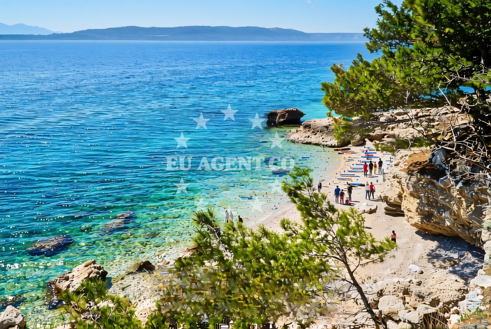
The shoreline is composed primarily of gravel and rocky outcrops, creating a terrain more suited to walking than swimming. The 100-meter length is flanked by natural shade from the landward side, which may offer respite during peak sunlight hours. The absence of artificial structures or beachgoer infrastructure emphasizes the area’s untouched quality, though this also means limited facilities for visitors.Swimming and shore
Swimming conditions are not ideal due to the rocky seabed and gravelly shore. The beach is better suited for coastal exploration, with opportunities to examine tidal patterns and marine life along the rocky intertidal zones. The natural shade can provide temporary relief from direct sun exposure, though visitors should still exercise caution with sun protection.Facilities and activities
No amenities such as showers, toilets, or changing rooms are present. The beach’s character is defined by its natural state, making it more appropriate for solitary exploration or photography than group activities. The rocky terrain may appeal to hikers or those interested in geological formations, though access is limited to the immediate shoreline.Access and location
The beach is situated in Živogošće, a small settlement within the Blato region of Croatia’s Dalmatian coast. This area is part of a larger network of coastal landscapes that include the nearby island of Šipan and the town of Ston. The beach’s proximity to Blato’s inland areas means it is less accessible than more tourist-facing shores, requiring local knowledge or guided access for visitors.What to expect
Expect a rugged coastline with gravel and rock formations, ideal for those seeking a remote coastal experience. The beach’s natural shade offers limited protection from the sun, and its lack of amenities means it is not suited for extended stays. The area’s isolation makes it a quiet alternative to more developed shores, with opportunities to observe the interplay between land and sea.Practical tips
Wear sturdy footwear for the rocky terrain. Sunscreen is recommended despite the natural shade. Check local tide times to avoid being stranded on exposed sections of the beach during low tide.Exploring the coast by yacht
For yacht charter guests, the Blato region offers a gateway to the broader Adriatic sailing routes. Nearby marinas in the town of Ston and on the island of Šipan provide docking options for motor yachts and sailboats. The area’s shallow waters and rocky inlets make it a strategic point for exploring the Pelješac Peninsula and the southern Dalmatian coast.Regional Context
Živogošće is part of the Blato municipality, known for its historical connection to the Šibenik-Knin County. The area’s geography includes a mix of coastal cliffs and inland valleys, with Blato istok representing one of the more secluded stretches of shoreline. Local traditions emphasize maritime heritage, though tourism infrastructure remains minimal compared to nearby towns like Dubrovnik or Split.Anchorages in the surrounding area
Anchorages in Drvenik and Sucuraj offer nearby options for mooring in the surrounding area.
- Anchorage — drvenik — 2.5 NM from beach
- Anchorage — sucuraj — hvar — 2.7 NM from beach
- Anchorage — sucuraj — hvar — 3.0 NM from beach
- Anchorage — sucuraj — hvar — 3.2 NM from beach
- Anchorage — sucuraj — hvar — 3.6 NM from beach
- Anchorage — selca kod bogomolja — hvar — 3.8 NM from beach
- Anchorage — selca kod bogomolja — hvar — 3.8 NM from beach
- Anchorage — selca kod bogomolja — hvar — 4.4 NM from beach
Distances are straight-line geographic distances, not sailing routes.
Mooring buoys in the surrounding area
- Drvenik - Ferry dock — drvenik ferry dock — 2.5 NM from beach
- Jetty — sucuraj — hvar — 2.7 NM from beach
- Kraj - Soline — kraj soline — drasnice — 4.8 NM from beach
- Konoba Gambo buoys — selca kod bogomolja — hvar — 5.2 NM from beach
- Brist — 6.3 NM from beach
Distances are straight-line geographic distances, not sailing routes.
Marine fuel stations
Fuel stations in Makarska, Ploce, and Korcula serve as refueling options for vessels traveling to the area.
- Ina — makarska — 10.9 NM from beach
- Fuel station — ploce — 12.7 NM from beach
- Fuel station — korcula — 13.0 NM from beach
- Fuel station — sumartin — brac — 16.2 NM from beach
Distances are straight-line geographic distances, not sailing routes.
Harbours in the surrounding area
Harbours in Živogošće and Drvenik are within close proximity to the beach.
- Živogošće — zivogosce — 2.0 NM from beach
- Drvenik — 2.4 NM from beach
- Sućuraj — sucuraj — hvar — 2.6 NM from beach
- Igrane — 2.8 NM from beach
- Zaostrog — 4.1 NM from beach
- Drašnice — drasnice — 4.7 NM from beach
Distances are straight-line geographic distances, not sailing routes.
Marinas in the surrounding area
Marinas in Tučepi, Korcula, and Lumbarda cater to yachts seeking berths in the region.
- Marina Tučepi — marina tucepi — 8.2 NM from beach
- ACI Marina Korčula — korcula — 12.9 NM from beach
- Marina Ramova — krvavica — 13.2 NM from beach
- Marina Lumbarda — korcula — 14.7 NM from beach
- Marina Baška Voda — marina baska voda — 15.7 NM from beach
Distances are straight-line geographic distances, not sailing routes.
Restaurants near the beach
Restaurants in Sucuraj offer dining options for visitors near Blato istok.
- Restaurant — sucuraj — hvar — 2.6 NM from beach
- Riblji Restoran — sucuraj — hvar — 2.7 NM from beach
- Mlaska — sucuraj — hvar — 3.0 NM from beach
Distances are straight-line geographic distances, not sailing routes.
Navigation guides for the surrounding area
Navigation guides for Otok Hvar and Uvala Drvenik assist in planning routes around the area.
- OTOK HVAR — 2.7 NM from beach
- Uvala Drvenik (Donja Vala) — 2.7 NM from beach
- Podgora — 6.6 NM from beach
- Uvala Kozja — 7.0 NM from beach
- Uvala Duboka — 7.2 NM from beach
Distances are straight-line geographic distances, not sailing routes.
Yachts from nearby departure bases
Yachts departing from Tučepi Port and Makarska Port provide access to the surrounding waters.
Sailing yachts
- Bavaria 40 Cruiser (LADY BUTTERFLY) — Tučepi Port — 8.3 NM from departure base to beach
- Elan 40 Impression (Karleta) — Ploče City Port — 12.6 NM from departure base to beach
- More 55 (MRS. ROBINSON) — Ploče City Port — 12.6 NM from departure base to beach
- Sun Odyssey 349 (Porto Tolero) — Ploče City Port — 12.6 NM from departure base to beach
Catamarans
- Lagoon 450 Fly (Alba Mouse) — Ploče City Port — 12.6 NM from departure base to beach
Motor yachts
- Princess V53 (Chablis) — Makarska Port — 10.7 NM from departure base to beach
Motor boats
- Jeanneau NC 37 (Black Pearl) — Makarska Port — 10.7 NM from departure base to beach
- Galeon 430 Skydeck (Bellagio) — Makarska Port — 10.7 NM from departure base to beach
- Jeanneau NC 37 (Black Pearl) — Makarska Port — 10.7 NM from departure base to beach
- Galeon 430 Skydeck (BELLAGIO) — Makarska Port — 10.7 NM from departure base to beach
Distances are straight-line geographic distances, not sailing routes.