Blatno istok, Milohnići (Krk) Beach, Croatia
6 photos
About this beach
Blatno istok, Milohnići (Krk)
Beach: Blatno istok
Location: Milohnići (Krk)
Characteristics and facilities
Pebbles, gravel, rocks
50 m
Natural shade
Beach character
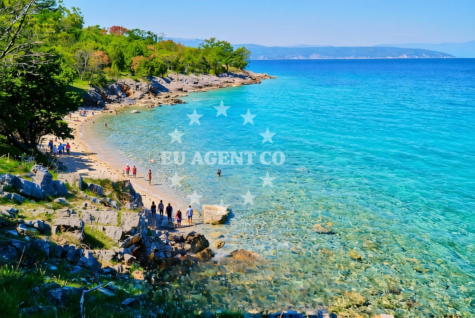
The beach consists of a mix of pebbles, gravel, and rocky outcrops, creating a textured shoreline that is more suited to casual strolls than sunbathing. The 50-meter stretch of natural shade, likely provided by overhanging cliffs or dense vegetation, offers a brief respite from direct sunlight. The absence of structured facilities means the beach retains a raw, unspoiled character, typical of many lesser-known Croatian coastlines.Swimming and shore
Swimming conditions at Blatno istok are influenced by the rocky terrain, which can create uneven entry points into the water. The shore itself is uneven, with pockets of finer sand between larger stones. The beach’s orientation on Krk’s northern coast means it may experience stronger wave action compared to more sheltered coves further south on the island.Facilities and activities
There are no formal facilities at Blatno istok, including showers, restrooms, or parking. The beach’s character is defined by its natural features rather than amenities. Activities are limited to walking along the shore, exploring the rocky coastline, and enjoying the unobstructed views of the Adriatic. The nearby village of Milohnići offers basic services for visitors needing supplies.Access and location
Blatno istok is situated in Milohnići, a small settlement on the northern coast of Krk Island. The beach is accessible via local roads connecting to the main island routes. Krk itself is reachable by ferry from the mainland, with services departing from Rijeka and other nearby ports. The beach’s location makes it a potential stop for those circumnavigating the island by boat or car.What to expect
Visitors to Blatno istok should expect a rugged, untamed shoreline rather than a conventional beach experience. The mix of pebbles, gravel, and rocks creates a unique walking surface, while the 50-meter stretch of natural shade provides limited relief from the sun. The beach’s isolation means it is unlikely to be crowded, though its lack of facilities makes it unsuitable for extended stays. The surrounding landscape offers opportunities for coastal exploration, particularly for those interested in Krk’s less-developed northern coastline.Practical tips
Wear sturdy footwear to navigate the uneven shoreline. Sun protection is essential, as the natural shade is limited. Arrive early to secure a spot on the beach, though its remote nature means it may not be heavily used.Exploring the coast by yacht
For yacht charter guests exploring the northern Adriatic, Blatno istok provides a glimpse into Krk’s lesser-known coastal areas. While not a formal anchorage, the beach’s proximity to Milohnići and the island’s marina infrastructure makes it a potential waypoint for those sailing along Krk’s northern coast. Euro-Agent’s yacht search tool can help identify vessels suited for coastal cruising in this region.Krk Island’s Coastal Character
Krk Island’s northern coast, where Blatno istok is located, is marked by a rugged, rocky shoreline that contrasts with the island’s more famous southern beaches. This section of the coast is less developed, offering a more authentic Adriatic experience. The island’s history as a Roman settlement and its medieval fortifications add historical context to the landscape.Anchorages in the surrounding area
- Anchorage — krk — 0.3 NM from beach
- Anchorage — krk — 0.6 NM from beach
- Camp Glavotok — krk — 1.2 NM from beach
- Anchorage — porat — krk — 1.9 NM from beach
- Anchorage — malinska — krk — 2.0 NM from beach
- Anchorage — krk — 2.4 NM from beach
- Anchorage — krk — 2.6 NM from beach
- Anchorage — pinezici — krk — 3.3 NM from beach
Distances are straight-line geographic distances, not sailing routes.
Mooring buoys in the surrounding area
- Camp Glavotok — krk — 1.1 NM from beach
- Jetty — pinezici — krk — 3.1 NM from beach
- Jetty — pinezici — krk — 3.2 NM from beach
- Buoy field — pinezici — krk — 3.6 NM from beach
- Jetty — pinezici — krk — 3.6 NM from beach
Distances are straight-line geographic distances, not sailing routes.
Marine fuel stations
- OMV — krk — 4.4 NM from beach
- Ina — krk — 6.3 NM from beach
- Flash — krk — 6.4 NM from beach
- Fuel station — cres — 8.7 NM from beach
Distances are straight-line geographic distances, not sailing routes.
Harbours in the surrounding area
- Glavotok — krk — 1.4 NM from beach
- Porat — krk — 1.9 NM from beach
- Vantačić — vantacic — vantacici — 2.0 NM from beach
- Club Harbour — krk — 2.3 NM from beach
- Haludovo — malinska — krk — 3.4 NM from beach
- Haludovo — malinska — krk — 3.4 NM from beach
Distances are straight-line geographic distances, not sailing routes.
Marinas in the surrounding area
- Omišalj Docks — omisalj — krk — 7.6 NM from beach
- Marina Punat — krk — 7.9 NM from beach
- Šilo — silo — krk — 9.2 NM from beach
- ACI Marina Cres — 9.3 NM from beach
- Marina Novi — novi vinodolski — 13.7 NM from beach
Distances are straight-line geographic distances, not sailing routes.
Restaurants near the beach
- Gostiona Sidro — porat — krk — 1.8 NM from beach
- Picolla Venezia — porat — krk — 1.9 NM from beach
- Porat — krk — 1.9 NM from beach
- Restaurant Obala — malinska — krk — 3.0 NM from beach
- Restaurant — malinska — krk — 3.4 NM from beach
- Restaurant — malinska — krk — 3.4 NM from beach
- Restaurant — pinezici — krk — 3.5 NM from beach
Distances are straight-line geographic distances, not sailing routes.
Navigation guides for the surrounding area
- Uvala Cavlena — 0.3 NM from beach
- Uvala Vala Jana — 2.3 NM from beach
- Luka Torkul — 3.3 NM from beach
- Uvala Sv. Fuska — 3.6 NM from beach
- Luka Kijac — 4.3 NM from beach
Distances are straight-line geographic distances, not sailing routes.
Yachts from nearby departure bases
Sailing yachts
- Sun Odyssey 29.2 (Mirabai) — Malinska Hotel Malin port — 2.7 NM from departure base to beach
- Bavaria Cruiser 46 (GARBIN) — Krk Marina Punat — 7.9 NM from departure base to beach
- Bavaria Cruiser 33 (PULENAT) — Krk Marina Punat — 7.9 NM from departure base to beach
- Bavaria 50 (Prominea) — Krk Marina Punat — 7.9 NM from departure base to beach
Catamarans
- Nautitech 46 Fly (STEFANY ) — Krk Marina Punat — 7.9 NM from departure base to beach
- Lavezzi 40 (Mrs. Brightside) — Krk Marina Punat — 7.9 NM from departure base to beach
Motor yachts
- Elegance 60 Fly (LIFESTYLE 1) — Krk Marina Punat — 7.9 NM from departure base to beach
- Galeon 500 Fly (Barbara) — Krk Marina Punat — 7.9 NM from departure base to beach
Motor boats
- Antares 42 (Santin) — Krk Marina Punat — 7.9 NM from departure base to beach
- Zodiac Medline 2 (Medline 2) — Krk Marina Punat — 7.9 NM from departure base to beach
Distances are straight-line geographic distances, not sailing routes.
Frequently asked questions
Is Blatno istok suitable for swimming?
The beach’s rocky and pebbled shoreline makes it less ideal for swimming compared to sandy beaches. However, the area is suitable for wading and exploring the coastal waters.Are there parking facilities near the beach?
There are no formal parking facilities at Blatno istok. Visitors should plan to arrive by foot or vehicle and park in nearby Milohnići.Nearby beaches
Blatno sredina, Milohnići (Krk) Beach
Blatno sredina
0.2 km
Pero beach II
Milohnići 1A, Milohnići
0.3 km
Vrulja, Milohnići (Krk)
Vrulja
0.3 km
Celebanovo istok, Milohnići (Krk) Beach
Celebanovo istok
0.4 km
Celebanovo zapad, Milohnići (Krk) Beach
Celebanovo zapad
0.5 km
Uvala Cavlena Beach
Milohnići 1A, Milohnići
0.5 km
Vela Riva, Poljica (Krk)
Vela Riva
0.7 km
Mršićeva istok, Milohnići (Krk) Beach
Mršićeva istok
0.7 km