Blatnice Zapad, Brist Beach, Croatia
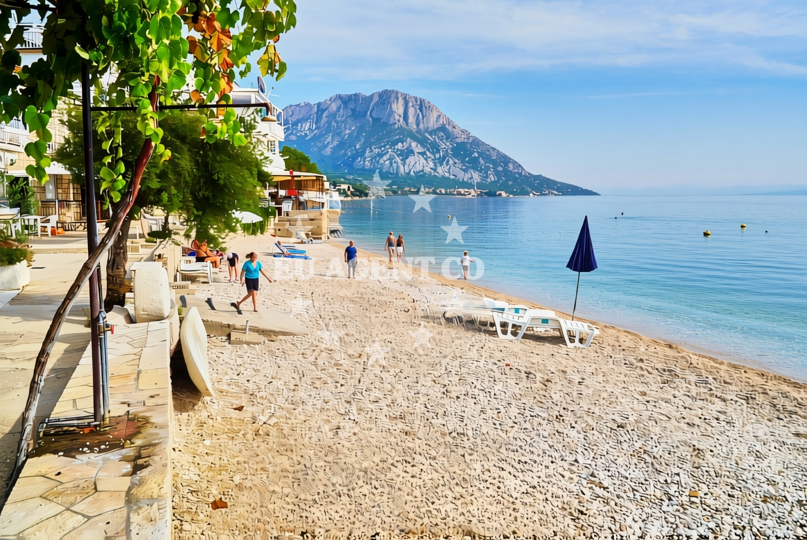
Blatnice Zapad, Brist Beach lies along the Adriatic coast near the town of Brist, offering a rugged shoreline of pebbles and gravel. This beach is characterized by its natural features and limited on-site amenities, making it a straightforward choice for visitors seeking a simple coastal experience. The beach's proximity to the open sea and surrounding settlements connects it to the broader network of Adriatic sailing routes, though it is not a primary anchorage or marina location.
About this beach
Blatnice zapad, Brist
Beach: Blatnice zapad
Location: Brist
Characteristics and facilities
Pebbles, gravel
200 m
Restaurant / snack bar
Caffe bar / Drinks stand
Natural shade
Beach character
The beach's pebbled and gravelly shoreline defines its character, creating a stark contrast to the soft sands of other Adriatic beaches. This terrain is suitable for those who prefer a more rugged coastal experience. Natural shade is available along parts of the beach, providing limited relief from the sun. The beach does not feature artificial structures or extensive landscaping, maintaining a raw, unaltered appearance typical of many Croatian coastal areas.
Swimming and shore
The pebbled shore makes swimming accessible but may require careful navigation due to the uneven surface. The beach's proximity to the open sea means water conditions can vary depending on weather and tidal patterns. No specific swimming facilities or safety equipment are noted in the beach's authoritative records, reflecting its minimalistic approach to amenities.
Facilities and activities
Basic facilities include a restaurant/snack bar and a caffe bar/drinks stand, catering to visitors seeking light meals or beverages. These amenities are limited in scope and do not extend to showers, restrooms, or parking. The beach does not list structured activities or rental services, aligning with its straightforward, low-key profile. The absence of detailed activity listings suggests it is not a destination for specialized water sports or organized events.
Access and location
Located in Brist, a coastal settlement on the Adriatic, the beach is positioned within a region known for its maritime traditions and sailing opportunities. While specific access details such as road proximity or parking availability are not documented, the beach's placement near Brist implies it is accessible via local roads. The area's connection to the Adriatic Sea positions it as a potential waypoint for sailors exploring the Dalmatian coast, though it is not marked as a primary anchorage in maritime guides.
What to expect
Visitors should expect a beach with a pebbled and gravelly shoreline, minimal on-site amenities, and a focus on natural coastal features. The presence of a restaurant/snack bar and caffe bar/drinks stand offers basic catering options, while natural shade provides limited sun protection. The beach does not feature artificial structures, organized activities, or extensive facilities, making it a choice for those seeking a simple, unembellished coastal experience. Its location near Brist and the Adriatic Sea connects it to the broader sailing network, though it is not a primary marina or anchorage point.
Practical tips
Given the beach's natural terrain, visitors may want to wear appropriate footwear for walking on pebbles. The availability of on-site dining suggests it is suitable for short stays, though extended visits may require nearby accommodations. The lack of detailed access information means visitors should plan for potential challenges in reaching the beach, particularly during peak hours or inclement weather.
Exploring the coast by yacht
Blatnice Zapad's location near Brist places it within the Adriatic sailing corridor, a region popular with motor yachts and sailing boats exploring the Dalmatian coast. While the beach itself is not marked as an anchorage or marina, its proximity to the sea and coastal settlements may make it a convenient stop for sailors passing through the area. Euro-Agent's yacht search platform can help identify nearby bases or marinas for more detailed sailing itineraries.
Regional Context and Coastal Setting
Brist is a small coastal town in Croatia, part of the Split-Dalmatia County. The area is known for its traditional fishing communities and historic maritime connections. The surrounding coastline features a mix of pebbled beaches, rocky outcrops, and clear waters typical of the Adriatic. This context positions Blatnice Zapad as one of many similar beaches in the region, reflecting the natural coastal geography of the area.
Anchorages in the surrounding area
Anchorages in Drvenik and Ploce lie within reach of Blatnice zapad, Brist Beach.
- Anchorage — drvenik — 3.6 NM from beach
- Anchorage — ploce — 4.4 NM from beach
- Anchorage — sucuraj — hvar — 5.8 NM from beach
- Anchorage — sucuraj — hvar — 6.7 NM from beach
- Anchorage — trpanj — 7.1 NM from beach
- Anchorage — sucuraj — hvar — 7.2 NM from beach
- Anchorage — selca kod bogomolja — hvar — 7.6 NM from beach
- Anchorage — selca kod bogomolja — hvar — 7.7 NM from beach
Distances are straight-line geographic distances, not sailing routes.
Mooring buoys in the surrounding area
A mooring buoy in Brist and additional buoys in Drvenik are situated near Blatnice zapad, Brist Beach.
- Brist — 0.3 NM from beach
- Drvenik - Ferry dock — drvenik ferry dock — 3.6 NM from beach
- Jetty — sucuraj — hvar — 5.6 NM from beach
- Konoba Gambo buoys — selca kod bogomolja — hvar — 9.5 NM from beach
- Jetty — blace — 10.1 NM from beach
Distances are straight-line geographic distances, not sailing routes.
Marine fuel stations
Fuel stations in Ploce and Korcula provide refueling options for vessels near Blatnice zapad, Brist Beach.
- Fuel station — ploce — 6.7 NM from beach
- Fuel station — korcula — 12.4 NM from beach
- Ina — makarska — 16.8 NM from beach
- Fuel station — sumartin — brac — 22.2 NM from beach
Distances are straight-line geographic distances, not sailing routes.
Harbours in the surrounding area
Harbors in Gradac and Zaostrog are in close proximity to Blatnice zapad, Brist Beach.
- Gradac — 1.5 NM from beach
- Zaostrog — 2.0 NM from beach
- Drvenik — 3.7 NM from beach
- Sućuraj — sucuraj — hvar — 5.6 NM from beach
- Ploče — ploce — 6.6 NM from beach
- Trpanj — 7.0 NM from beach
Distances are straight-line geographic distances, not sailing routes.
Marinas in the surrounding area
- ACI Marina Korčula — korcula — 12.5 NM from beach
- Marina Lumbarda — korcula — 13.4 NM from beach
- Marina Tučepi — marina tucepi — 14.2 NM from beach
- Marina Ramova — krvavica — 19.0 NM from beach
- Marina Baška Voda — marina baska voda — 21.5 NM from beach
Distances are straight-line geographic distances, not sailing routes.
Navigation guides for the surrounding area
Navigation guides for Gradac and Uvala Drvenik assist with routing near Blatnice zapad, Brist Beach.
- Gradac — 1.7 NM from beach
- Uvala Drvenik (Donja Vala) — 3.4 NM from beach
- OTOK HVAR — 4.9 NM from beach
- Place (Kardeljeva) — 6.8 NM from beach
- Trpanj — 6.9 NM from beach
Distances are straight-line geographic distances, not sailing routes.
Yachts from nearby departure bases
Sailing yachts
- Elan 40 Impression (Karleta) — Ploče City Port — 6.6 NM from departure base to beach
- More 55 (MRS. ROBINSON) — Ploče City Port — 6.6 NM from departure base to beach
- Sun Odyssey 349 (Porto Tolero) — Ploče City Port — 6.6 NM from departure base to beach
- Sun Odyssey 419 (Luka Ploce) — Ploče City Port — 6.6 NM from departure base to beach
- Elan 514 Impression (Cesarica III) — Ploče City Port — 6.6 NM from departure base to beach
- Salona 44 (SAMOA) — Ploče City Port — 6.6 NM from departure base to beach
- Sun Odyssey 349 (Visnjica) — Ploče City Port — 6.6 NM from departure base to beach
- Bavaria 40 Cruiser (LADY BUTTERFLY) — Tučepi Port — 14.2 NM from departure base to beach
Catamarans
- Lagoon 450 Fly (Alba Mouse) — Ploče City Port — 6.6 NM from departure base to beach
Motor yachts
- Princess V53 (Chablis) — Makarska Port — 16.6 NM from departure base to beach
Distances are straight-line geographic distances, not sailing routes.