Bistrina, Stupa Beach, Croatia
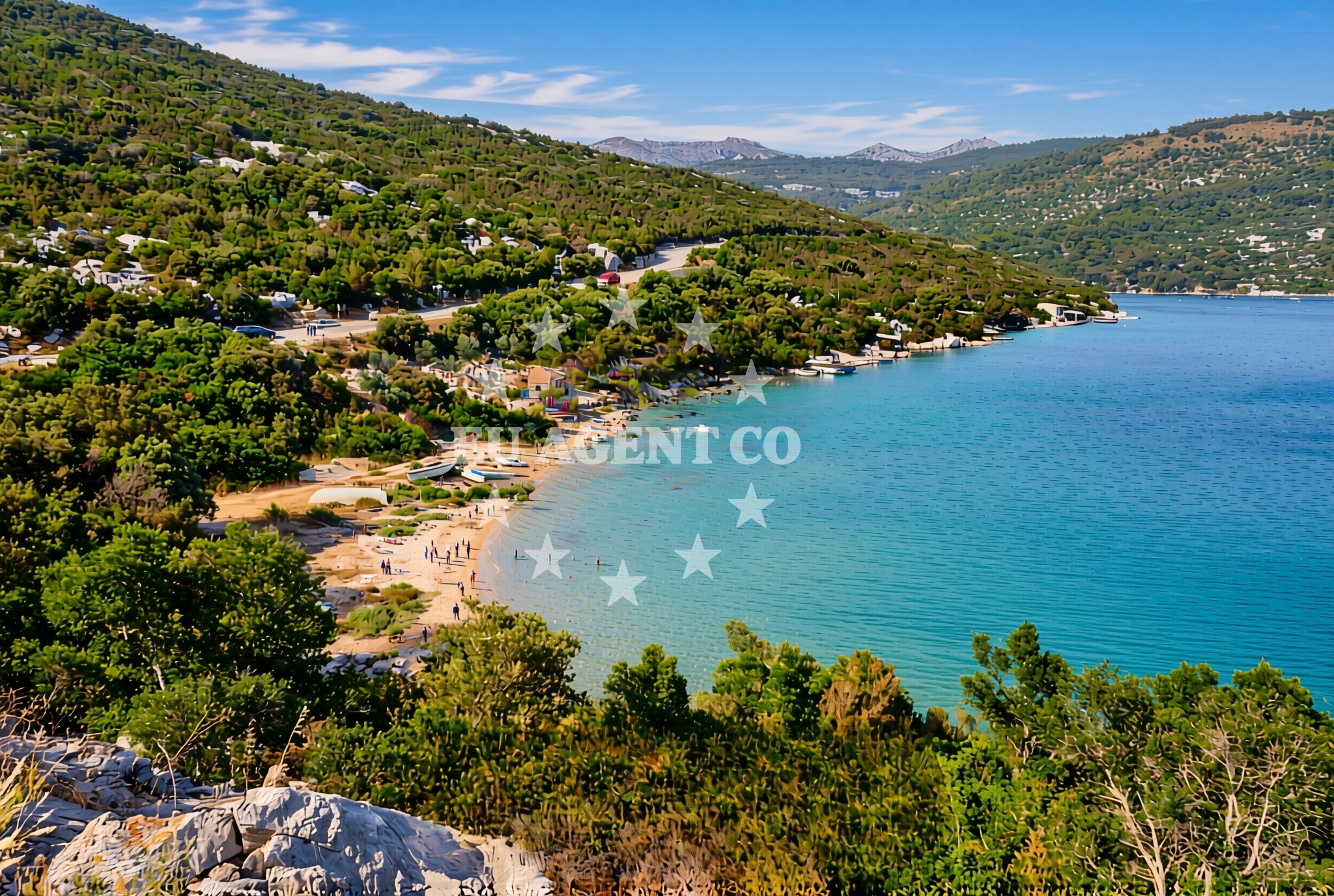
Located in the coastal town of Bistrina on Croatia's Adriatic coast, Stupa Beach is a short, pebble-strewn shoreline that offers a quiet vantage point over the surrounding waters. While not a large or highly developed beach, its proximity to the town and the natural character of the shore make it a local destination for brief visits and coastal exploration.
About this beach
Bistrina, Stupa
Beach: Bistrina
Location: Stupa
Characteristics and facilities
Pebbles, gravel
40 m
Beach character
The beach consists of pebbles and gravel, stretching approximately 40 meters along the shore. The lack of sand means it is not ideal for extended sunbathing, but the compact length makes it accessible for quick visits. The shoreline is relatively flat, with no significant elevation changes, and the water appears to be shallow near the shore based on the beach's short length.
Swimming and shore
Swimming conditions at Stupa Beach are likely influenced by the pebble substrate, which may make entry into the water less comfortable compared to sandy beaches. The shore's brevity means there is limited space for activities beyond walking along the water's edge. The beach does not appear to have designated swimming zones, lifeguards, or safety equipment, which is typical for smaller, less-developed coastal stretches in this region.
Facilities and activities
No specific facilities or activities are listed for Stupa Beach. The absence of amenities such as showers, restrooms, or seating suggests it is not a primary recreational destination. The beach's character appears to be purely natural, with no infrastructure for tourism beyond basic access to the shore.
Access and location
Stupa Beach is situated within the town of Bistrina, which lies along the eastern coast of the island of Brač in the Adriatic Sea. The beach is likely accessible via local roads connecting to the town center, though specific parking or walkway details are not documented. Its location near Bistrina means it is within reach of other coastal attractions on Brač, including the island's famous Zlatni Rat Beach and the town's historic harbor.
What to expect
Visitors to Stupa Beach should expect a short, pebble-covered shoreline that is more suited to brief exploration than extended relaxation. The beach's proximity to Bistrina makes it a convenient stop for those visiting the town, though its limited size and lack of amenities mean it is not a destination in itself. The surrounding area of Brač offers more extensive coastal experiences, and Stupa Beach may serve as a quieter alternative to the island's busier shores.
Practical tips
Given the pebble substrate, visitors may want to wear sturdy footwear for walking along the shore. The beach's brevity means there is little need for extensive equipment, though sun protection and hydration are always advisable in the Adriatic climate. Those seeking more developed beaches or facilities may wish to explore nearby areas of Bistrina or the broader Brač coastline.
Exploring the coast by yacht
For yacht charter guests exploring the Adriatic, Stupa Beach lies within the sailing area of Brač, a popular destination for motor yachts and sailboats. The nearby town of Bistrina has a harbor that serves as a common base for charter boats navigating the island's coast. While Stupa Beach itself is not a major anchorage point, its location near the town makes it a potential stop for brief land excursions during longer sailing itineraries along the Dalmatian coast.
Regional Context: Brač and the Adriatic Sailing Route
The island of Brač, where Bistrina is located, is a key waypoint on the Adriatic sailing circuit. Its coastline features a mix of pebble beaches, limestone cliffs, and sheltered bays that appeal to both motor yachts and sailboats. Charter guests often use Bistrina's harbor as a base to explore the island's western coast, with Stupa Beach serving as a minor but accessible point of interest along the route.
Anchorages in the surrounding area
Anchorages near Uvala Bistrina in South Adriatic are listed here.
- Anchorage — mali ston — 1.9 NM from beach
- Anchorage — prapratno — 4.0 NM from beach
- Anchorage — broce — 4.7 NM from beach
- Ribnja — broce — 4.8 NM from beach
- Anchorage — broce — 4.9 NM from beach
- Anchorage — broce — 5.5 NM from beach
- Anchorage — broce — 6.7 NM from beach
- Anchorage — klek — 7.2 NM from beach
Distances are straight-line geographic distances, not sailing routes.
Mooring buoys in the surrounding area
Mooring buoys and jetties in prapratno, kobas, and broce are included.
- Quay — prapratno — 4.0 NM from beach
- Quay — kobas — 4.9 NM from beach
- Lukas Taverna jetty — kobas — 4.9 NM from beach
- Konoba Nico jetty — kobas — 5.0 NM from beach
- Brijesta — 7.6 NM from beach
Distances are straight-line geographic distances, not sailing routes.
Marine fuel stations
- Fuel station — sobra — mljet — 9.2 NM from beach
- Fuel station — ploce — 15.6 NM from beach
- Ina — dubrovnik — 21.3 NM from beach
- Ina — dubrovnik — 22.5 NM from beach
Distances are straight-line geographic distances, not sailing routes.
Harbours in the surrounding area
Harbors in Hodilje, Mali Ston, and Prapranto Ferry Harbour are featured.
- Hodilje — 1.4 NM from beach
- Mali Ston — 1.9 NM from beach
- Ston — 2.7 NM from beach
- Prapranto Ferry Harbour — prapratno — 4.2 NM from beach
- Doli — 6.0 NM from beach
- Okuklje — mljet — 9.3 NM from beach
Distances are straight-line geographic distances, not sailing routes.
Marinas in the surrounding area
- ACI Marina Slano — 10.1 NM from beach
- Marina Frapa Dubrovnik — 21.4 NM from beach
- ACI Marina Dubrovnik — 22.5 NM from beach
- Marina Lumbarda — korcula — 23.4 NM from beach
- ACI Marina Korčula — korcula — 25.2 NM from beach
Distances are straight-line geographic distances, not sailing routes.
Restaurants near the beach
Restaurants in Mali Ston, prapratno, and kobas are highlighted nearby.
- Bota Sare — mali ston — 2.0 NM from beach
- Restaurant — prapratno — 3.8 NM from beach
- Gastro Mare — kobas — 4.9 NM from beach
- Luka's Taverna — lukas taverna — kobas — 4.9 NM from beach
- Nico — kobas — 5.0 NM from beach
Distances are straight-line geographic distances, not sailing routes.
Navigation guides for the surrounding area
Navigation guides for Uvala Bistrina and surrounding points are provided.
- Uvala Bistrina — 0.6 NM from beach
- Luka — 1.3 NM from beach
- Hodilje — 1.3 NM from beach
- Uvala Bjejvica — 1.6 NM from beach
- Mali Ston — 2.0 NM from beach
Distances are straight-line geographic distances, not sailing routes.
Yachts from nearby departure bases
Yachts departing from Slano ACI Marina are listed with their sailboat and catamaran options.
Sailing yachts
- Oceanis 45 (Cancan) — Slano ACI Marina — 10.1 NM from departure base to beach
- Elan 45 Impression (Skyfall) — Slano ACI Marina — 10.1 NM from departure base to beach
- Elan 50 Impression (Timeless) — Slano ACI Marina — 10.1 NM from departure base to beach
- Oceanis 45 (Soul) — Slano ACI Marina — 10.1 NM from departure base to beach
- Oceanis 45 (Mambo 1) — Slano ACI Marina — 10.1 NM from departure base to beach
Catamarans
- Lagoon 42 (HAPPY KEY) — Slano ACI Marina — 10.1 NM from departure base to beach
- Astrea 42 (Wave) — Slano ACI Marina — 10.1 NM from departure base to beach
- Lagoon 40 (SUNLIGHT) — Slano ACI Marina — 10.1 NM from departure base to beach
- Lagoon 42 (MALA KATE I) — Slano ACI Marina — 10.1 NM from departure base to beach
- Lagoon 40 (SAILOR MOON) — Slano ACI Marina — 10.1 NM from departure base to beach
Distances are straight-line geographic distances, not sailing routes.