Bijeli Galeb, Šimuni (Pag) Beach, Croatia
About this beach
Bijeli galeb, Šimuni (Pag)
Beach: Bijeli galeb
Location: Šimuni (Pag)
Characteristics and facilities
Gravel, concrete / stone slabs
340 m
Natural shade
Beach character
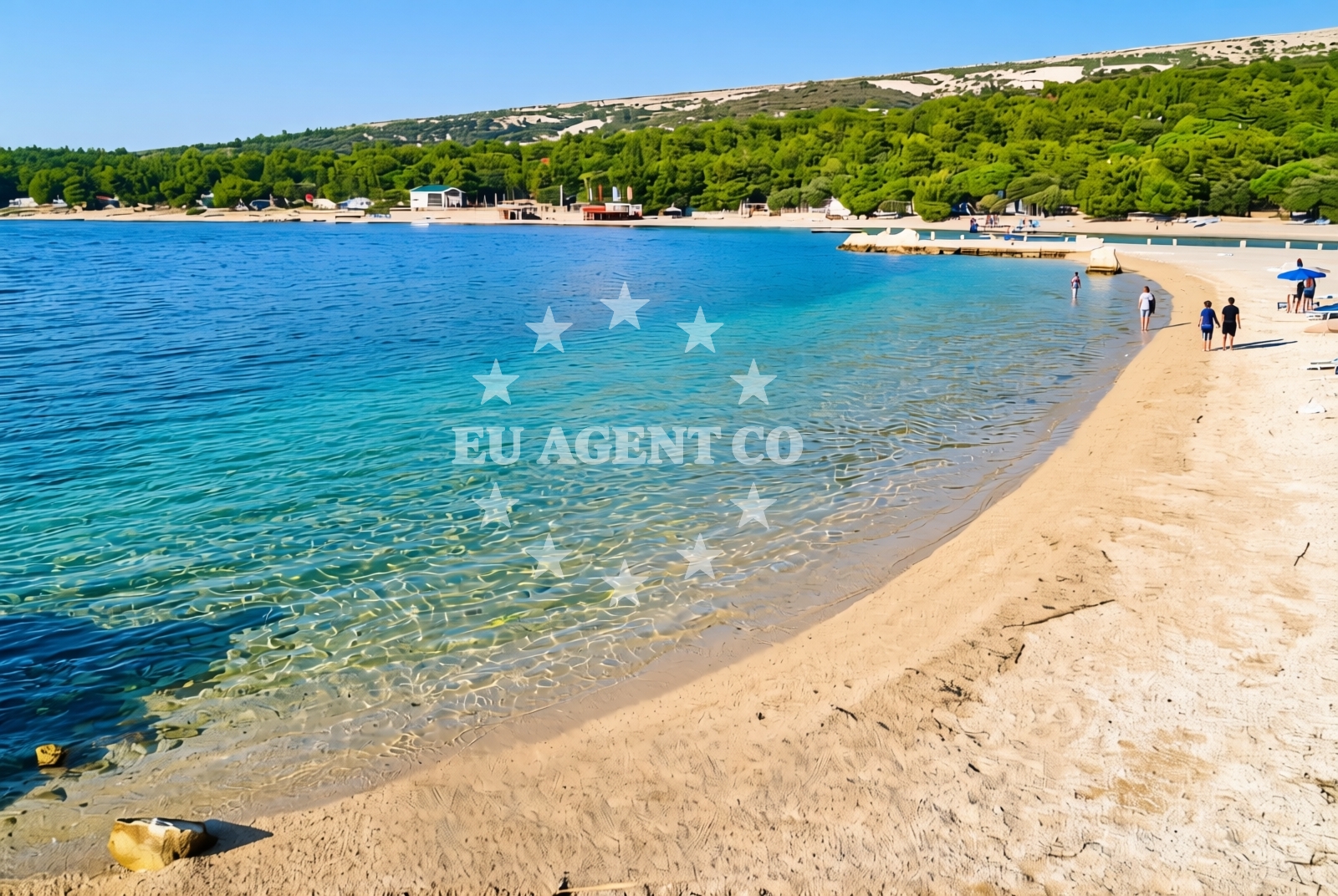
The beach’s surface consists of gravel and stone slabs, a rarity along Croatia’s more typically sandy shores. This texture creates a firm footing for visitors while offering a stark contrast to the soft sands of other Adriatic beaches. The 340-meter length provides ample space for exploration, though the lack of traditional amenities means visitors should come prepared for a more rugged, natural environment. Natural shade is available from the island’s limestone cliffs and sparse vegetation, making it a welcome respite during the hotter months.Swimming and shore
The gravel and stone composition of the beach influences swimming conditions, with clearer water visibility compared to sandy shores. However, the shore itself is not ideal for wading, as the rocky terrain may make entry into the sea less straightforward. The Adriatic’s generally calm waters in this region mean swimming is possible, though visitors should be mindful of the beach’s uneven surface when approaching the water.Facilities and activities
No formal facilities or services are listed for Bijeli Galeb Beach. The absence of amenities such as showers, restrooms, or umbrellas means visitors should bring their own supplies. The beach’s unique character lends itself to activities like rock-hopping, photography, and exploring the surrounding cliffs. Its remote location makes it an appealing spot for those seeking solitude away from more crowded Adriatic beaches.Access and location
Located in Šimuni, a small coastal village on Pag Island, the beach is accessible via local roads connecting to the island’s main settlements. Pag itself is renowned for its pine forests, traditional stone houses, and salt pans, offering a glimpse into Croatia’s rural coastal life. The island’s proximity to the mainland and its position within the Adriatic’s popular sailing routes make it a strategic point for yacht charter guests exploring the region.What to expect
Visitors to Bijeli Galeb should expect a rugged, natural shoreline with gravel and stone slabs. The beach’s 340-meter length provides space for walking or sunbathing, though the lack of amenities means self-sufficiency is key. Natural shade from the island’s cliffs and vegetation offers relief from the sun. The area’s connection to Pag’s cultural heritage, including its historic salt production and traditional architecture, adds context to the visit.Practical tips
Wear sturdy footwear to navigate the gravel and stone surface comfortably. Pack sunscreen and a towel, as shade is limited to natural formations. The beach’s remote nature means it is less likely to be crowded, making it ideal for those seeking tranquility.Exploring the coast by yacht
Pag Island is a well-known destination for yacht charter guests, with its sheltered bays and clear waters attracting sailors. While Bijeli Galeb itself is not an anchorage, the surrounding coast offers several marinas and harbors suitable for yachts. Charter guests exploring the Adriatic may find Pag’s coastline an ideal base for day trips to nearby islands or excursions along the Dalmatian coast.Pag Island’s Cultural Heritage
Pag Island’s history is deeply tied to salt production, with ancient salt pans still in use today. The island’s traditional architecture, including stone houses and windmills, reflects its long-standing connection to the sea. Visitors can explore Šimuni’s historic sites, such as the Church of St. Nicholas, which dates back to the 16th century.Anchorages in the surrounding area
Anchorages in nearby areas such as maun and mandre on Pag offer proximity to Bijeli galeb, Šimuni (Pag) Beach.
- Anchorage — maun — 3.0 NM from beach
- Anchorage — mandre — pag — 3.3 NM from beach
- Anchorage — maun — 3.3 NM from beach
- Potcrkvine — maun — 3.4 NM from beach
- Anchorage — mandre — pag — 3.6 NM from beach
- Anchorage — maun — 3.6 NM from beach
- Anchorage — mandre — pag — 4.0 NM from beach
- Anchorage — proboj — pag — 4.5 NM from beach
Distances are straight-line geographic distances, not sailing routes.
Mooring buoys in the surrounding area
- Jetty — simuni — pag — 0.1 NM from beach
- Jetty — zubovici — pag — 3.7 NM from beach
- Jetty — zubovici — pag — 3.8 NM from beach
- Buoy field — novalja — pag — 7.2 NM from beach
- Buoy field Slatinica — olib — 8.7 NM from beach
Distances are straight-line geographic distances, not sailing routes.
Marine fuel stations
- Ina — rab — 20.0 NM from beach
- Ina — mali losinj — 22.1 NM from beach
- Adria Oil — mali losinj — 22.6 NM from beach
- Ina — zadar — 23.4 NM from beach
Distances are straight-line geographic distances, not sailing routes.
Harbours in the surrounding area
- Pag — 3.6 NM from beach
- Karlobag — 5.9 NM from beach
- Košljun — kosljun pag — 6.1 NM from beach
- Novalja — pag — 7.0 NM from beach
- Žigljen — zigljen — pag — 7.3 NM from beach
- Prizna — 8.5 NM from beach
Distances are straight-line geographic distances, not sailing routes.
Marinas in the surrounding area
ACI Marina Šimuni, located in Simuni, Pag, is a nearby marina offering direct access to the beach area.
- ACI Marina Šimuni — simuni — pag — 0.9 NM from beach
- Marina Veli Rat — dugi otok — 19.7 NM from beach
- ACI Marina Rab — 19.9 NM from beach
- Y/C Marina Mali Lošinj — mali losinj — 22.3 NM from beach
- Marina Borik — zadar — 22.4 NM from beach
Distances are straight-line geographic distances, not sailing routes.
Restaurants near the beach
Restaurants in Simuni, Pag, such as Pizzeria Villa Olea and Didova Kuča, are situated close to the beach.
- Pizzeria Villa Olea — simuni — pag — 0.5 NM from beach
- Didova Kuča — simuni — pag — 0.7 NM from beach
- Ribarska Koliba Šimuni — simuni — pag — 0.7 NM from beach
- Bistro Šimuni — simuni — pag — 0.7 NM from beach
- Maestral — simuni — pag — 1.0 NM from beach
- Dubrava — pag — 3.8 NM from beach
- Konoba Bile — pag — 3.9 NM from beach
Distances are straight-line geographic distances, not sailing routes.
Navigation guides for the surrounding area
Navigation guides for areas like Caska, Novalja, and Uvala Prizna assist in planning routes near the beach.
- Caska — 5.5 NM from beach
- Novalja — 6.7 NM from beach
- Uvala Bliznica — 7.3 NM from beach
- Uvala Prizna — 8.5 NM from beach
- Luka Olib — 9.3 NM from beach
Distances are straight-line geographic distances, not sailing routes.
Yachts from nearby departure bases
Sailing yachts
- First 45 (Egeria) — Šimuni Kolan ACI Marina — 1.0 NM from departure base to beach
- Bavaria 46 Cruiser (DEA) — Mali Lošinj — 22.3 NM from departure base to beach
Motor yachts
- Absolute 50 Fly (Acrobat) — Rab ACI Marina — 19.9 NM from departure base to beach
Motor boats
- BWA Sport 22GT (BWA ) — Pag City Port — 3.8 NM from departure base to beach
- Balt 818 Titanium (Valentina 2) — Novalja — 6.9 NM from departure base to beach
- Balt 818 Titanium (Valentina) — Novalja — 6.9 NM from departure base to beach
- Merry Fisher 895 — Povljana Marina — 8.9 NM from departure base to beach
- Rancraft RS Cinque.5 — Zadar Diklo Port — 21.1 NM from departure base to beach
- Rancraft RM19 (Daycruiser) — Zadar Diklo Port — 21.1 NM from departure base to beach
- Rancraft RM21 (Dugi otok) — Zadar Diklo Port — 21.1 NM from departure base to beach
Distances are straight-line geographic distances, not sailing routes.