Berulia, Brela Beach, Croatia
Berulia, Brela Beach is a gravel shoreline located in the coastal town of Brela on the Adriatic Sea. This beach combines natural features with basic amenities, offering visitors a mix of relaxation and structured activities. Situated in a region known for its maritime heritage, the beach serves as a convenient stop for those exploring the Croatian coast by land or sea.
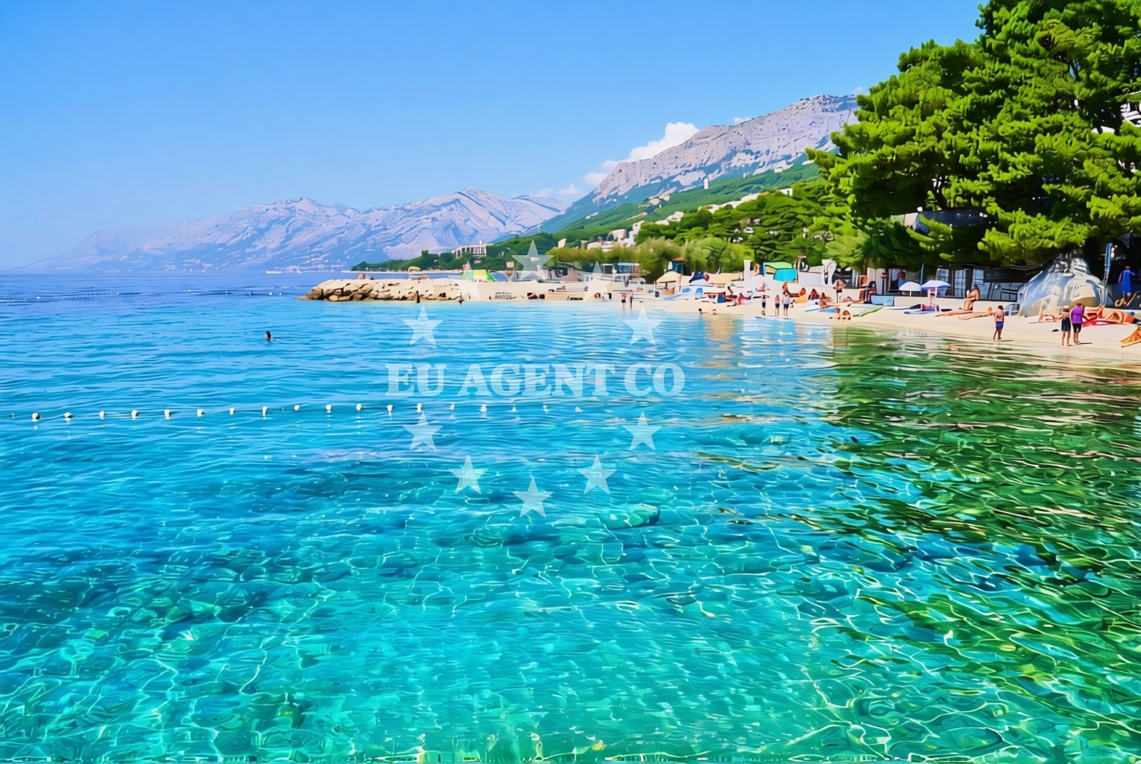
About this beach
Berulia, Brela
Beach: Berulia
Location: Brela
Characteristics and facilities
Gravel
350 m
Restaurant / snack bar
Caffe bar / Drinks stand
Natural shade
shower
pool
Slide / Aquapark
Changing cabin
Beach character
The beach consists of gravel, providing a distinct texture for visitors to navigate. Its layout includes a 350-meter stretch, making it suitable for casual strolls or sunbathing. The presence of natural shade areas offers respite from direct sunlight, while the beach's proximity to Brela's town center ensures easy access to local services and attractions.
Swimming and shore
While the beach is not primarily known for swimming, it features a dedicated pool area with a slide and aquapark, catering to families and children. The shallow, gravelly shore makes it a safer option for young swimmers, though the lack of designated swimming zones means visitors should exercise caution when entering the water.
Facilities and activities
Berulia, Brela Beach includes several amenities to enhance visitor comfort. A restaurant and snack bar provide on-site dining options, while a caffe bar serves drinks and light refreshments. Showers and changing cabins are available for beachgoers, and the aquapark offers recreational activities for all ages. The beach does not explicitly list additional facilities like toilets or parking, but its location in Brela suggests nearby infrastructure may be accessible.
Access and location
Located in Brela, a coastal town on the island of Brač, the beach benefits from the town's well-established road network. Brela itself is a popular destination on the Adriatic, connected to other parts of Croatia via ferry routes and major highways. The beach's proximity to the town center ensures it is easily reachable by foot, bike, or vehicle, with no specific access restrictions noted in available records.
What to expect
Berulia, Brela Beach offers a straightforward experience centered on its gravel shoreline and basic amenities. Visitors can expect a 350-meter stretch of beach with natural shade, a restaurant/snack bar, caffe bar, showers, changing cabins, and an aquapark with a slide. The beach lacks detailed information on crowd levels or seasonal variations, but its location in Brela—a town known for its maritime tourism—suggests it may be busier during peak summer months.
Practical tips
Visitors should bring swimwear and beach towels, as changing cabins are available but may have limited capacity. The aquapark and slide are ideal for families, though lifeguards are not explicitly mentioned. Those planning to dine on-site should note the presence of a restaurant and snack bar, though specific menus or operating hours are not provided.
Exploring the coast by yacht
For yacht charter guests exploring the Adriatic, Brela's location on Brač Island offers access to a network of marinas and anchorages along the Dalmatian coast. The nearby town of Supetar, home to a major marina, is approximately 15 kilometers away, making it a convenient base for sailing excursions. The surrounding waters are known for their clarity and gentle currents, supporting both motor and sailing yachts. Visitors arriving by sea may find the beach's proximity to Brela's harbor useful for land excursions or refueling stops.
Regional Context: Brela and Brač Island
Brela is a coastal settlement on Brač Island, part of the Split-Dalmatia County in Croatia. The island is renowned for its limestone landscapes, vineyards, and historic sites like the Church of St. Nicholas. The beach's location near Brela's harbor connects it to the island's broader tourism infrastructure, including boat tours to nearby islands like Hvar and Vis. The region's sailing routes are well-developed, with marinas in Supetar and Bol serving as common bases for charter yachts.
Anchorages in the surrounding area
- Anchorage — promajna — 2.2 NM from beach
- Anchorage — povlja — brac — 3.9 NM from beach
- Anchorage — povlja — brac — 4.0 NM from beach
- Anchorage — sumartin — brac — 4.0 NM from beach
- Anchorage — povlja — brac — 4.2 NM from beach
- Anchorage — povlja — brac — 4.4 NM from beach
- Anchorage — povlja — brac — 4.6 NM from beach
- Anchorage — povlja — brac — 5.0 NM from beach
Distances are straight-line geographic distances, not sailing routes.
Mooring buoys in the surrounding area
- Baško Polje — basko polje — baska voda — 1.2 NM from beach
- Quay — krvavica — 3.0 NM from beach
- Konoba Rojen jetty — povlja — brac — 6.3 NM from beach
- Restaurant Pipo jetty — povlja — brac — 6.4 NM from beach
- Restaurant Pipo buoys — povlja — brac — 6.5 NM from beach
Distances are straight-line geographic distances, not sailing routes.
Marine fuel stations
- Ina — makarska — 5.2 NM from beach
- Fuel station — sumartin — brac — 5.6 NM from beach
- Fuel station — bol — brac — 13.8 NM from beach
- Ina — vrboska — hvar — 15.9 NM from beach
Distances are straight-line geographic distances, not sailing routes.
Harbours in the surrounding area
- Brela — 0.4 NM from beach
- Stomarica — 1.6 NM from beach
- Pisak — 4.1 NM from beach
- Harbour — makarska — 4.7 NM from beach
- Makarska — 5.4 NM from beach
- Sumartin — brac — 5.4 NM from beach
Distances are straight-line geographic distances, not sailing routes.
Marinas in the surrounding area
- Marina Baška Voda — marina baska voda — 0.4 NM from beach
- Marina Ramova — krvavica — 3.0 NM from beach
- Marina Tučepi — marina tucepi — 7.9 NM from beach
- ACI Marina Vrboska — hvar — 15.9 NM from beach
- Marina Lav — podstrana — 19.1 NM from beach
Distances are straight-line geographic distances, not sailing routes.
Restaurants near the beach
- Konoba Feral — brela — 0.4 NM from beach
- Marko — brela — 0.4 NM from beach
- Restoran King — baska voda — 0.4 NM from beach
- Restaurant Ramova — krvavica — 3.0 NM from beach
- Kala — povlja — brac — 4.8 NM from beach
- Stara Uljara — povlja — brac — 4.8 NM from beach
Distances are straight-line geographic distances, not sailing routes.
Navigation guides for the surrounding area
- Su martin — 5.3 NM from beach
- Uvala Luka — 6.0 NM from beach
- Mi mice — 6.1 NM from beach
- Uvala Studena — 6.7 NM from beach
- Pucisca — 8.6 NM from beach
Distances are straight-line geographic distances, not sailing routes.
Yachts from nearby departure bases
Sailing yachts
- Elan Impression 40 (KARLETA) — Baška Voda Port — 0.3 NM from departure base to beach
- Bavaria 50 (NINA AC) — Baška Voda — 0.5 NM from departure base to beach
- Oceanis 38.1 (Baby Dory) — Baška Voda — 0.5 NM from departure base to beach
- Bavaria 44 (Infinity) — Baška Voda — 0.5 NM from departure base to beach
- Bavaria 50 (Marastina) — Baška Voda — 0.5 NM from departure base to beach
- Bavaria 41 (Seagoll) — Baška Voda — 0.5 NM from departure base to beach
- D&D Kufner 54 (Komiza) — Baška Voda — 0.5 NM from departure base to beach
Catamarans
- Lagoon 450 (LAMANTIN) — Baška Voda — 0.5 NM from departure base to beach
Motor yachts
- Canados 86 (Karisma) — Baška Voda — 0.5 NM from departure base to beach
Motor boats
- Pearl Sea 31 Hard Top (Aero) — Baška Voda Port — 0.3 NM from departure base to beach
Distances are straight-line geographic distances, not sailing routes.