Benići Zapad, Rtina Beach, Croatia
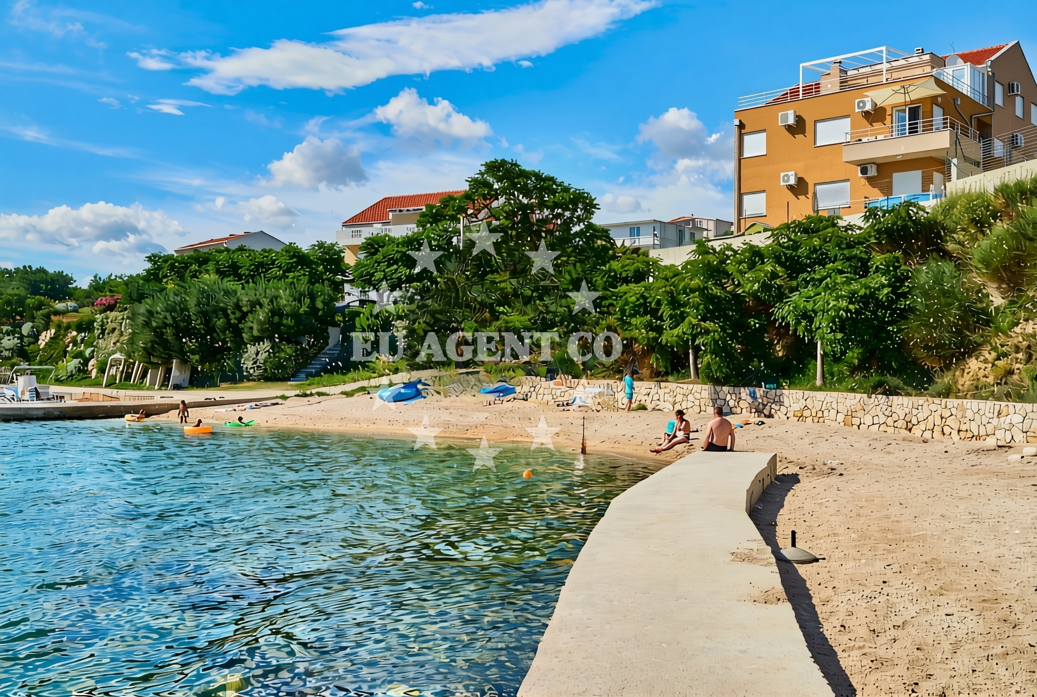
About this beach
Benići zapad, Rtina
Beach: Benići zapad
Location: Rtina
Characteristics and facilities
Gravel
170 m
Caffe bar / Drinks stand
shower
Children's playground
Beach character
Rtina Beach is characterized by its gravel composition, which contrasts with the more common sandy beaches of the Adriatic. This texture creates a distinct walking surface along the shore, though it may be less comfortable for prolonged sunbathing. The beach's length of 170 meters provides sufficient space for a small group of visitors, with the shoreline marked by the presence of a caffe bar and drinks stand. These facilities offer basic refreshments, making it a suitable spot for short stays or as a midpoint during longer coastal excursions.Swimming and shore
While the beach lacks detailed water quality information in its records, the gravel substrate suggests a rocky shoreline that may limit direct swimming access in some areas. The shore itself is relatively straightforward, with no significant elevation changes or natural features beyond the basic facilities. Visitors should expect a utilitarian beach experience rather than a secluded or picturesque setting.Facilities and activities
The beach includes a caffe bar and drinks stand for refreshments, along with showers for visitor convenience. A children's playground is also present, making it a family-friendly option despite the gravel surface. No additional activities or structured amenities are listed, reflecting the beach's modest scale and focus on basic functionality.Access and location
Rtina Beach is positioned on the western side of Benići, a settlement on the island of Brač. Its exact coordinates (44.308489, 15.276983) place it within the broader context of the Central Dalmatian coast. Access to the beach is likely via local roads connecting to Benići, though specific parking details are not documented. The beach's location near the mainland makes it potentially accessible to visitors exploring the Brač island region.What to expect
This beach is best described as a functional coastal spot with minimal amenities. Visitors can expect a gravel shoreline, a caffe bar for light refreshments, and a children's playground. The beach's straightforward nature makes it suitable for short visits or as a stopover during longer trips along the Brač coast. No detailed visitor feedback is available to confirm specific experiences, but the listed facilities suggest a basic level of service.Practical tips
Given the gravel surface, visitors may wish to bring footwear for comfort along the shore. The presence of a children's playground indicates family suitability, though parents should be prepared for the beach's utilitarian character. As with all Adriatic beaches, sun protection and hydration are recommended during peak hours.Exploring the coast by yacht
For yacht charter guests exploring the Brač island region, Rtina Beach represents one of many accessible points along the western coast. While not a primary anchorage, its proximity to Benići and the mainland makes it a potential stop for sailors passing through the area. Nearby marinas in Benići and along the Brač coast provide more comprehensive facilities for longer stays.Regional Context
The beach lies within the municipality of Benići on Brač, an island known for its limestone landscapes and historic villages. The area is part of the Split-Dalmatia County, which includes several popular yacht charter destinations. Visitors to Rtina Beach may also consider exploring nearby settlements like Supetar or the island of Hvar for more developed coastal experiences.
Anchorages in the surrounding area
Anchorages near Rtina Beach include options in Rtina and surrounding areas such as Ljubac and Tribanj.
- Anchorage — rtina — 1.4 NM from beach
- Anchorage — rtina — 1.8 NM from beach
- Anchorage — vlasici — pag — 2.7 NM from beach
- Anchorage — vrsi — 3.2 NM from beach
- Anchorage — ljubac — 3.2 NM from beach
- Anchorage — tribanj — 3.3 NM from beach
- Anchorage — ljubac — 3.6 NM from beach
- Anchorage — smokvica — 3.8 NM from beach
Distances are straight-line geographic distances, not sailing routes.
Mooring buoys in the surrounding area
Mooring buoys in the vicinity include jetty locations at Ljubac and Sibuljina Point, among others.
- Jetty — ljubac — 3.0 NM from beach
- Šibuljina Point — sibuljina point — 3.2 NM from beach
- Vir — 8.3 NM from beach
- Punta Skala — petrcane — 9.0 NM from beach
- Jetty — zadar — 11.2 NM from beach
Distances are straight-line geographic distances, not sailing routes.
Marine fuel stations
- Ina — zadar — 11.6 NM from beach
- Ina — preko — ugljan — 14.4 NM from beach
- Fuel station — sukosan — 15.4 NM from beach
- Ina — zaglav — dugi otok — 22.3 NM from beach
Distances are straight-line geographic distances, not sailing routes.
Harbours in the surrounding area
Nearby harbors include Miškovići on Pag and harbors in Nin and Starigrad Paklenica.
- Miškovići — miskovici — pag — 2.7 NM from beach
- Ražanac — razanac — 3.3 NM from beach
- Mulo — nin — 4.1 NM from beach
- Nin — 5.6 NM from beach
- Starigrad Paklenica — 7.0 NM from beach
- Privlaka — 7.3 NM from beach
Distances are straight-line geographic distances, not sailing routes.
Marinas in the surrounding area
Marinas in the area include Marina Borik in Zadar and facilities on Ugljan.
- Marina Borik — zadar — 11.1 NM from beach
- Vitrenjak Zadar — 11.2 NM from beach
- Marina Zadar — 11.6 NM from beach
- Olive Island Marina — sutomiscica — ugljan — 13.6 NM from beach
- Marina Preko — ugljan — 14.2 NM from beach
Distances are straight-line geographic distances, not sailing routes.
Navigation guides for the surrounding area
Navigation guides cover areas such as Otok Pag and Privlaka, providing route information for the surrounding waters.
- KrusCica and Uvala KrusCica Duboka — 3.1 NM from beach
- VELESITSKI KANAL (S) — 3.6 NM from beach
- OTOK PAG — 6.9 NM from beach
- Privlaka — 7.2 NM from beach
- Starigrad-Paklenica {Velebitski Kanai) — 7.2 NM from beach
Distances are straight-line geographic distances, not sailing routes.
Yachts from nearby departure bases
Yachts depart from nearby bases including Povljana Marina and Zadar Diklo Port, offering various types from motor boats to catamarans.
Sailing yachts
- Dufour 460 (ELTHEOLE II) — Zadar Marina Borik — 11.1 NM from departure base to beach
- Bavaria Cruiser 46 (Jameson II.) — Zadar Marina Borik — 11.1 NM from departure base to beach
Catamarans
- Leopard 50 (Solaia) — Zadar Marina Borik — 11.1 NM from departure base to beach
- Sunreef 60 (SINATA) — Zadar Marina Borik — 11.1 NM from departure base to beach
Motor yachts
- Prestige 550 Fly (Floria) — Zadar Marina Borik — 11.1 NM from departure base to beach
Motor boats
- Merry Fisher 895 — Povljana Marina — 7.8 NM from departure base to beach
- Rancraft RM19 (Daycruiser) — Zadar Diklo Port — 9.9 NM from departure base to beach
- Rancraft RM21 (Dugi otok) — Zadar Diklo Port — 9.9 NM from departure base to beach
- Rancraft RS Cinque.5 — Zadar Diklo Port — 9.9 NM from departure base to beach
- Merry Fisher 895 (VIP 3029ZD) — Zadar Marina Borik — 11.1 NM from departure base to beach
Distances are straight-line geographic distances, not sailing routes.