Belecica Beach, Croatia
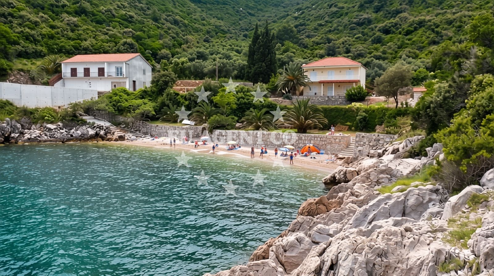
Beach character
The beach's defining feature is its crescent-shaped cove, hugged by low-lying hills that create a natural barrier against open sea swells. The predominant surface consists of smooth beige pebbles, creating a unique tactile experience for visitors. The surrounding landscape is dominated by rugged mountain ridges, offering panoramic views of the Adriatic. The sea floor's gradual slope and moderate depth make it suitable for cautious swimmers, though the pebble substrate may require careful footing.Swimming and shore
Snorkeling is the primary water activity at Belecica Beach, with clear visibility revealing vibrant marine life in the shallow zones. The small pebble-covered seabed creates a mosaic of textures, while the moderate depth increase allows for exploration without excessive wading. The beach's sheltered position provides calmer waters compared to the open coast, though swimmers should remain cautious of uneven footing on the pebble surface.Facilities and activities
Belecica Beach lacks formal amenities such as restrooms, showers, or food services, as noted in visitor reports. The only structured activity available is snorkeling, though the absence of rental equipment means visitors must bring their own gear. The beach's character is defined by its natural state, with no designated parking areas or infrastructure beyond the pebble shoreline.Access and location
Located in Trpanj, a coastal village near Dubrovnik, Belecica Beach is accessible via a short drive from the Neretva River region. The beach's remote position within a cove requires navigating a narrow coastal path from the nearest road. Its proximity to Dubrovnik's UNESCO-listed Old Town and the Neretva River adds to its appeal for travelers exploring the southern Dalmatian coast.What visitors say
Visitors consistently highlight Belecica Beach's seclusion and natural beauty. One reviewer described it as 'beautiful and secluded,' while another called it 'nice and cozy.' However, multiple reports note the absence of amenities, with one visitor stating, 'Beautiful nature but no amenities.' The beach maintains a low crowd index even during peak seasons, offering a peaceful alternative to more developed coastal areas.Practical tips
Given the lack of on-site facilities, visitors should bring sufficient water, snacks, and sun protection. The pebble beach may require beach towels for comfort. Arriving early is advisable to secure parking in nearby Trpanj, as the beach's remote location may limit vehicle access.Exploring the coast by yacht
For yacht charter guests exploring the Dubrovnik region, Belecica Beach represents one of many secluded coves along the southern Adriatic coast. The area's sheltered bays and clear waters make it a popular anchorage zone for motor yachts and sailboats. Nearby marinas in Trpanj and Cavtat offer docking options for those seeking to combine land and sea experiences in this historic sailing region.Regional Context
Trpanj's location between Dubrovnik and the Neretva River places it at the crossroads of ancient trade routes and modern tourism. The surrounding hills are part of the Pelješac Peninsula, known for its vineyards and historic fortifications. Yacht charter guests often use this area as a base to explore both the eastern Adriatic coast and the islands of Mljet and Šipan.Anchorages in the surrounding area
Anchorages near Trpanj, including Duba Peljeska, Podobuce, and Korcula.
- Anchorage — trpanj — 1.7 NM from beach
- Anchorage — duba peljeska — 2.1 NM from beach
- Anchorage — podobuce — 4.3 NM from beach
- Anchorage — badija — 5.2 NM from beach
- Anchorage — korcula — 5.8 NM from beach
- Anchorage — crikvice — 6.0 NM from beach
- Anchorage — korcula — 6.0 NM from beach
- Anchorage — lumbarda — korcula — 6.2 NM from beach
Distances are straight-line geographic distances, not sailing routes.
Mooring buoys in the surrounding area
Mooring buoys at Restaurant Moro in Stupe and Vrnik Arts Club in Vrnik.
- Restaurant Moro buoys — stupe — 3.9 NM from beach
- Fuel jetty — korcula — 5.5 NM from beach
- Vrnik Arts Club buoys — 5.7 NM from beach
- Quay — vrnik — 5.7 NM from beach
- Jetty — korcula — 6.8 NM from beach
Distances are straight-line geographic distances, not sailing routes.
Marine fuel stations
Marine fuel stations in Korcula, Ploce, and Makarska.
- Fuel station — korcula — 5.5 NM from beach
- Fuel station — ploce — 8.6 NM from beach
- Ina — makarska — 19.8 NM from beach
- Fuel station — sobra — mljet — 23.3 NM from beach
Distances are straight-line geographic distances, not sailing routes.
Harbours in the surrounding area
Harbours in Trpanj, Duba Peljeska, and Korcula.
- Trpanj — 0.9 NM from beach
- Duba — duba peljeska — 3.4 NM from beach
- Orebić — orebic — 3.9 NM from beach
- Korčula E harbour — korcula — 5.7 NM from beach
- Korčula W harbour — korcula — 5.8 NM from beach
- Tatinja — lumbarda — korcula — 6.1 NM from beach
Distances are straight-line geographic distances, not sailing routes.
Marinas in the surrounding area
Marinas in Korcula, Lumbarda, and Tučepi.
- ACI Marina Korčula — korcula — 5.8 NM from beach
- Marina Lumbarda — korcula — 6.2 NM from beach
- Marina Tučepi — marina tucepi — 17.2 NM from beach
- Marina Ramova — krvavica — 22.0 NM from beach
- Marina Korkyra — vela luka — korcula — 23.7 NM from beach
Distances are straight-line geographic distances, not sailing routes.
Restaurants near the beach
Restaurant Moro located in Stupe.
- Moro — stupe — 3.9 NM from beach
Distances are straight-line geographic distances, not sailing routes.
Navigation guides for the surrounding area
Navigation guides for Trpanj, Uvala Divna, and Orebic.
- Trpanj — 1.0 NM from beach
- Uvala Divna — 1.8 NM from beach
- Orebic — 3.7 NM from beach
- Otocic Badija — 5.0 NM from beach
- Uvala Racisce — 6.1 NM from beach
Distances are straight-line geographic distances, not sailing routes.
Yachts from nearby departure bases
Yachts departing from Ploče City Port and Tučepi Port.
Sailing yachts
- Elan 40 Impression (Karleta) — Ploče City Port — 8.5 NM from departure base to beach
- Sun Odyssey 349 (Visnjica) — Ploče City Port — 8.5 NM from departure base to beach
- More 55 (MRS. ROBINSON) — Ploče City Port — 8.5 NM from departure base to beach
- Salona 44 (SAMOA) — Ploče City Port — 8.5 NM from departure base to beach
- Elan 514 Impression (Cesarica III) — Ploče City Port — 8.5 NM from departure base to beach
- Sun Odyssey 419 (Luka Ploce) — Ploče City Port — 8.5 NM from departure base to beach
- Sun Odyssey 349 (Porto Tolero) — Ploče City Port — 8.5 NM from departure base to beach
- Bavaria 40 Cruiser (LADY BUTTERFLY) — Tučepi Port — 17.2 NM from departure base to beach
Catamarans
- Lagoon 450 Fly (Alba Mouse) — Ploče City Port — 8.5 NM from departure base to beach
Motor yachts
- Princess V53 (Chablis) — Makarska Port — 19.6 NM from departure base to beach
Distances are straight-line geographic distances, not sailing routes.
Frequently asked questions
Is there parking available at Belecica Beach?
While the beach itself has no designated parking, nearby Trpanj offers limited roadside parking options. Visitors are advised to arrive early to secure a spot.What snorkeling equipment is available?
No rental equipment is provided on-site. Visitors must bring their own snorkeling gear for use in the clear, pebble-strewn waters.Nearby beaches
Reviews
Beautiful and secluded
Nice, cozy beach edin smajic
Beautiful nature but no amenities. Dubrovnik-Neretva