Beach Vodice - Drasnice, Croatia
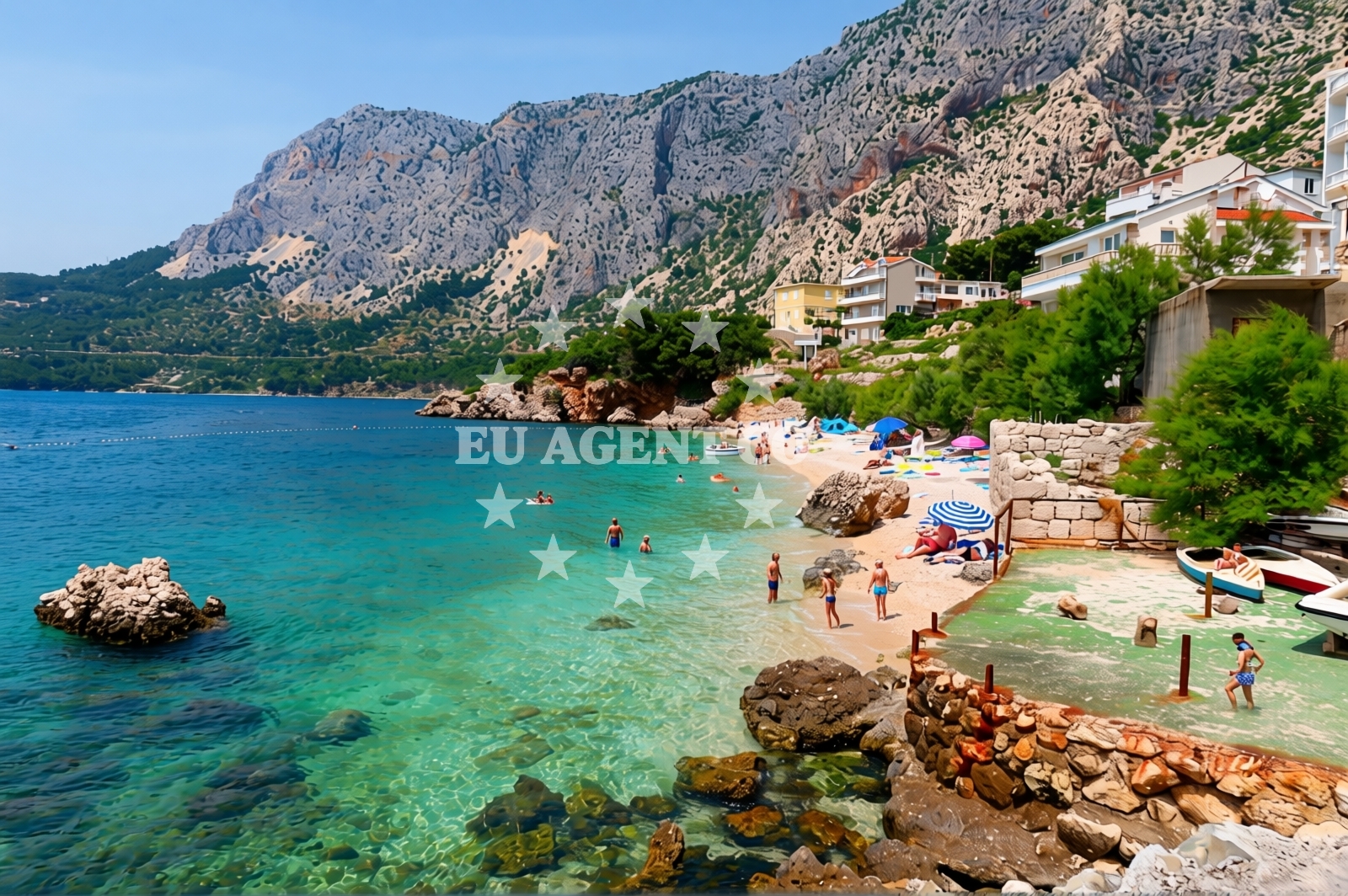
Beach Vodice lies along the rugged coastline of Drasnice, a small settlement in Croatia's Dalmatian region. This 160-meter-long beach stretches in a straight line between rocky outcrops, offering a unique contrast to the area's mountainous backdrop. The shoreline is composed of beige sand intermixed with pebbles, with the sea floor mirroring this composition. Depth increases gradually, making it a safe option for families and novice swimmers.
Beach character
The beach's linear shape and modest dimensions create an intimate setting, with the surrounding cliffs and mountains providing a dramatic frame. The predominant surface is black sand with pebbles, though beige areas are also present. This geological mix influences the beach's texture and the sea floor's composition. The smooth gradient of the sea bed ensures easy wading, a feature particularly appreciated by visitors with young children.
Swimming and shore
Swimming conditions at Beach Vodice are characterized by gentle depth progression, with water reaching sufficient depth for swimming within a short distance from shore. The absence of strong currents and the gradual seabed slope make it a suitable spot for those who cannot swim or prefer shallow-water activities. The beach's orientation and surrounding topography create natural shelter from direct winds, though wave activity can vary with seasonal weather patterns.
Facilities and activities
No permanent facilities are listed for Beach Vodice, but the area supports several water-based activities. Stand-up paddleboarding (SUP) is popular due to the calm conditions, while the consistent wave patterns make it a viable spot for surfing. Snorkeling opportunities exist in the clear waters, with the sea floor's sandy and pebbly composition offering varied underwater terrain. Visitors should note that no amenities such as showers, restrooms, or umbrellas are explicitly documented for this location.
Access and location
Beach Vodice is situated in Drasnice, a coastal village on the island of Brač, part of the Split-Dalmatia County. The beach's coordinates (43.21882, 17.10792) place it within the broader context of the Dalmatian coast, a region renowned for its dramatic cliffs and clear waters. The nearest major settlement is Bol, known for its iconic Zlatni Rat beach. Access to the beach is via local roads connecting Drasnice to the rest of Brač, with the island's ferry network providing links to mainland Croatia and other Dalmatian islands.
What to expect
Beach Vodice offers a distinctive coastal experience shaped by its geological features and natural surroundings. The straight shoreline and mix of sand and pebbles create a unique tactile experience for visitors. The gradual seabed slope ensures safe swimming conditions, particularly for families. While no formal amenities are listed, the beach's integration into Drasnice's coastal landscape provides opportunities for exploration beyond the shore. The area's popularity during high season means visitors should expect moderate crowds, though the beach's size accommodates groups without feeling overcrowded.
Practical tips
Visitors should consider the beach's orientation when planning activities, as the linear shape may affect sun exposure patterns. The smooth depth increase is particularly advantageous for families with young children. For those interested in water sports, the consistent wave conditions support SUP and surfing, though equipment rental details are not specified in the beach's documentation. The absence of listed facilities means bringing personal items such as towels and sunscreen is advisable.
Exploring the coast by yacht
Beach Vodice's location on Brač Island positions it within a region highly regarded for sailing. The Dalmatian coast offers numerous anchorages and marinas, with the nearby town of Bol serving as a key hub for charter boats. Sailors exploring the area may find the beach's proximity to the island's western coastline useful for short excursions. The surrounding waters, part of the Adriatic Sea's protected zones, provide opportunities for both coastal cruising and open-sea sailing. For those arriving by boat, the nearest marinas include those in Bol and Supetar, both accessible via the island's network of navigable channels.
Regional Context and Travel Connections
The Dalmatian coast, where Beach Vodice is located, is a gateway to the Adriatic's most scenic sailing routes. Brač Island itself is a popular destination for yacht charters, with its limestone cliffs and clear waters attracting both leisure sailors and professional crews. The island's ferry connections to Split and Hvar facilitate land-based exploration, while its marinas accommodate vessels of various sizes. For visitors combining beach relaxation with nautical adventures, the region's combination of sheltered bays and open sea routes offers diverse options.
Anchorages in the surrounding area
Anchorages in Hvar, central Dalmatia, lie approximately 5 to 6 nautical miles from Beach Vodice in Drasnice.
- Anchorage — selca kod bogomolja — hvar — 5.0 NM from beach
- Anchorage — sucuraj — hvar — 5.0 NM from beach
- Anchorage — selca kod bogomolja — hvar — 5.3 NM from beach
- Anchorage — bogomolje — hvar — 5.8 NM from beach
- Anchorage — selca kod bogomolja — hvar — 6.1 NM from beach
- Anchorage — selca kod bogomolja — hvar — 6.1 NM from beach
- Anchorage — selca kod bogomolja — hvar — 6.2 NM from beach
- Anchorage — bogomolje — hvar — 6.2 NM from beach
Distances are straight-line geographic distances, not sailing routes.
Mooring buoys in the surrounding area
Mooring buoys in Drasnice are within 0.06 nautical miles of Beach Vodice, with additional options in Hvar up to 6.63 nautical miles away.
- Kraj - Soline — kraj soline — drasnice — 0.1 NM from beach
- Konoba Gambo buoys — selca kod bogomolja — hvar — 6.1 NM from beach
- Quay — bogomolje — hvar — 6.2 NM from beach
- Jetty — sucuraj — hvar — 6.6 NM from beach
- Drvenik - Ferry dock — drvenik ferry dock — 7.3 NM from beach
Distances are straight-line geographic distances, not sailing routes.
Marine fuel stations
Marine fuel stations in Makarska, 6.09 nautical miles from Beach Vodice, and further stations in Brac, Korcula, and Ploce.
- Ina — makarska — 6.1 NM from beach
- Fuel station — sumartin — brac — 11.5 NM from beach
- Fuel station — korcula — 16.0 NM from beach
- Fuel station — ploce — 17.5 NM from beach
Distances are straight-line geographic distances, not sailing routes.
Harbours in the surrounding area
Harbours in Drasnice, 0.18 nautical miles from Beach Vodice, and nearby options in Caklje, Igrane, and Podgora.
- Drašnice — drasnice — 0.2 NM from beach
- Čaklje — caklje — podgora — 1.2 NM from beach
- Igrane — 2.0 NM from beach
- Podgora — 2.2 NM from beach
- Živogošće — zivogosce — 2.9 NM from beach
- Tučepi — tucepi — 3.4 NM from beach
Distances are straight-line geographic distances, not sailing routes.
Marinas in the surrounding area
Marinas in Tučepi, 3.46 nautical miles from Beach Vodice, and additional facilities in Krvavica, Baska Voda, and Korcula.
- Marina Tučepi — marina tucepi — 3.5 NM from beach
- Marina Ramova — krvavica — 8.4 NM from beach
- Marina Baška Voda — marina baska voda — 10.9 NM from beach
- ACI Marina Korčula — korcula — 15.7 NM from beach
- Marina Lumbarda — korcula — 17.9 NM from beach
Distances are straight-line geographic distances, not sailing routes.
Navigation guides for the surrounding area
Navigation guides for Podgora, 1.79 nautical miles from Beach Vodice, and surrounding areas like Uvala Kozja and Hvar.
- Podgora — 1.8 NM from beach
- Uvala Kozja — 6.6 NM from beach
- Uvala Duboka — 6.7 NM from beach
- OTOK HVAR — 7.0 NM from beach
- Uvala Drvenik (Donja Vala) — 7.5 NM from beach
Distances are straight-line geographic distances, not sailing routes.
Yachts from nearby departure bases
Yachts departing from Tučepi Port, 3.47 nautical miles away, and Makarska Port, 5.88 nautical miles from Beach Vodice, with bases in Baška Voda up to 10.89 nautical miles away.
Sailing yachts
- Bavaria 40 Cruiser (LADY BUTTERFLY) — Tučepi Port — 3.5 NM from departure base to beach
- Bavaria 44 (TARISA ) — Baška Voda — 10.9 NM from departure base to beach
- Bavaria 41 (Seagoll) — Baška Voda — 10.9 NM from departure base to beach
Catamarans
- Lagoon 450 (LAMANTIN) — Baška Voda — 10.9 NM from departure base to beach
Motor yachts
- Princess V53 (Chablis) — Makarska Port — 5.9 NM from departure base to beach
- Canados 86 (Karisma) — Baška Voda — 10.9 NM from departure base to beach
Motor boats
- Galeon 430 Skydeck (Bellagio) — Makarska Port — 5.9 NM from departure base to beach
- Jeanneau NC 37 (Black Pearl) — Makarska Port — 5.9 NM from departure base to beach
- Jeanneau NC 37 (Black Pearl) — Makarska Port — 5.9 NM from departure base to beach
- Galeon 430 Skydeck (BELLAGIO) — Makarska Port — 5.9 NM from departure base to beach
Distances are straight-line geographic distances, not sailing routes.