Beach Molva, Zavala, Croatia
20 photos
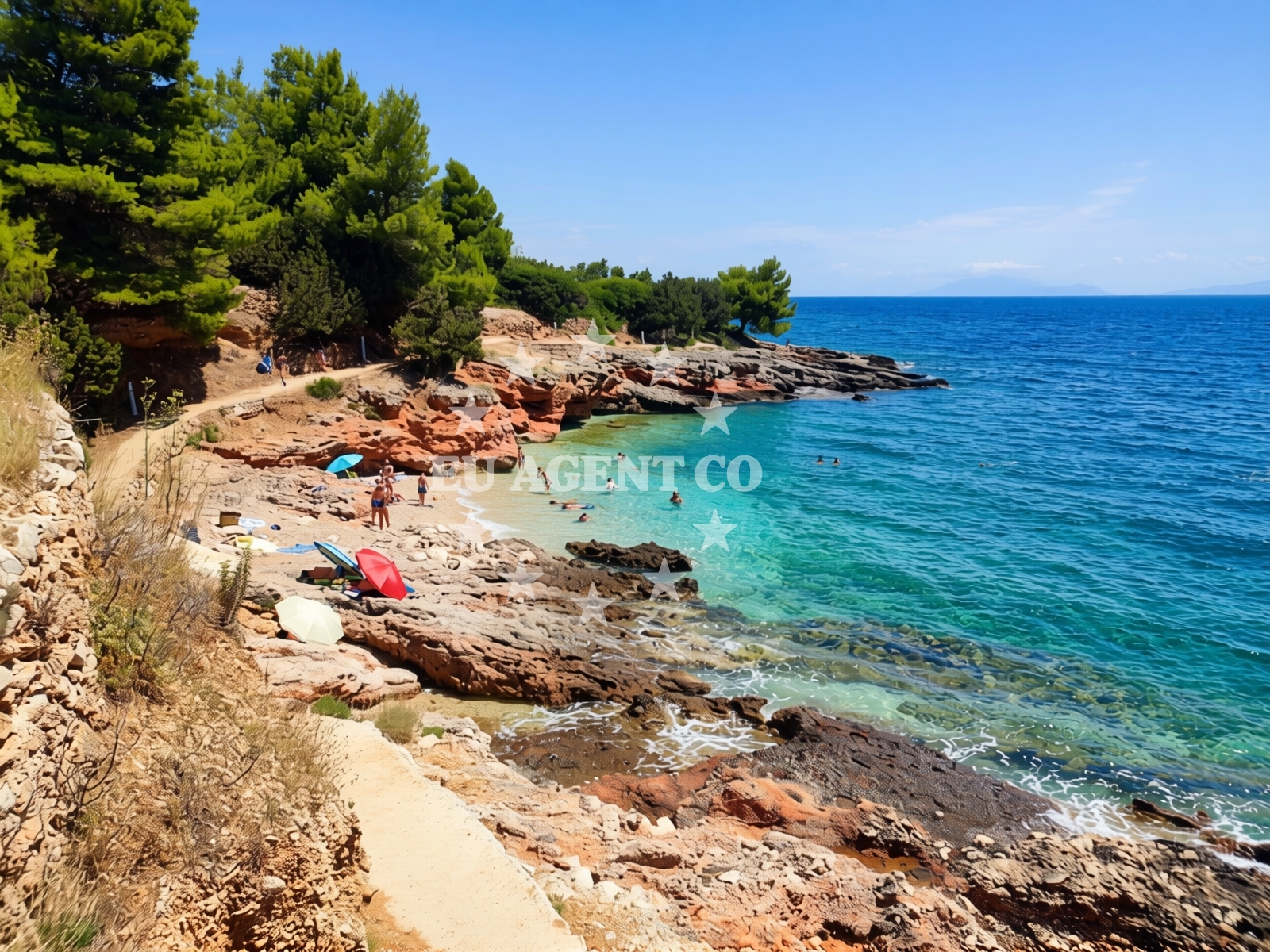
Beach character
The beach's straight shoreline contrasts with the rugged cliffs that frame it. The pebble-covered shore is interspersed with patches of sand, creating a varied texture underfoot. The sea floor transitions from sand near the shore to larger boulders further out, with depth increasing gradually. This topography supports moderate swimming conditions, though the pebble beach may require water shoes for comfort.Swimming and shore
Swimming is possible along the sandier sections of the beach, though the pebble-dominated shoreline may make entry challenging for some. The moderate depth increase allows for safe wading, and the seabed's mix of sand and boulders creates interesting underwater terrain. The beach's orientation and surrounding cliffs influence wave patterns, making it a viable spot for surfing and stand-up paddleboarding.Facilities and activities
No formal amenities are listed for Beach Molva, but the area supports recreational activities. SUP and surfing are explicitly associated with the beach, suggesting opportunities for water sports. The lack of structured facilities means visitors should plan for self-sufficiency, though the beach's cleanliness index indicates reasonable maintenance standards.Access and location
Located at Zavala 151 A, the beach is accessible via the settlement of Zavala, which sits along the coast between the towns of Split and Makarska. The surrounding area features a mix of coastal cliffs and inland hills, with Zavala itself serving as a gateway to the broader Dalmatian Coast. Nearby roads connect to major routes along the Adriatic, facilitating access from larger cities.What to expect
Visitors should expect a beach experience defined by its natural landscape rather than formal infrastructure. The pebble shore and cliff backdrop create a rugged yet scenic environment. The beach's moderate crowd levels during high season suggest it's neither overly busy nor completely secluded. The good cleanliness index indicates that the area is maintained to reasonable standards, though no showers, toilets, or parking facilities are explicitly listed.Practical tips
Wear water shoes to navigate the pebble beach comfortably. Check tide times to ensure safe access to the shore. The beach's orientation may create varying wave conditions, so surfers and SUP enthusiasts should assess conditions before heading out.Exploring the coast by yacht
Beach Molva's location near Zavala places it within reach of several sailing routes along the Dalmatian Coast. The nearby waters are part of a larger network of Adriatic sailing areas, with marinas and anchorages available in larger settlements like Split and Makarska. Yacht charter guests exploring this region may find the beach a convenient stop for water sports or a scenic anchorage nearby.Local Context and Surrounding Area
Zavala is a small coastal settlement known for its traditional architecture and proximity to natural attractions. The surrounding region features a mix of coastal cliffs, inland forests, and agricultural land. The area's historical significance is reflected in its medieval fortifications and rural villages, offering visitors a glimpse into Croatia's coastal heritage.Anchorages in the surrounding area
- Anchorage — zavala — hvar — 0.3 NM from beach
- Anchorage — hvar — 2.1 NM from beach
- Anchorage — scedro — 2.6 NM from beach
- Anchorage — scedro — 2.6 NM from beach
- Anchorage — scedro — 2.7 NM from beach
- Anchorage — scedro — 2.9 NM from beach
- Anchorage — hvar — 3.4 NM from beach
- Anchorage — vrboska — hvar — 3.5 NM from beach
Distances are straight-line geographic distances, not sailing routes.
Mooring buoys in the surrounding area
- Jetty — zavala — hvar — 0.3 NM from beach
- Buoy field Lovišće, Šćedro — buoy field lovisce scedro — 1.8 NM from beach
- Konoba Mostir buoys — scedro — 1.9 NM from beach
- Lovisce — scedro — 2.0 NM from beach
- Quay — hvar — 4.1 NM from beach
Distances are straight-line geographic distances, not sailing routes.
Marine fuel stations
- Ina — vrboska — hvar — 3.5 NM from beach
- Fuel station — bol — brac — 8.4 NM from beach
- Ina — vela luka — korcula — 9.7 NM from beach
- Fuel station — hvar — 11.1 NM from beach
Distances are straight-line geographic distances, not sailing routes.
Harbours in the surrounding area
- Port Jelsa — hvar — 2.4 NM from beach
- Vrboska — hvar — 3.6 NM from beach
- Marina Bilo Idro — sveta nedjelja — hvar — 4.6 NM from beach
- Stari Grad — hvar — 5.7 NM from beach
- Bol — brac — 8.5 NM from beach
- Vela Luka — korcula — 9.6 NM from beach
Distances are straight-line geographic distances, not sailing routes.
Marinas in the surrounding area
- ACI Marina Vrboska — hvar — 3.5 NM from beach
- Marina Korkyra — vela luka — korcula — 9.8 NM from beach
- ACI Marina Palmižana — aci marina palmizana — st klement — 13.2 NM from beach
- ACI Marina Milna — milna brac — 16.2 NM from beach
- Marina Milna Kanarija — milna brac — 16.3 NM from beach
Distances are straight-line geographic distances, not sailing routes.
Restaurants near the beach
- Davor — zavala — hvar — 0.3 NM from beach
- Rato — scedro — 1.8 NM from beach
- Mostir — scedro — 1.9 NM from beach
- Kod Ive — scedro — 2.0 NM from beach
- Zlatan's Restaurant — zlatans restaurant — scedro — 2.0 NM from beach
- Tavern Turan — jelsa — hvar — 2.2 NM from beach
- Bistro Hit — jelsa — hvar — 2.4 NM from beach
Distances are straight-line geographic distances, not sailing routes.
Navigation guides for the surrounding area
- Zavala (Pitavska Plaza) — 0.4 NM from beach
- Luka Lovisce — 1.8 NM from beach
- Uvala Manastir — 1.9 NM from beach
- Jelsa — 2.5 NM from beach
- Vrboska — 3.5 NM from beach
Distances are straight-line geographic distances, not sailing routes.
Yachts from nearby departure bases
Sailing yachts
- Bavaria 46 Cruiser (MO) — Milna Marina Vlaška — 16.6 NM from departure base to beach
- Hanse 455 (AURUM 1) — Milna Marina Vlaška — 16.6 NM from departure base to beach
- Hanse 388 (BANJO) — Milna Marina Vlaška — 16.6 NM from departure base to beach
- Hanse 505 (AVALON) — Milna Marina Vlaška — 16.6 NM from departure base to beach
- Elan Impression 40 (KARLETA) — Baška Voda Port — 18.1 NM from departure base to beach
Motor yachts
- Princess V53 (Chablis) — Makarska Port — 17.6 NM from departure base to beach
Motor boats
- Jeanneau NC 37 (Black Pearl) — Makarska Port — 17.6 NM from departure base to beach
- Galeon 430 Skydeck (Bellagio) — Makarska Port — 17.6 NM from departure base to beach
- Galeon 430 Skydeck (BELLAGIO) — Makarska Port — 17.6 NM from departure base to beach
- Jeanneau NC 37 (Black Pearl) — Makarska Port — 17.6 NM from departure base to beach
Distances are straight-line geographic distances, not sailing routes.
Frequently asked questions
Is Beach Molva suitable for families with young children?
The pebble shoreline may pose challenges for very young children, though the sandier sections offer more accessible areas. Parents should assess the beach's conditions before visiting with infants.Are there any nearby restaurants or services?
Zavala itself offers basic amenities, but more extensive services are available in nearby towns like Split and Makarska, which are within a short drive or boat ride.Nearby beaches
Pod konteju istok, Zavala (Jelsa) (Hvar) Beach
Pod konteju istok
0.2 km
Pod konteju zapad, Zavala (Jelsa) (Hvar) Beach
Pod konteju zapad
0.2 km
Skalinada beach
, Jelsa
0.3 km
Zavala (Jelsa) (Hvar): beaches and coves (11)
Zavala (Jelsa) (Hvar)
0.3 km
Velo žolo, Zavala (Jelsa) (Hvar)
Velo žolo
0.4 km
Zavala beach
, Jelsa
0.5 km
Petrovac, Zavala (Jelsa) (Hvar) Beach
Petrovac
0.6 km
Stela beach
Zavala 151 A (ground floor), Zavala
0.7 km