Batalaža istok, Ugljan (Ugljan) Beach, Croatia
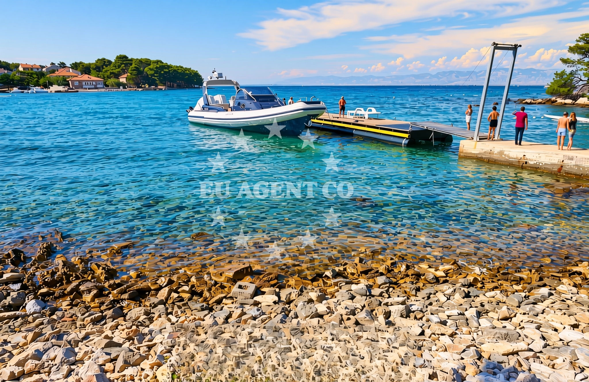
Batalaža istok is a pebbled and rocky shoreline located on the island of Ugljan, part of the Zadar archipelago in Croatia. This beach offers a raw, unspoiled stretch of coast where the terrain transitions between gravel, pebbles, and exposed rock formations. While not a traditional sandy beach, its natural character makes it a unique spot for visitors seeking a more rugged coastal experience. The beach lies along the eastern coast of Ugljan, facing the open waters of the Adriatic Sea, which are known for their clear visibility and gentle currents during the summer months.
About this beach
Batalaža istok, Ugljan (Ugljan)
Beach: Batalaža istok
Location: Ugljan (Ugljan)
Characteristics and facilities
Pebbles, gravel, rocks
Beach character
The beach is defined by its pebbled and rocky terrain, with no significant sandy areas. The shoreline is composed of gravel, small pebbles, and larger rock formations that extend into the water. This composition creates a stark contrast to the more developed beaches found elsewhere on Ugljan. The lack of soft sand means the beach is better suited for activities like rock-hopping or exploring the coastal outcrops rather than sunbathing on a traditional beach. The rocky nature of the shoreline also means that the beach is less likely to be crowded, offering a more secluded experience compared to other parts of the island.
Swimming and shore
Swimming conditions at Batalaža istok depend on the tide and wave action. The rocky shoreline can make entry into the water challenging, particularly during periods of high wave activity. However, the Adriatic Sea is generally calm during the summer, and the beach's position on the eastern side of Ugljan may offer shelter from some wind directions. The water quality is typically good, as the area is not heavily developed. Visitors should be cautious of the uneven terrain when entering or exiting the water, as the pebbles and rocks can be slippery. The beach does not feature any artificial structures like piers or jetties, so swimmers should be mindful of the natural contours of the shore.
Facilities and activities
There are no formal facilities or amenities directly associated with Batalaža istok, as the beach is not a developed tourist destination. The absence of infrastructure means there are no showers, restrooms, or designated parking areas. However, the beach's natural setting offers opportunities for exploration, such as walking along the rocky shoreline or observing the surrounding marine life. The area's proximity to Ugljan's more populated regions means that visitors may find nearby accommodations, restaurants, or other services on the island itself. Activities like hiking, birdwatching, or simply enjoying the unspoiled coastline are the primary attractions here.
Access and location
Batalaža istok is located on the eastern coast of Ugljan, which is part of the Zadar archipelago in Croatia. The island of Ugljan is situated near the mainland city of Zadar, approximately 15 kilometers (8 nautical miles) to the northeast. Access to the beach is likely via local roads on Ugljan, though specific details about parking or road access are not documented in the beach's catalog. Visitors arriving by car would need to navigate to Ugljan, which can be reached by ferry from the mainland or via a bridge connecting the island to the nearby island of Šolta. The beach's position on the island's eastern side means it is relatively isolated compared to other parts of Ugljan, making it a quieter alternative to more developed coastal areas.
What to expect
Visitors to Batalaža istok should expect a natural, undeveloped beach with a pebbled and rocky shoreline. The absence of formal amenities means the beach is best suited for those seeking a tranquil, off-the-beaten-path experience. The area's isolation contributes to its seclusion, though this also means it is less likely to be crowded. The beach's position on the eastern coast of Ugljan offers views of the open Adriatic Sea, and the surrounding landscape includes both rocky outcrops and patches of vegetation. While the beach is not ideal for sunbathing on soft sand, it provides a unique opportunity to explore a rugged coastline. Nearby, Ugljan offers more developed options for dining, accommodation, and other recreational activities.
Practical tips
Due to the beach's pebbled and rocky nature, visitors should wear sturdy footwear to protect against uneven terrain. The absence of formal facilities means visitors should bring their own supplies, such as water, snacks, and sun protection. The beach's isolation suggests it may be less accessible during inclement weather, so planning ahead for transportation is advisable. Those interested in exploring the area further may want to consider staying on Ugljan, where more amenities are available.
Exploring the coast by yacht
The waters surrounding Ugljan, including the area near Batalaža istok, are part of the Adriatic Sea's well-known sailing routes. The region is popular with yacht charter guests due to its combination of sheltered bays, open sea, and proximity to cultural landmarks. The nearby island of Šolta, reachable by bridge, and the mainland city of Zadar, with its historic sites, are common destinations for sailors exploring the area. For those interested in yacht charters, Euro-Agent's Yacht Search page provides access to motor yachts and sailboats available for rental in the region. The beach's location on the eastern side of Ugljan may offer a vantage point for observing passing vessels or planning sailing excursions along the coast.
Local Context: Ugljan's Role in the Zadar Archipelago
The island of Ugljan is one of the largest in the Zadar archipelago, known for its vineyards, olive groves, and traditional fishing communities. Its position between the mainland and the islands of Šolta and Vis makes it a strategic point for both land and sea travel. The island's cultural heritage includes historic churches, stone towers, and a long history of maritime activity. Visitors to Batalaža istok may find it interesting to explore Ugljan's inland villages or take a boat tour to nearby islands, which are often included in yacht charter itineraries.
Anchorages in the surrounding area
Anchorages in the surrounding area include options on Ugljan and nearby locations.
- Anchorage — ugljan — 0.0 NM from beach
- Anchorage — ceprljanda — ugljan — 1.1 NM from beach
- Anchorage — muline — ugljan — 1.3 NM from beach
- Anchorage — muline — ugljan — 1.4 NM from beach
- Anchorage — ugljan — 1.8 NM from beach
- Anchorage — ugljan — 1.9 NM from beach
- Anchorage — ugljan — 2.0 NM from beach
- Anchorage — rivanj — 2.0 NM from beach
Distances are straight-line geographic distances, not sailing routes.
Mooring buoys in the surrounding area
- Jetty — ugljan — 0.1 NM from beach
- Buoy field — muline — ugljan — 1.3 NM from beach
- Buoy field Muline — ugljan — 1.3 NM from beach
- Punta Skala — petrcane — 3.9 NM from beach
- Jetty — iz veli — 4.8 NM from beach
Distances are straight-line geographic distances, not sailing routes.
Marine fuel stations
- Ina — preko — ugljan — 5.4 NM from beach
- Ina — zadar — 5.7 NM from beach
- Fuel station — sukosan — 9.9 NM from beach
- Ina — zaglav — dugi otok — 11.4 NM from beach
Distances are straight-line geographic distances, not sailing routes.
Harbours in the surrounding area
Harbours in the surrounding area include Ugljan and nearby coastal locations.
- Ugljan — 0.5 NM from beach
- Čeprljanda — ceprljanda — ugljan — 1.0 NM from beach
- Muline — ugljan — 1.2 NM from beach
- Lukoran — ugljan — 3.0 NM from beach
- Rivanj — 3.2 NM from beach
- Sutomišćica — sutomiscica — ugljan — 3.7 NM from beach
Distances are straight-line geographic distances, not sailing routes.
Marinas in the surrounding area
Marinas in the surrounding area are situated in Ugljan and Zadar.
- Olive Island Marina — sutomiscica — ugljan — 3.9 NM from beach
- Marina Borik — zadar — 4.8 NM from beach
- Vitrenjak Zadar — 5.1 NM from beach
- Marina Preko — ugljan — 5.1 NM from beach
- Marina Veli Iž — iz veli — 5.1 NM from beach
Distances are straight-line geographic distances, not sailing routes.
Restaurants near the beach
Restaurants near the beach offer dining options in Ugljan and adjacent areas.
- Trapula — ugljan — 0.4 NM from beach
- Kaleta — ugljan — 0.4 NM from beach
- Apollo — ugljan — 0.5 NM from beach
- Pizzaria Muline — ugljan — 1.1 NM from beach
- Stivon — muline — ugljan — 1.2 NM from beach
- Kažot — muline — ugljan — 1.3 NM from beach
- Olive Garden — sutomiscica — ugljan — 3.8 NM from beach
Distances are straight-line geographic distances, not sailing routes.
Navigation guides for the surrounding area
Navigation guides for the surrounding area cover Ugljan and nearby coastal regions.
- Ugljan — 0.6 NM from beach
- Muline — 1.2 NM from beach
- Ceprljanda — 1.3 NM from beach
- Lukoran Veli — 3.0 NM from beach
- Uvala Kablin — 3.7 NM from beach
Distances are straight-line geographic distances, not sailing routes.
Yachts from nearby departure bases
Yachts from nearby departure bases include vessels based in Ugljan and Zadar.
Sailing yachts
- Elan Impression 40 (Val) — Ugljan Sutomišćica Olive Island — 3.9 NM from departure base to beach
- Bavaria C42 (Dna) — Zadar Marina Borik — 4.8 NM from departure base to beach
- Bavaria Cruiser 37 (Porec) — Zadar Marina Borik — 4.8 NM from departure base to beach
Catamarans
- Sunreef 60 (SINATA) — Zadar Marina Borik — 4.8 NM from departure base to beach
Motor yachts
- Prestige 460 (Adudu 2) — Zadar Marina Borik — 4.8 NM from departure base to beach
Motor boats
- Quicksilver Activ 905 (Galeb) — Ugljan Sutomišćica Olive — 3.9 NM from departure base to beach
- Rancraft RM21 (Dugi otok) — Zadar Diklo Port — 4.6 NM from departure base to beach
- Rancraft RM19 (Daycruiser) — Zadar Diklo Port — 4.6 NM from departure base to beach
- Rancraft RS Cinque.5 — Zadar Diklo Port — 4.6 NM from departure base to beach
- Merry Fisher 895 (Miami Vice) — Zadar Marina Borik — 4.8 NM from departure base to beach
Distances are straight-line geographic distances, not sailing routes.