Baška (Krk): Beaches and Coves, Croatia
About this beach
Baška (Krk): beaches and coves
Beach character
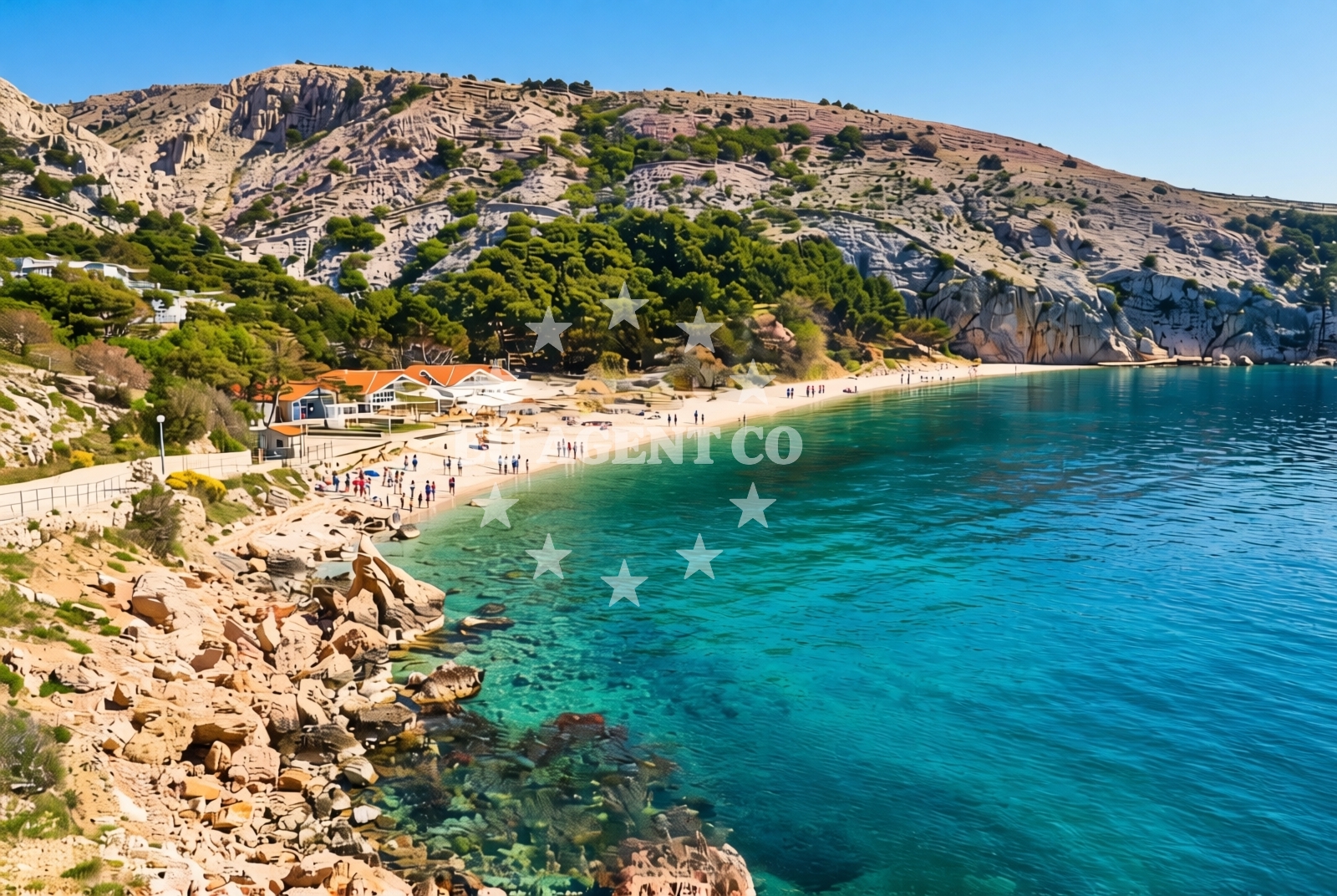
The beaches and coves of Baška are defined by their integration with the island's natural topography. The coastline features a mix of pebbled shores and rocky inlets, with some areas offering more gradual access to the water. The absence of detailed structural amenities in official records suggests a focus on unspoiled natural settings, though local infrastructure in nearby settlements like Baška village provides basic services for visitors. The area's appeal lies in its relative tranquility compared to more touristed parts of the Croatian coast, making it a destination for those seeking a more subdued coastal experience.Swimming and shore
Swimming conditions in the coves around Baška are influenced by the surrounding geology. Sheltered bays tend to have calmer waters, while more exposed areas may experience stronger currents. The shorelines vary from steep, rocky descents to gentler slopes, with some coves offering natural seating areas formed by the landmass. While no specific facilities are documented for the beaches themselves, the proximity to Baška village ensures access to essential amenities such as refreshments and local artisanal products.Facilities and activities
Official records do not specify facilities directly on the beaches of Baška, but the nearby settlement provides a range of services. The village of Baška, located inland from the coast, offers accommodations, dining options, and cultural landmarks such as the Baška Church and the Krk Island Museum. These attractions provide context for the region's historical significance as a center of medieval Croatian heritage. For those seeking activities beyond the shore, the surrounding island and mainland offer hiking trails, vineyards, and connections to the broader Istrian Peninsula.Access and location
Access to the beaches and coves of Baška is primarily via roads leading from the village of Baška and other points along Krk Island's northern coast. The island's position in the Kvarner Gulf places it within reach of major Adriatic ports, with the nearby city of Rijeka serving as a key gateway. For those arriving by sea, the waters around Krk are part of a well-established sailing route, with marinas and anchorages available in both Baška and other coastal towns on the island.What to expect
Visitors to Baška's beaches and coves should anticipate a landscape shaped by natural formations rather than extensive development. The coastline's character is defined by its integration with the island's terrain, offering a mix of accessible and more secluded spots. While no specific facilities are documented for the beaches themselves, the nearby village of Baška provides essential services. The area's appeal is rooted in its historical and cultural context, with opportunities to explore local landmarks and experience the rhythms of island life.Practical tips
Given the lack of detailed structural information for the beaches, visitors are advised to check local conditions for access points and seasonal variations. The proximity to Baška village ensures that basic amenities are available, though those seeking more specialized services may need to travel to larger towns on Krk Island or the mainland.Exploring the coast by yacht
For yacht charter guests, the waters around Krk Island, including the Baška coastline, are part of a popular sailing area in the Adriatic. The island's position allows for easy access to both the Kvarner Gulf and the broader Adriatic Sea, with routes connecting to nearby islands such as Cres, Lošinj, and the Istrian Peninsula. Anchorages and marinas in Baška and other coastal towns provide options for mooring, while the surrounding waters offer opportunities for coastal cruising and exploration of the region's maritime heritage.Historical Context of Baška and Krk
Baška's historical significance is underscored by its role in the medieval Kingdom of Croatia. The village is home to the Baška Church, a 12th-century Romanesque structure that reflects the island's ecclesiastical heritage. Krk Island itself has been a strategic location for centuries, with its position influencing trade routes and maritime defense in the Adriatic.Anchorages in the surrounding area
Anchorages near Baška (Krk) include Baska, Krk, and surrounding coves.
- Anchorage — baska — krk — 0.4 NM from beach
- Anchorage — krk — 2.1 NM from beach
- Bracol — krk — 2.2 NM from beach
- Vela Luka — krk — 2.2 NM from beach
- Mala Luka — krk — 2.4 NM from beach
- Anchorage — krk — 2.6 NM from beach
- Anchorage — krk — 2.8 NM from beach
- Anchorage — stara baska — krk — 2.9 NM from beach
Distances are straight-line geographic distances, not sailing routes.
Mooring buoys in the surrounding area
- Jetty — krk — 2.2 NM from beach
- Buoy field — krk — 2.2 NM from beach
- Jetty — krk — 2.3 NM from beach
- Jetty — stara baska — krk — 2.9 NM from beach
- Jetty — stara baska — krk — 2.9 NM from beach
Distances are straight-line geographic distances, not sailing routes.
Marine fuel stations
Marine fuel stations in Krk, Novi Vinodolski, and OMV serve the Baška (Krk) area.
- Flash — krk — 8.2 NM from beach
- Ina — krk — 8.3 NM from beach
- INA — novi vinodolski — 9.4 NM from beach
- OMV — krk — 11.3 NM from beach
Distances are straight-line geographic distances, not sailing routes.
Harbours in the surrounding area
- Baška — baska — krk — 0.4 NM from beach
- Punat — krk — 6.1 NM from beach
- Senj — 6.3 NM from beach
- Vrbnik — krk — 7.3 NM from beach
- St. Juraj — st juraj — 7.5 NM from beach
- Melna — goli otok — 7.8 NM from beach
Distances are straight-line geographic distances, not sailing routes.
Marinas in the surrounding area
Marinas in Punat, Novi Vinodolski, and Supetarska Draga are located near Baška (Krk).
- Marina Punat — krk — 6.4 NM from beach
- Mitan Marina — novi vinodolski — 9.3 NM from beach
- Marina Novi — novi vinodolski — 9.5 NM from beach
- ACI Marina Supetarska Draga — rab — 10.2 NM from beach
- Šilo — silo — krk — 11.3 NM from beach
Distances are straight-line geographic distances, not sailing routes.
Restaurants near the beach
Restaurants in Baska, Vela Luka, and Stara Baska offer dining close to Baška (Krk).
- Restaurant — baska — krk — 0.3 NM from beach
- Restaurant — baska — krk — 0.4 NM from beach
- Vela Luka — krk — 2.2 NM from beach
- Restaurant — krk — 2.2 NM from beach
- Mala Luka — krk — 2.4 NM from beach
- Restaurant — stara baska — krk — 2.9 NM from beach
- Mariana Restaurant — stara baska — krk — 2.9 NM from beach
Distances are straight-line geographic distances, not sailing routes.
Navigation guides for the surrounding area
Navigation guides for Baška, Uvala Vela Luka, and Senj aid route planning near Baška (Krk).
- Baška — 0.6 NM from beach
- Uvala Vela Luka — 2.5 NM from beach
- Senj — 6.5 NM from beach
- Uvala Sv. Jelena — 6.5 NM from beach
- Vrbnik — 7.2 NM from beach
Distances are straight-line geographic distances, not sailing routes.
Yachts from nearby departure bases
Sailing yachts
- First 25.7 (Petra) — Krk Punat port — 6.1 NM from departure base to beach
- Salona 45 (Nati) — Krk Punat port — 6.1 NM from departure base to beach
- Bavaria 46 Cruiser (SIRIUS I) — Krk Marina Punat — 6.4 NM from departure base to beach
- Oceanis 46.1 (Stream) — Krk Marina Punat — 6.4 NM from departure base to beach
Catamarans
- Lagoon 380 (Xenia) — Krk Punat port — 6.1 NM from departure base to beach
- Lagoon 40 (SUNLIGHT) — Krk Marina Punat — 6.4 NM from departure base to beach
- Lipari 41 (ARGOS) — Krk Marina Punat — 6.4 NM from departure base to beach
Motor yachts
- Sunseeker 64 (MARITA) — Krk Marina Punat — 6.4 NM from departure base to beach
- Ferretti 460 (Summertime) — Krk Marina Punat — 6.4 NM from departure base to beach
Motor boats
- Motor boat (PAOLA) — Krk Marina Punat — 6.4 NM from departure base to beach
Distances are straight-line geographic distances, not sailing routes.