Banje istok, Rogač (Šolta) Beach, Croatia
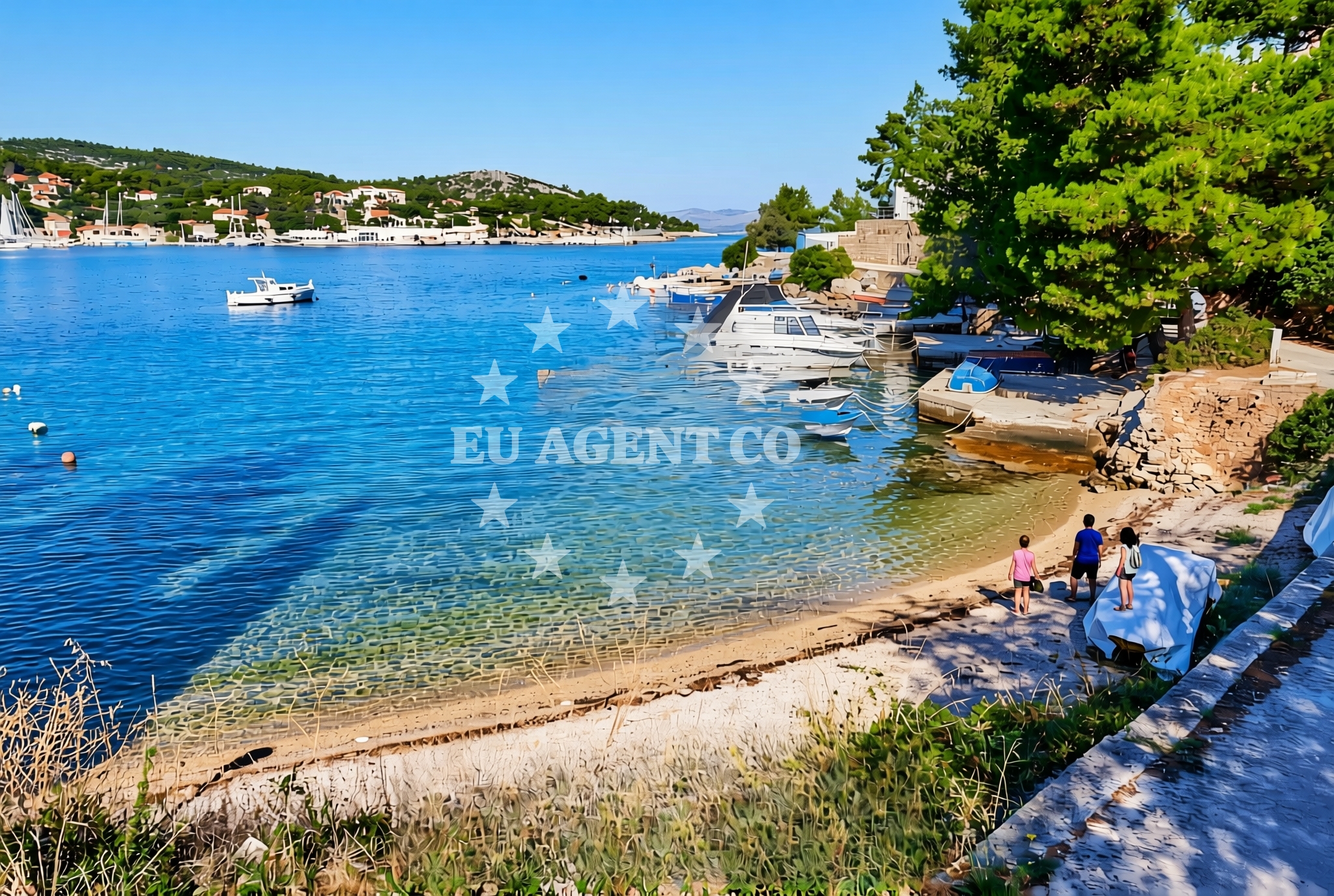
About this beach
Banje istok, Rogač (Šolta)
Beach: Banje istok
Location: Rogač (Šolta)
Characteristics and facilities
Gravel
Natural shade
Beach character
The beach's gravel substrate creates a distinct tactile experience, contrasting with the smooth sands of other Adriatic shores. Natural shade is provided by low-lying vegetation and rock formations along the shoreline, offering intermittent relief from direct sunlight. The absence of artificial structures or amenities emphasizes the beach's natural state, aligning with the broader character of Šolta's lesser-developed coastal areas. This gravel beach is part of a broader network of shores on Šolta that prioritize preservation over commercialization.Swimming and shore
Swimming conditions at Banje istok are influenced by the gravel substrate, which can make entry and exit from the water less comfortable compared to sandy beaches. The shoreline's natural contours create varying water depths, with deeper sections farther from the gravel. The Adriatic Sea's generally clear waters are visible in areas where the gravel gives way to smoother seabed transitions. The beach's orientation on the island's southern coast means it faces open sea conditions, which can affect wave patterns during stronger winds.Facilities and activities
No formal facilities are present at Banje istok, consistent with its designation as a natural shore. There are no designated parking areas, restrooms, or changing rooms. The beach's character precludes typical recreational activities like sunbathing on deckchairs or organized sports. However, the surrounding Šolta Island offers hiking trails and cultural sites that can be accessed via Rogač village, located approximately 2 kilometers inland from the beach. Nearby villages on Šolta provide basic amenities for visitors.Access and location
Banje istok is accessible via a short path from the Rogač village road, which runs along the island's southern coast. The beach is part of Šolta's network of coastal trails that connect to other shores and inland attractions. For visitors arriving by sea, the island's proximity to Split and the nearby marina at Supetar (on the island of Brač) makes it a feasible day-trip destination. Šolta's lack of major marinas means most yacht visitors anchor in nearby bays or use the small harbor at Šolta village.What to expect
Visitors should expect a beach defined by its gravel composition and natural shading rather than by amenities or services. The shoreline is best suited for those seeking a secluded, undeveloped coastal experience. The lack of infrastructure means visitors should bring their own supplies, including water, sunscreen, and appropriate footwear for the gravel. The beach's position on Šolta's southern coast offers views of the open Adriatic, with the island's interior accessible via nearby trails.Practical tips
Wear sturdy footwear to navigate the gravel shoreline comfortably. Bring water and snacks, as there are no facilities on-site. Arrive early to secure a spot, as the beach's accessibility makes it popular with local visitors. Respect the natural environment by avoiding littering and staying on designated paths.Exploring the coast by yacht
For yacht charter guests, Šolta's coastline offers a range of anchorage options in sheltered bays, with the island's southern shores providing open sea views. The nearby Supetar Marina (Brač) and Split Marina are common bases for exploring the area. Charter yachts can anchor in Šolta's bays or use the small harbor at Šolta village for land access. The island's position in the central Adriatic makes it a strategic stop for itineraries covering the Split, Hvar, and Brač regions.Šolta Island Context
Šolta, the largest island in the Šolta archipelago, is known for its olive groves, vineyards, and traditional villages. The island's coastal trails connect beaches like Banje istok to historical sites such as the 16th-century Šolta Fortress. Local agriculture and fishing remain central to the economy, with olive oil and wine production defining the region's cultural heritage.Anchorages in the surrounding area
Anchorages near Rogac and Necujam on Solta provide nearby mooring options.
- Anchorage — rogac — solta — 0.1 NM from beach
- Anchorage — necujam — solta — 0.5 NM from beach
- Anchorage — rogac — solta — 0.5 NM from beach
- Anchorage — necujam — solta — 0.6 NM from beach
- Anchorage — necujam — solta — 0.7 NM from beach
- Anchorage — necujam — solta — 0.8 NM from beach
- Anchorage — solta — 1.5 NM from beach
- Anchorage — solta — 1.6 NM from beach
Distances are straight-line geographic distances, not sailing routes.
Mooring buoys in the surrounding area
- Pasarela restaurant jetty — rogac — solta — 0.1 NM from beach
- Resturant Sveti Petar bouy — necujam — solta — 1.0 NM from beach
- Jetty — necujam — solta — 1.0 NM from beach
- Lonely Paradise restaurant buoys — solta — 1.6 NM from beach
- Buoy field — solta — 1.7 NM from beach
Distances are straight-line geographic distances, not sailing routes.
Marine fuel stations
A fuel station in Rogac and others in Milna Brac and Trogir serve the area.
- Fuel station — rogac — solta — 0.2 NM from beach
- Ina — milna brac — 7.3 NM from beach
- Ina — trogir — 7.6 NM from beach
- B-Max — b max — trogir — 7.9 NM from beach
Distances are straight-line geographic distances, not sailing routes.
Harbours in the surrounding area
Harbours in Rogac and Stomorska on Solta are within short distances.
- Rogač — rogac — solta — 0.3 NM from beach
- Stomorska — solta — 2.5 NM from beach
- Toče — okrug gornji — ciovo — 6.4 NM from beach
- Slatine — ciovo — 6.5 NM from beach
- Arbanija — okrug gornji — ciovo — 7.2 NM from beach
- Milna — milna brac — 7.4 NM from beach
Distances are straight-line geographic distances, not sailing routes.
Marinas in the surrounding area
- Marina Martinis Marchi — maslinica — solta — 4.3 NM from beach
- Marina Vlaška — milna brac — 7.1 NM from beach
- Marina Milna Kanarija — milna brac — 7.3 NM from beach
- ACI Marina Milna — milna brac — 7.5 NM from beach
- Marina Trogir — 7.6 NM from beach
Distances are straight-line geographic distances, not sailing routes.
Restaurants near the beach
Restaurants in Rogac, including Pasarela and Stara Kuća, are close to the beach.
- Pasarela — rogac — solta — 0.2 NM from beach
- Stara Kuća — rogac — solta — 0.2 NM from beach
- Villa Solta — rogac — 0.5 NM from beach
- Konoba Mareta — necujam — solta — 0.8 NM from beach
- Restaurant Punta — necujam — solta — 0.9 NM from beach
- Sveti Petar — necujam — solta — 1.0 NM from beach
- Lonely Paradise — solta — 1.5 NM from beach
Distances are straight-line geographic distances, not sailing routes.
Navigation guides for the surrounding area
Navigation guides for Rogac and Uvala Necujam assist with local waterway planning.
- Rogac — 0.1 NM from beach
- Uvala Necujam — 0.8 NM from beach
- Uvala Donja Krusica — 1.7 NM from beach
- Uvala Tatinja — 1.8 NM from beach
- Stomorska — 2.5 NM from beach
Distances are straight-line geographic distances, not sailing routes.
Yachts from nearby departure bases
Sailing yachts
- Sun Odyssey 490 (Izzy) — Šolta Rogač — 0.2 NM from departure base to beach
- Cyclades 39.3 (Patagonia) — Šolta Rogač — 0.2 NM from departure base to beach
- Cyclades 43.4 (Tigris) — Šolta Rogač — 0.2 NM from departure base to beach
- Oceanis 41.1 (Goa) — Šolta Rogač — 0.2 NM from departure base to beach
- Oceanis 46.1 (Everest) — Šolta Rogač — 0.2 NM from departure base to beach
Catamarans
- Lagoon 450 (Madagascar) — Šolta Rogač — 0.2 NM from departure base to beach
- Lagoon 40 (Solentia) — Šolta Rogač — 0.2 NM from departure base to beach
- Lagoon 450 Flybridge (Samogon) — Šolta Rogač — 0.2 NM from departure base to beach
- Lagoon 42 (Galapagos) — Šolta Rogač — 0.2 NM from departure base to beach
- Lagoon 400 (Greenland) — Šolta Rogač — 0.2 NM from departure base to beach
Distances are straight-line geographic distances, not sailing routes.