Balića Rat Istok, Stanići (Omiš) Beach, Croatia
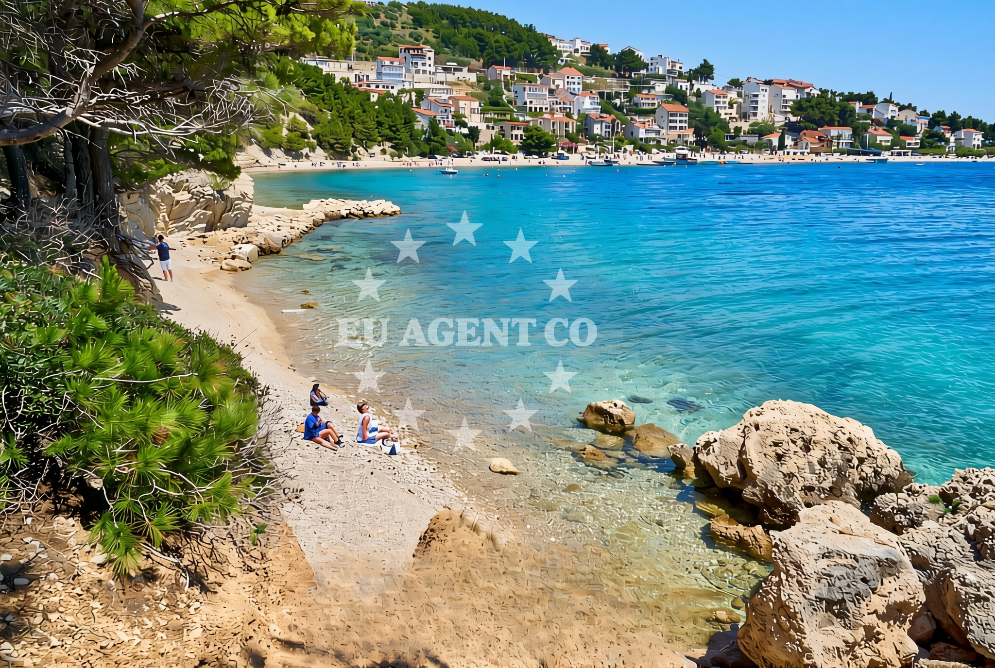
Balića Rat Istok is a gravel beach located in Stanići, a coastal settlement near Omiš in southern Croatia. Stretching approximately 60 meters along the Adriatic coast, the beach is characterized by its natural gravel composition and shaded areas, offering a unique contrast to the region’s more common pebble or sandy shores. While the beach lacks formal amenities, its proximity to Omiš and the surrounding landscape make it a point of interest for visitors exploring the area’s natural and cultural heritage.
About this beach
Balića rat istok, Stanići (Omiš)
Beach: Balića rat istok
Location: Stanići (Omiš)
Characteristics and facilities
Gravel
60 m
Natural shade
Beach character
The beach’s gravel surface is a defining feature, providing a firm and stable walking surface that contrasts with the soft sands of other Adriatic beaches. The 60-meter length is modest but sufficient for casual relaxation, with natural shade available from nearby vegetation or rocky outcrops. Gravel beaches are relatively rare along the Croatian coast, making this stretch of shoreline distinct. The absence of artificial structures or facilities means visitors should come prepared for a more rustic experience, though the beach’s simplicity may appeal to those seeking tranquility away from crowded tourist spots.
Swimming and shore
Swimming conditions at Balića Rat Istok are not explicitly documented in the beach’s authoritative features. Gravel beaches can present challenges for swimmers due to the uneven surface, which may make entering and exiting the water less straightforward than on sandy shores. However, the beach’s location along the Adriatic coast suggests generally clear waters, typical of the region. Visitors should exercise caution when entering the sea, as the gravel could affect footing near the shoreline.
Facilities and activities
No formal facilities or activities are listed for Balića Rat Istok in the beach’s authoritative records. The lack of amenities such as parking, restrooms, or lifeguard services means visitors should plan accordingly. The beach’s gravel composition may limit recreational activities typically associated with sandy shores, such as sunbathing or beach volleyball. However, the area’s natural setting offers opportunities for walking, photography, or simply enjoying the unspoiled coastal landscape.
Access and location
Located in Stanići, a small coastal village near Omiš, Balića Rat Istok is part of the broader Omiš region, a historic and scenic area on Croatia’s southern coast. Omiš itself is a town with a rich medieval heritage, home to the Omiš Fortress and the Cetina River, which flows through the town and offers opportunities for kayaking and rafting. The beach’s proximity to Omiš means visitors can easily access the town’s cultural sites, restaurants, and marinas. The surrounding area is also known for its dramatic cliffs, caves, and hiking trails, making it a hub for outdoor enthusiasts.
What to expect
Visitors to Balića Rat Istok should expect a simple, natural beach experience with minimal infrastructure. The gravel surface may require sturdy footwear for walking, and the lack of formal amenities means visitors should bring their own supplies. The beach’s shaded areas provide relief from the sun, though sun protection is still advisable. The location’s proximity to Omiš and the surrounding landscape makes it a good base for exploring the region’s cultural and natural attractions, from historical sites to water-based activities.
Practical tips
Given the beach’s gravel composition, visitors may want to wear comfortable shoes for walking along the shore. Sunscreen and a hat are recommended, even in shaded areas, due to the Adriatic sun’s intensity. While the beach itself lacks facilities, nearby Omiš offers a range of services, including restaurants, shops, and marinas. Parking options in the area should be confirmed in advance, as the beach’s specific parking details are not documented.
Exploring the coast by yacht
The Omiš region is a popular sailing destination along the Adriatic coast, with its sheltered waters, scenic coastline, and proximity to the Cetina River. Yacht charter guests exploring the area may find Balića Rat Istok’s location useful as a reference point for navigating the coast. Nearby marinas in Omiš and other towns along the Dalmatian coast provide docking options for motor yachts and sailboats. The region’s sailing routes often include stops at nearby islands, caves, and historic sites, making it an appealing choice for those seeking both adventure and cultural immersion.
Cultural and Historical Context of Omiš
Omiš, the town near Balića Rat Istok, has a long history dating back to ancient times, with its medieval fortress offering panoramic views of the Adriatic. The town’s strategic location on the Cetina River made it a key point in the region’s history, and today it remains a gateway to the surrounding natural and cultural attractions. Visitors can explore the town’s narrow streets, historic buildings, and the nearby Krka National Park, which features waterfalls and lush landscapes.
Anchorages in the surrounding area
Anchorages in the surrounding area include Konopjikova and Anchorage near Postira and Povlja on Brac.
- Konopjikova — postira — brac — 3.4 NM from beach
- Anchorage — postira — brac — 3.6 NM from beach
- Anchorage — postira — brac — 4.9 NM from beach
- Anchorage — splitska — brac — 5.7 NM from beach
- Tri luke — povlja — brac — 5.7 NM from beach
- Anchorage — povlja — brac — 6.3 NM from beach
- Anchorage — povlja — brac — 6.4 NM from beach
- Anchorage — povlja — brac — 6.5 NM from beach
Distances are straight-line geographic distances, not sailing routes.
Mooring buoys in the surrounding area
Mooring buoys in the surrounding area include Quay near Postira and Restaurant Pipo jetty near Povlja on Brac.
- Quay — postira — brac — 3.4 NM from beach
- Restaurant Pipo buoys — povlja — brac — 5.6 NM from beach
- Restaurant Pipo jetty — povlja — brac — 5.7 NM from beach
- Konoba Rojen jetty — povlja — brac — 5.7 NM from beach
- Jetty — podstrana — 7.5 NM from beach
Distances are straight-line geographic distances, not sailing routes.
Marine fuel stations
Marine fuel stations are located in Bol, Sumartin, Milna Brac, and Split, providing refueling options for boats in the area.
- Fuel station — bol — brac — 9.8 NM from beach
- Fuel station — sumartin — brac — 9.9 NM from beach
- Ina — milna brac — 13.2 NM from beach
- Ina — split — 13.7 NM from beach
Distances are straight-line geographic distances, not sailing routes.
Harbours in the surrounding area
- Omiš — omis — 1.9 NM from beach
- Dugi Rat — 3.9 NM from beach
- Mimice — 3.9 NM from beach
- Pučišća harbour — pucisca — brac — 4.1 NM from beach
- Sumpetar — dugi rat — 4.6 NM from beach
- Postira — brac — 4.6 NM from beach
Distances are straight-line geographic distances, not sailing routes.
Marinas in the surrounding area
Marinas in the surrounding area include Marina Lav in Podstrana and Marina Baška Voda, providing mooring options on Brac and nearby areas.
- Marina Lav — podstrana — 9.1 NM from beach
- Marina Baška Voda — marina baska voda — 10.5 NM from beach
- Marina Ramova — krvavica — 12.7 NM from beach
- ACI Marina Milna — milna brac — 13.0 NM from beach
- Marina Milna Kanarija — milna brac — 13.1 NM from beach
Distances are straight-line geographic distances, not sailing routes.
Restaurants near the beach
Restaurants near the beach include Konoba Milo in Omiš and Restaurant in Postira, offering dining options for visitors.
- Konoba Milo — omis — 2.1 NM from beach
- Restaurant — postira — brac — 3.6 NM from beach
- Lado — pucisca — brac — 4.1 NM from beach
- Pizzeria Marin — pucisca — brac — 4.2 NM from beach
- Galija — postira — brac — 4.6 NM from beach
Distances are straight-line geographic distances, not sailing routes.
Navigation guides for the surrounding area
Navigation guides for the surrounding area include Omis, Dugi Rat, and Pucisca, assisting with local sailing routes.
- Omis — 1.7 NM from beach
- Dugi Rat (Uvala Orisac) — 3.7 NM from beach
- Mi mice — 4.1 NM from beach
- Pucisca — 4.2 NM from beach
- Postire — 4.5 NM from beach
Distances are straight-line geographic distances, not sailing routes.
Yachts from nearby departure bases
Yachts from nearby departure bases include gulets from Omiš City Port and catamarans from Sumpetar Port, offering various charter options.
Sailing yachts
- Jeanneau 53 (Win Win) — Podstrana Marina Lav — 9.1 NM from departure base to beach
Catamarans
- Lagoon 450 Fly (Falco) — Sumpetar Port — 4.6 NM from departure base to beach
Motor yachts
- Sunseeker Predator 72 (Ghost) — Podstrana Marina Lav — 9.1 NM from departure base to beach
Gulets / Cruisers
- Gulet (Trebenna) — Omiš City Port — 1.9 NM from departure base to beach
- Gulet (Primorac) — Omiš City Port — 1.9 NM from departure base to beach
- Gulet (PATRONICE) — Omiš City Port — 2.1 NM from departure base to beach
- Gulet (Cataleya) — Sumpetar Port — 4.6 NM from departure base to beach
- Gulet (Altair) — Sumpetar Port — 4.6 NM from departure base to beach
- Gulet cruiser (AGORA) — Dugi Rat Luka Krilo — 5.9 NM from departure base to beach
Motor boats
- Sealine T 50 (Maja 2) — Podstrana Marina Lav — 9.1 NM from departure base to beach
Distances are straight-line geographic distances, not sailing routes.