Babina Zapad Beach, Čara (Korčula), Croatia
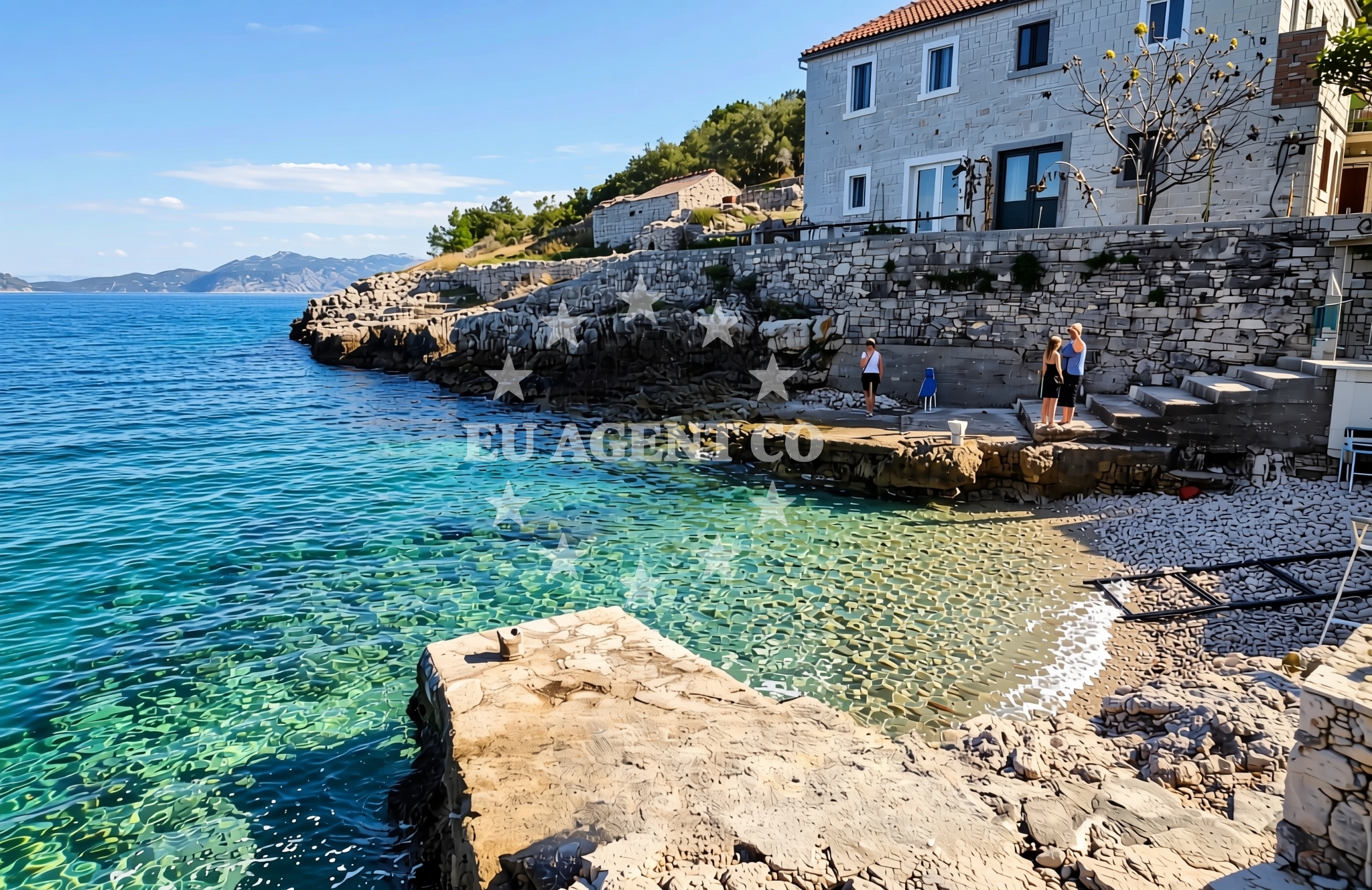
Babina Zapad Beach is a secluded stretch of coastline located in Čara, on the island of Korčula in southern Dalmatia. Situated along the eastern shore of the island, the beach is characterized by its gravelly and rocky terrain, offering a stark contrast to the more tourist-developed beaches of the region. Its natural features make it a unique spot for visitors seeking a more rugged coastal experience.
About this beach
Babina zapad, Čara (Korčula)
Beach: Babina zapad
Location: Čara (Korčula)
Characteristics and facilities
Gravel, concrete / stone slabs, rocks
Natural shade
Beach character
The beach is composed primarily of gravel, concrete slabs, and exposed rock formations, creating a landscape that is more suited to casual exploration than sunbathing. Natural shade is available in areas where rock formations and overhanging cliffs provide limited relief from the sun. The absence of artificial amenities means the beach retains a raw, unaltered character typical of many lesser-known Croatian coastlines.
Swimming and shore
Swimming conditions at Babina Zapad are influenced by the rocky shoreline and the proximity to deeper waters. The beach is not ideal for swimming due to the uneven terrain and the lack of shallow, calm areas. However, the surrounding waters are part of the broader Korčula sailing region, known for its clear blue depths and gentle currents that attract experienced sailors.
Facilities and activities
No formal facilities are present at Babina Zapad Beach. There are no showers, restrooms, or umbrellas available, and the beach is not serviced by lifeguards or local authorities. The lack of infrastructure means it is best suited for visitors who prefer a minimalist approach to beachgoing. Activities are limited to walking along the shoreline and exploring the rocky outcrops that define the area.
Access and location
Access to Babina Zapad Beach is via a short walk from the village of Čara on Korčula. The beach is not directly reachable by car, requiring visitors to navigate a path through the rocky terrain. Its location on the island’s eastern coast places it within easy reach of Korčula Town, the island’s main settlement, and closer to the open waters of the Adriatic Sea than to the more sheltered bays of the island’s northern and western coasts.
What to expect
Visitors to Babina Zapad should expect a rugged, undeveloped coastline that is more suited to exploration than relaxation. The beach’s gravelly surface and lack of amenities make it an unconventional choice for sun-seekers, but it offers a unique opportunity to experience the natural geography of Korčula’s lesser-known shores. The beach is best visited during off-peak seasons when the absence of crowds enhances its tranquil atmosphere.
Practical tips
Wear sturdy footwear to navigate the rocky and gravelly terrain safely. Bring water and snacks, as there are no refreshment options on-site. The beach is not recommended for families with young children due to the uneven surface and lack of safety features. Early morning visits may offer the most peaceful experience, as the area is typically quiet throughout the day.
Exploring the coast by yacht
For yacht charter guests, the proximity of Babina Zapad to the open waters of the Adriatic makes it a useful reference point for navigating the Korčula sailing area. The island is a popular destination for motor yachts and sailing boats, with its sheltered bays and clear waters offering opportunities for both cruising and anchoring. While the beach itself is not a designated anchorage, the surrounding coastline is dotted with marinas and harbors that cater to charter vessels exploring the region.
Geographical Context of Čara, Korčula
Čara is a small village on the eastern coast of Korčula, a historic island in the Adriatic Sea. The village is known for its traditional stone houses and its position as a gateway to the island’s more remote beaches. Korčula itself is part of the Pelješac Peninsula, a region renowned for its vineyards, medieval architecture, and sailing opportunities. The island’s coastline is a mix of pebbly beaches, rocky cliffs, and sheltered coves, with Babina Zapad representing one of the more rugged sections of this diverse shoreline.
Anchorages in the surrounding area
Anchorages in the surrounding area include nearby options on Korčula and nearby islands.
- Anchorage — korcula — 0.3 NM from beach
- Rasoha — korcula — 0.4 NM from beach
- Anchorage — korcula — 3.3 NM from beach
- Anchorage — korcula — 3.5 NM from beach
- Anchorage — korcula — 4.0 NM from beach
- Anchorage — racisce — korcula — 4.4 NM from beach
- Anchorage — korcula — 4.4 NM from beach
- Grahova — brna — korcula — 4.6 NM from beach
Distances are straight-line geographic distances, not sailing routes.
Mooring buoys in the surrounding area
Mooring buoys in the surrounding area are located in Lovište and other nearby coastal areas.
- Jetty — loviste — 4.7 NM from beach
- Konoba Estravaganca buoys - Duba — konoba estravaganca buoys duba — loviste — 5.5 NM from beach
- Restaurant Korkyra xyz buoys — loviste — 5.7 NM from beach
- Jetty — loviste — 5.8 NM from beach
- Quay — vela luka — korcula — 7.4 NM from beach
Distances are straight-line geographic distances, not sailing routes.
Marine fuel stations
- Ina — vela luka — korcula — 9.1 NM from beach
- Fuel station — korcula — 10.0 NM from beach
- Ina — ubli — lastovo — 14.2 NM from beach
- Ina — vrboska — hvar — 16.6 NM from beach
Distances are straight-line geographic distances, not sailing routes.
Harbours in the surrounding area
Harbours in the surrounding area include Zavalatica and Racisce on Korčula, along with Brna and Lovište.
- Zavalatica — korcula — 3.5 NM from beach
- Račišće — racisce — korcula — 4.4 NM from beach
- Brna — korcula — 4.8 NM from beach
- Prigradica — korcula — 4.9 NM from beach
- Lovište — loviste — 5.8 NM from beach
- Viganj — 7.9 NM from beach
Distances are straight-line geographic distances, not sailing routes.
Marinas in the surrounding area
Marinas in the surrounding area are situated in Vela Luka and other ports on Korčula and nearby islands.
- Marina Korkyra — vela luka — korcula — 9.2 NM from beach
- ACI Marina Korčula — korcula — 9.5 NM from beach
- Marina Lumbarda — korcula — 11.4 NM from beach
- Marina Solitudo — lastovo — 13.1 NM from beach
- ACI Marina Vrboska — hvar — 16.5 NM from beach
Distances are straight-line geographic distances, not sailing routes.
Restaurants near the beach
Restaurants near the beach include options in Racisce and Brna on Korčula.
- Vala — racisce — korcula — 4.3 NM from beach
- Restaurant — korcula — 4.4 NM from beach
- Konoba Mijo — korcula — 4.4 NM from beach
- Bistro Prigradica — korcula — 4.8 NM from beach
- Galeb — brna — korcula — 4.8 NM from beach
- Dragan — brna — korcula — 4.8 NM from beach
Distances are straight-line geographic distances, not sailing routes.
Navigation guides for the surrounding area
Navigation guides for the surrounding area include Uvala Zavalatica and Luka Racisce on Korčula.
- Uvala Zavalatica — 3.6 NM from beach
- Luka Racisce — 4.6 NM from beach
- Brna — 4.9 NM from beach
- Uvala Kneza — 5.7 NM from beach
- Uvala Prizba Mali — 6.8 NM from beach
Distances are straight-line geographic distances, not sailing routes.
Yachts from nearby departure bases
Yachts from nearby departure bases include options based in Tučepi and Makarska.
Sailing yachts
- Bavaria 40 Cruiser (LADY BUTTERFLY) — Tučepi Port — 18.6 NM from departure base to beach
- Elan 40 Impression (Karleta) — Ploče City Port — 23.0 NM from departure base to beach
- Sun Odyssey 349 (Porto Tolero) — Ploče City Port — 23.0 NM from departure base to beach
- Elan 514 Impression (Cesarica III) — Ploče City Port — 23.0 NM from departure base to beach
Catamarans
- Lagoon 450 Fly (Alba Mouse) — Ploče City Port — 23.0 NM from departure base to beach
Motor yachts
- Princess V53 (Chablis) — Makarska Port — 19.8 NM from departure base to beach
Motor boats
- Galeon 430 Skydeck (BELLAGIO) — Makarska Port — 19.8 NM from departure base to beach
- Jeanneau NC 37 (Black Pearl) — Makarska Port — 19.8 NM from departure base to beach
- Galeon 430 Skydeck (Bellagio) — Makarska Port — 19.8 NM from departure base to beach
- Jeanneau NC 37 (Black Pearl) — Makarska Port — 19.8 NM from departure base to beach
Distances are straight-line geographic distances, not sailing routes.