Babina Beach, Croatia
Beach character
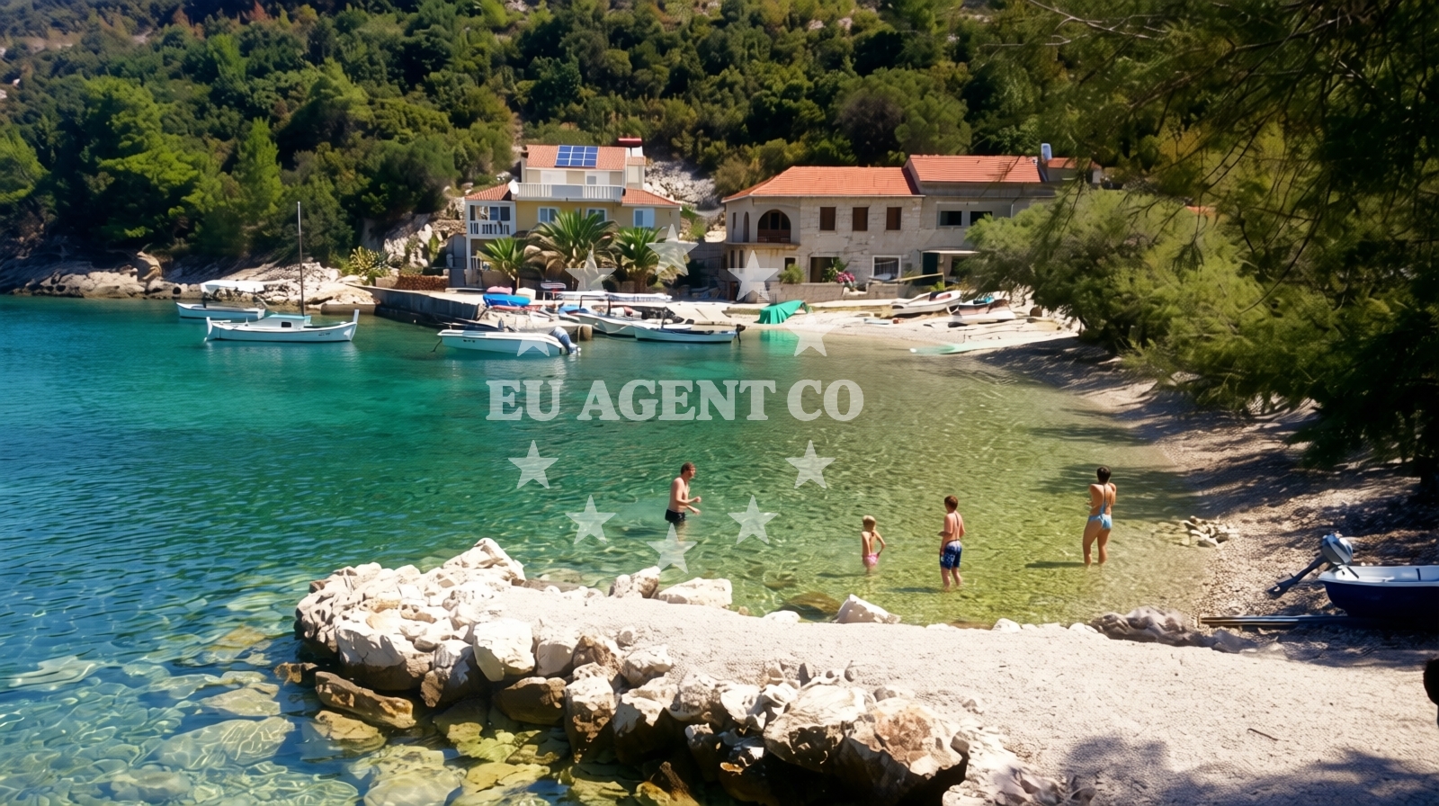
The beach's defining feature is its cove shape, sheltered by nearby hills that cast natural shade during the day. The predominant surface is concrete, which contrasts with the pebbled seabed extending into the water. Depth increases moderately, with no abrupt changes, making it suitable for cautious swimmers. The beach's small size and secluded location contribute to its appeal as a quiet retreat, though its limited dimensions may feel restrictive for larger groups.Swimming and shore
The sea floor consists of pebbles, which can make barefoot swimming uncomfortable. Depth increases gradually, with no sharp drops, though the moderate slope means swimmers should exercise caution near the shore. The absence of structured amenities like showers or changing rooms is noted in official records, aligning with visitor reports of minimal infrastructure.Facilities and activities
Official records indicate no structured amenities or facilities at Babina Beach. Visitor reviews also mention no permanent infrastructure such as parking, restrooms, or food services. The beach's character is defined by its natural setting rather than人工 developments.Access and location
Babina Beach is located in Blato, a coastal settlement on the island of Hvar. The coordinates (42.9682° N, 16.92885° E) place it near the southern coast of Hvar, with proximity to the town of Jelsa and the broader Adriatic sailing routes. Access is via local roads leading to Danca-Babina bb, though visitor reviews note its relative isolation from major tourist hubs.What visitors say
Visitors consistently describe Babina Beach as a peaceful, secluded spot. One reviewer noted it as 'a small hidden bay overlooking the island of Hvar, far from mass tourism,' while another called it 'very peaceful.' Despite official records citing 'very poor' cleanliness, no specific facilities or services were mentioned in reviews, suggesting the beach's natural state is preserved without artificial interventions.
Practical tips
Given the beach's 'very poor' cleanliness rating, visitors may wish to bring personal supplies. The absence of structured amenities means no showers, restrooms, or food services are available. The pebbled seabed may require water shoes for comfort. Parking options are not specified in official records, so local road access should be confirmed in advance.
Exploring the coast by yacht
Blato's location on the island of Hvar places Babina Beach within a popular sailing region of the Adriatic. Yacht charter guests exploring the Hvar coast may find the area's natural bays and coves appealing for anchoring or short excursions. While no specific marinas are mentioned for Babina Beach itself, the broader Hvar coastline offers several options for yacht berthing and fueling, accessible via nearby towns like Jelsa and Supetar.
Regional Context
Blato is part of the municipality of Hvar, known for its vineyards and coastal villages. The surrounding area includes the Hvar Town UNESCO-protected site and the Pakleni Islands, which are frequented by yachts. Babina Beach's isolation from major roads aligns with the region's emphasis on preserving natural landscapes over commercial development.
Anchorages in the surrounding area
Anchorages in nearby Korcula and Loviste.
- Anchorage — korcula — 0.0 NM from beach
- Rasoha — korcula — 0.8 NM from beach
- Anchorage — korcula — 2.9 NM from beach
- Anchorage — korcula — 3.3 NM from beach
- Anchorage — korcula — 3.9 NM from beach
- Anchorage — racisce — korcula — 4.0 NM from beach
- Anchorage — korcula — 4.1 NM from beach
- Anchorage — loviste — 4.5 NM from beach
Distances are straight-line geographic distances, not sailing routes.
Mooring buoys in the surrounding area
Mooring buoys in Loviste and Vela Luka.
- Jetty — loviste — 4.5 NM from beach
- Konoba Estravaganca buoys - Duba — konoba estravaganca buoys duba — loviste — 5.2 NM from beach
- Restaurant Korkyra xyz buoys — loviste — 5.6 NM from beach
- Jetty — loviste — 5.6 NM from beach
- Quay — vela luka — korcula — 7.6 NM from beach
Distances are straight-line geographic distances, not sailing routes.
Marine fuel stations
Marine fuel stations in Vela Luka, Korcula, and Lastovo.
- Ina — vela luka — korcula — 9.4 NM from beach
- Fuel station — korcula — 9.7 NM from beach
- Ina — ubli — lastovo — 14.2 NM from beach
- Ina — vrboska — hvar — 16.9 NM from beach
Distances are straight-line geographic distances, not sailing routes.
Harbours in the surrounding area
Harbours in Korcula and Loviste.
- Zavalatica — korcula — 3.3 NM from beach
- Račišće — racisce — korcula — 4.0 NM from beach
- Brna — korcula — 4.8 NM from beach
- Prigradica — korcula — 5.2 NM from beach
- Lovište — loviste — 5.6 NM from beach
- Viganj — 7.6 NM from beach
Distances are straight-line geographic distances, not sailing routes.
Marinas in the surrounding area
Marinas in Korcula, Vela Luka, Lastovo, and Hvar.
- ACI Marina Korčula — korcula — 9.1 NM from beach
- Marina Korkyra — vela luka — korcula — 9.5 NM from beach
- Marina Lumbarda — korcula — 11.0 NM from beach
- Marina Solitudo — lastovo — 13.1 NM from beach
- ACI Marina Vrboska — hvar — 16.9 NM from beach
Distances are straight-line geographic distances, not sailing routes.
Restaurants near the beach
Restaurants in Korcula.
- Vala — racisce — korcula — 4.0 NM from beach
- Restaurant — korcula — 4.0 NM from beach
- Konoba Mijo — korcula — 4.0 NM from beach
- Galeb — brna — korcula — 4.9 NM from beach
- Dragan — brna — korcula — 4.9 NM from beach
Distances are straight-line geographic distances, not sailing routes.
Navigation guides for the surrounding area
Navigation guides in Korcula.
- Uvala Zavalatica — 3.4 NM from beach
- Luka Racisce — 4.2 NM from beach
- Brna — 5.0 NM from beach
- Uvala Kneza — 5.3 NM from beach
- Uvala Prizba Mali — 7.0 NM from beach
Distances are straight-line geographic distances, not sailing routes.
Yachts from nearby departure bases
Yachts from Tučepi Port, Makarska Port, and Ploče City Port.
Sailing yachts
- Bavaria 40 Cruiser (LADY BUTTERFLY) — Tučepi Port — 18.6 NM from departure base to beach
- Elan 40 Impression (Karleta) — Ploče City Port — 22.7 NM from departure base to beach
- Sun Odyssey 349 (Porto Tolero) — Ploče City Port — 22.7 NM from departure base to beach
- Elan 514 Impression (Cesarica III) — Ploče City Port — 22.7 NM from departure base to beach
Catamarans
- Lagoon 450 Fly (Alba Mouse) — Ploče City Port — 22.7 NM from departure base to beach
Motor yachts
- Princess V53 (Chablis) — Makarska Port — 19.8 NM from departure base to beach
Motor boats
- Jeanneau NC 37 (Black Pearl) — Makarska Port — 19.8 NM from departure base to beach
- Galeon 430 Skydeck (BELLAGIO) — Makarska Port — 19.8 NM from departure base to beach
- Jeanneau NC 37 (Black Pearl) — Makarska Port — 19.8 NM from departure base to beach
- Galeon 430 Skydeck (Bellagio) — Makarska Port — 19.8 NM from departure base to beach
Distances are straight-line geographic distances, not sailing routes.
Frequently asked questions
Is Babina Beach suitable for families with young children?
The beach's pebbled seabed and limited facilities may make it less ideal for families with very young children, though its calm waters and shaded areas could appeal to older children and adults seeking tranquility.Are there nearby marinas for yacht charter guests?
While Babina Beach itself has no marinas, the nearby towns of Jelsa and Supetar on the island of Hvar offer several options for yacht berthing and fueling.Nearby beaches
Reviews
Great quiet place to have a nice vacation!loved it!
Nature at its best. zamek 42
very peaceful zerix maximuz
A small hidden bay overlooking the island of Hvar, far from mass tourism with a beautiful beach of super-clean sea. Valuable visit Dubrovnik-Neretva