Artina, Kali (Ugljan) Beach, Croatia
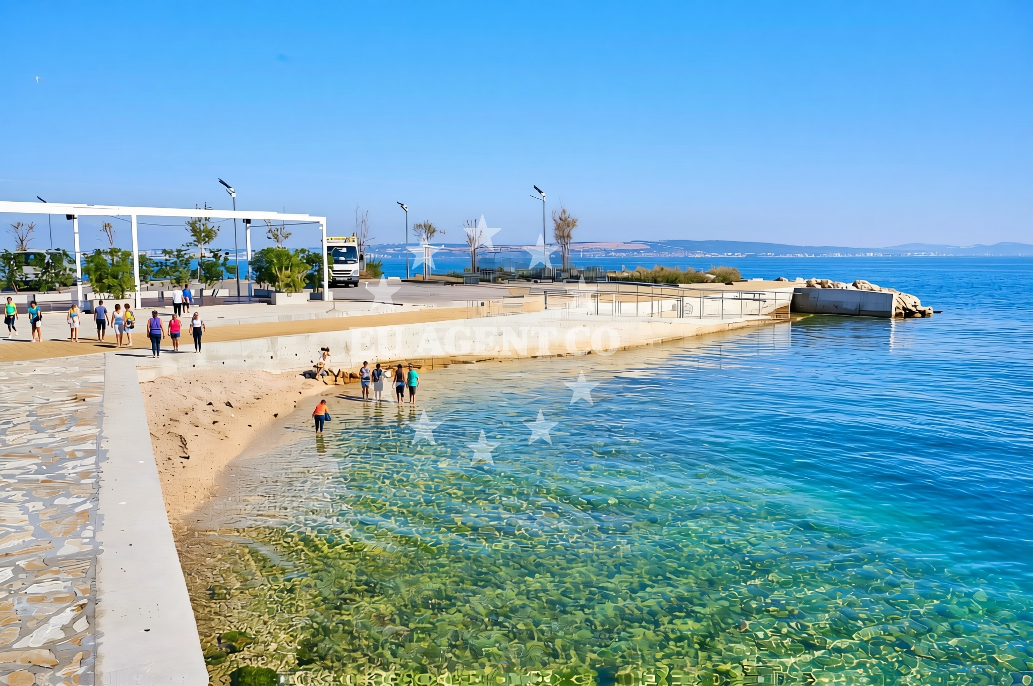
Artina, Kali (Ugljan) Beach lies on the southern coast of Ugljan Island, part of the Dalmatian archipelago in Croatia. This shoreline is characterized by its gravel and concrete/stone slabs, offering a unique texture for visitors to explore. The beach is accessible to people with disabilities, making it an inclusive destination. While the area lacks natural sandy shores, its proximity to local amenities and the broader Adriatic sailing network positions it as a practical stop for both beachgoers and yacht charter guests.
About this beach
Artina, Kali (Ugljan)
Beach: Artina
Location: Kali (Ugljan)
Characteristics and facilities
Gravel, concrete / stone slabs
Restaurant / snack bar
Caffe bar / Drinks stand
accessible
Access for people with disabilities
Beach character
The beach’s surface consists of gravel and concrete/stone slabs, a feature that distinguishes it from typical sandy shores. This composition may appeal to visitors seeking a more rugged coastal experience. The shoreline is flanked by the broader Ugljan Island landscape, which is known for its vineyards and olive groves. While the beach itself does not extend into a large cove or bay, its location on the island’s southern coast offers views of the open Adriatic Sea.
Swimming and shore
Swimming conditions at Artina, Kali (Ugljan) Beach are not explicitly detailed in the catalog, but the gravel and concrete shoreline suggest that the immediate water access may be limited to shallower areas. The beach’s character is more suited to leisurely walks along the shore or using the nearby facilities rather than extensive water activities. The absence of natural sand or rock formations means the beach is not ideal for snorkeling or diving, but it serves as a convenient access point for those exploring the surrounding coastline by foot or vehicle.
Facilities and activities
The beach includes a restaurant/snack bar and a café bar/drinks stand, providing basic refreshments for visitors. These facilities are accessible to people with disabilities, ensuring inclusivity. While no specific activities are listed in the catalog, the presence of a café and restaurant suggests the area is designed for short stays or as a pit stop during longer excursions. The beach does not appear to host organized events or rental services, focusing instead on passive recreation.
Access and location
Artina, Kali (Ugljan) Beach is located on Ugljan Island, which is part of the Split-Dalmatia County in Croatia. The island is connected to the mainland via a bridge near the village of Supetar, making it accessible by car or public transport. Visitors arriving by yacht may find anchorage opportunities in nearby bays on Ugljan, though specific marinas or docking facilities are not highlighted for this beach. The beach’s accessibility for people with disabilities indicates that local infrastructure supports mobility, though detailed parking or road access information is not provided in the catalog.
What to expect
Artina, Kali (Ugljan) Beach offers a straightforward coastal experience with its gravel and concrete shoreline. Visitors can expect basic facilities such as a café and restaurant, making it suitable for short stays or as a midpoint during longer trips. The beach’s accessibility for people with disabilities is a notable feature, though the lack of natural sand or rock formations means it is not ideal for water-based activities. The surrounding Ugljan Island provides a backdrop of vineyards and olive groves, adding to the area’s agricultural character. For those interested in sailing, the nearby Adriatic routes and proximity to Split make this beach a potential stop for yacht charter guests exploring the region.
Practical tips
Visitors should consider the gravel and concrete surface when planning footwear, as it may be less comfortable for prolonged walking. The café and restaurant are available for refreshments, but it is advisable to confirm operating hours if planning to visit during specific times. Given the beach’s location on Ugljan Island, arriving by car or yacht is recommended for convenience, though local transport options may be limited.
Exploring the coast by yacht
The broader Adriatic sailing routes, particularly those connecting Split to the islands of Hvar and Brač, pass near Ugljan. Yacht charter guests may find this beach a convenient stop for fueling, dining, or exploring the island’s vineyards. While the beach itself does not host marinas, nearby anchorages on Ugljan offer safe mooring options for motor yachts and sailboats. The area’s proximity to Split and the Dalmatian coast makes it a strategic point for longer sailing itineraries.
Cultural and Regional Context
Ugljan Island is historically significant for its role in Croatian winemaking, particularly the production of the Plavac Mali grape. The island’s landscape is dominated by vineyards and olive groves, which contrast with the coastal gravel beaches. Visitors interested in local culture may explore nearby villages such as Supetar, known for its traditional architecture and seafood restaurants. The island’s connection to the Adriatic sailing routes has made it a popular destination for both leisure and commercial maritime traffic.
Anchorages in the surrounding area
Anchorages near Artina, Kali (Ugljan) Beach include locations in Kali and Kukljica on Ugljan, as well as areas in Zadar and Iz.
- Anchorage — kali — ugljan — 0.9 NM from beach
- Anchorage — kukljica — ugljan — 2.7 NM from beach
- Anchorage — kukljica — ugljan — 3.0 NM from beach
- Anchorage — iz mali — 3.6 NM from beach
- Anchorage — zadar — 3.9 NM from beach
- Puntamika — zadar — 4.3 NM from beach
- Anchorage — ugljan — 4.3 NM from beach
- Anchorage — ugljan — 4.6 NM from beach
Distances are straight-line geographic distances, not sailing routes.
Mooring buoys in the surrounding area
- Ošljak — osljak — 0.8 NM from beach
- Buoy — kali — ugljan — 0.9 NM from beach
- Buoy field — kukljica — ugljan — 3.2 NM from beach
- Mali Ždrelac — zdrelac — pasman — 3.5 NM from beach
- Buoy field — iz — 3.7 NM from beach
Distances are straight-line geographic distances, not sailing routes.
Marine fuel stations
Marine fuel stations in the vicinity include locations in Preko and Zadar, as well as Sukosan and Dugi Otok.
- Ina — preko — ugljan — 1.1 NM from beach
- Ina — zadar — 3.4 NM from beach
- Fuel station — sukosan — 3.8 NM from beach
- Ina — zaglav — dugi otok — 7.4 NM from beach
Distances are straight-line geographic distances, not sailing routes.
Harbours in the surrounding area
Harbours near Artina, Kali (Ugljan) Beach include Batalaža and Poljana on Ugljan, as well as Gaženica and Sutomišćica.
- Batalaža — kali — ugljan — 0.1 NM from beach
- Batalaža — kali — ugljan — 0.1 NM from beach
- Vela Lamjana — kali — ugljan — 1.1 NM from beach
- Poljana — ugljan — 2.1 NM from beach
- Gaženica — gazenica — zadar — 2.7 NM from beach
- Sutomišćica — sutomiscica — ugljan — 2.8 NM from beach
Distances are straight-line geographic distances, not sailing routes.
Marinas in the surrounding area
Marinas in the surrounding area include Marina Preko and Kukljica on Ugljan, as well as Marina Zadar and Vitrenjak Zadar.
- Marina Preko — ugljan — 1.4 NM from beach
- Kukljica — ugljan — 2.4 NM from beach
- Olive Island Marina — sutomiscica — ugljan — 2.6 NM from beach
- Marina Zadar — 3.4 NM from beach
- Vitrenjak Zadar — 3.8 NM from beach
Distances are straight-line geographic distances, not sailing routes.
Restaurants near the beach
Restaurants near Artina, Kali (Ugljan) Beach are located in Preko, offering various dining options.
- Pazifik — preko — ugljan — 1.1 NM from beach
- Petrina — preko — ugljan — 1.2 NM from beach
- Barbara — preko — ugljan — 1.3 NM from beach
- Jardin — preko — ugljan — 1.4 NM from beach
- Dominik — preko — ugljan — 1.4 NM from beach
- Taverna Joso — preko — ugljan — 1.5 NM from beach
- Roko Konoba & Grill — preko — ugljan — 1.5 NM from beach
Distances are straight-line geographic distances, not sailing routes.
Navigation guides for the surrounding area
Navigation guides for the surrounding area include references to Kali, Uvala Lamjana, and Marina Maslina.
- Kali — 0.2 NM from beach
- Uvala Lamjana Mala — 1.0 NM from beach
- Uvala Lamjana Vela — 1.4 NM from beach
- Marina (Marina Maslina) — 2.6 NM from beach
- Lukoran Veli — 3.5 NM from beach
Distances are straight-line geographic distances, not sailing routes.
Yachts from nearby departure bases
Sailing yachts
- Elan Impression 40 (Val) — Ugljan Sutomišćica Olive Island — 2.6 NM from departure base to beach
- Bavaria Cruiser 37 (Matija) — Zadar Marina — 3.4 NM from departure base to beach
- Bavaria 37 Cruiser (Rita) — Zadar Marina — 3.4 NM from departure base to beach
Catamarans
- Delta F40-XT (Veronchie) — Zadar Marina — 3.4 NM from departure base to beach
- Bali 4.6 (Jako 2) — Zadar Marina — 3.4 NM from departure base to beach
Motor yachts
- Bluegame BG74 (Kimani) — Zadar Port — 3.3 NM from departure base to beach
Gulets / Cruisers
- Gulet (Dolin) — Zadar Port — 3.3 NM from departure base to beach
Motor boats
- Quicksilver Activ 905 (Galeb) — Ugljan Sutomišćica Olive — 2.6 NM from departure base to beach
- Passport 430 cabin (Tijat) — Zadar Port — 3.3 NM from departure base to beach
- Tempest 600 (CAPELLI) — Zadar Marina — 3.4 NM from departure base to beach
Distances are straight-line geographic distances, not sailing routes.