Artina istok, Lokva Rogoznica Beach: A Gravel Shore with Coastal Amenities in Croatia
About this beach
Artina istok, Lokva Rogoznica
Beach: Artina istok
Location: Lokva Rogoznica
Characteristics and facilities
Gravel
160 m
Restaurant / snack bar
Caffe bar / Drinks stand
Natural shade
shower
Beach character
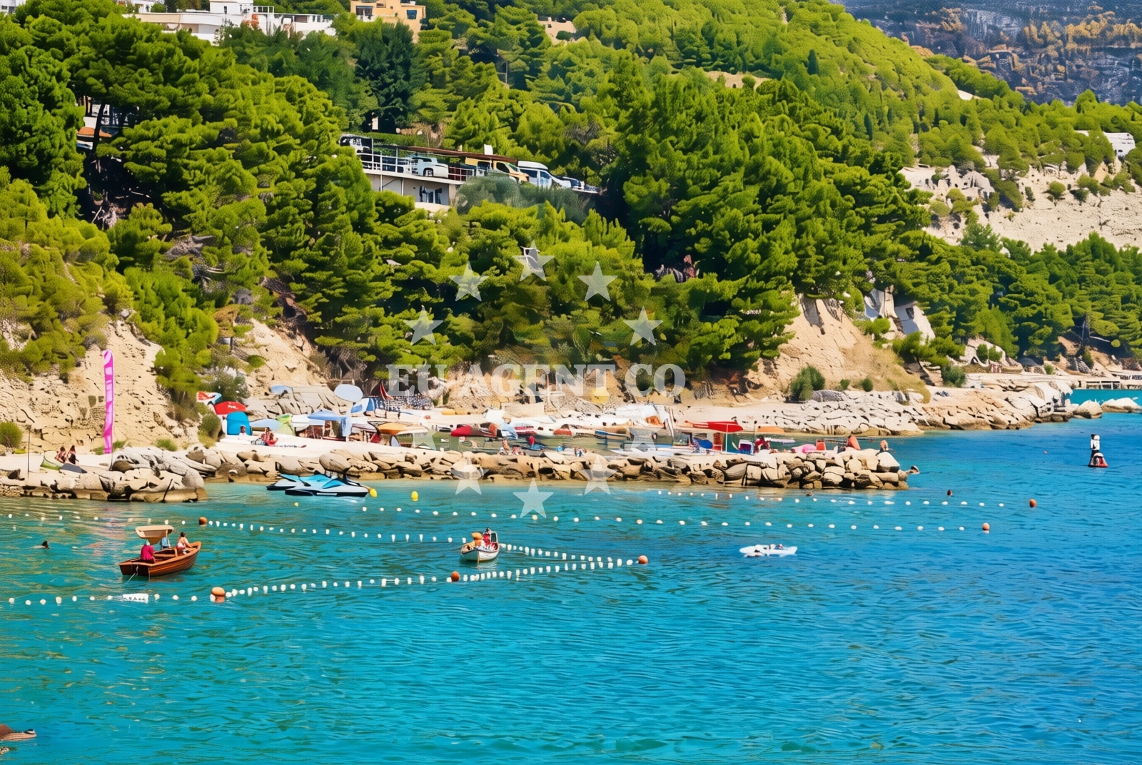
The beach is composed of gravel, offering a unique texture for visitors to walk along its 160-meter length. Natural shade is available, providing relief from the sun, while the adjacent shower facility ensures convenience for beachgoers. The gravel substrate may influence swimming conditions, making it more suitable for casual wading than for swimming. The beach’s proximity to Lokva Rogoznica, a small coastal settlement, connects it to the broader cultural and historical context of the region.Swimming and shore
Swimming conditions at Artina istok, Lokva Rogoznica Beach are influenced by the gravel composition of the shore. While the beach is not ideal for deep-water swimming, the shallow, gravelly seabed allows for wading and short swims. The natural shade and nearby shower facility enhance the visitor experience, making it a practical spot for relaxation and light aquatic activities.Facilities and activities
The beach offers a restaurant/snack bar and a café bar/drinks stand, catering to visitors seeking refreshments. Natural shade is provided by the surrounding landscape, and a shower facility is available for hygiene. While no specific recreational activities are listed, the beach’s amenities support casual relaxation, dining, and socializing. The absence of structured activities makes it a quiet spot for those seeking unobtrusive coastal time.Access and location
Artina istok, Lokva Rogoznica Beach is located in the coastal area of Lokva Rogoznica, Croatia, part of the broader Adriatic coastline. Its position near the town of Rogoznica places it within reach of local amenities, historical sites, and other beaches in the region. The area is accessible by road, connecting it to nearby settlements and the wider Dalmatian coast, which is a popular hub for yacht charter travelers.What to expect
Visitors to Artina istok, Lokva Rogoznica Beach can expect a gravel shore with a 160-meter length, complemented by a restaurant/snack bar and a café bar/drinks stand. Natural shade and a shower facility are available, ensuring comfort for beachgoers. The beach’s location in Lokva Rogoznica connects it to the surrounding Adriatic region, which is known for its scenic coastal routes and yacht charter opportunities. While the gravel substrate may limit swimming, the area is ideal for relaxation and casual exploration of the coastline.Practical tips
Bring a towel for the gravel shore to ensure comfort. Utilize the shower facility for hygiene after a day at the beach. The nearby restaurant and café offer convenient dining options. Given the gravel texture, swimming may be limited to shallow areas.Exploring the coast by yacht
The Adriatic coastline near Lokva Rogoznica is a well-traveled route for yacht charter guests, with marinas and anchorages available in nearby towns such as Rogoznica and Supetar. Artina istok’s proximity to these sailing hubs makes it a convenient stop for those exploring the region by boat. Charterers may find the beach a useful reference point when navigating the southern Adriatic, though it is not designated as an anchorage or marina.Cultural and Regional Context
Lokva Rogoznica is part of the Šibenik-Knin County in Croatia, an area rich in history and natural beauty. The region is known for its medieval fortresses, such as the Krka National Park and the town of Šibenik, a UNESCO World Heritage site. The Adriatic Sea’s clear waters and coastal villages make it a popular destination for both tourists and yacht charterers.Anchorages in the surrounding area
Anchorages near Povlja on Brac, including Tri luke and several others.
- Tri luke — povlja — brac — 4.1 NM from beach
- Anchorage — povlja — brac — 4.4 NM from beach
- Anchorage — povlja — brac — 4.5 NM from beach
- Anchorage — povlja — brac — 4.5 NM from beach
- Anchorage — povlja — brac — 4.6 NM from beach
- Anchorage — povlja — brac — 4.7 NM from beach
- Anchorage — povlja — brac — 4.9 NM from beach
- Anchorage — povlja — brac — 4.9 NM from beach
Distances are straight-line geographic distances, not sailing routes.
Mooring buoys in the surrounding area
Mooring buoys and jetties near Povlja and Postira on Brac, such as Restaurant Pipo buoys and Konoba Rojen jetty.
- Restaurant Pipo buoys — povlja — brac — 4.0 NM from beach
- Restaurant Pipo jetty — povlja — brac — 4.1 NM from beach
- Konoba Rojen jetty — povlja — brac — 4.1 NM from beach
- Quay — postira — brac — 5.0 NM from beach
- Baško Polje — basko polje — baska voda — 8.4 NM from beach
Distances are straight-line geographic distances, not sailing routes.
Marine fuel stations
Marine fuel stations in Sumartin, Bol, Ina (Makarska), and Ina (Vrboska, Hvar).
- Fuel station — sumartin — brac — 8.0 NM from beach
- Fuel station — bol — brac — 10.4 NM from beach
- Ina — makarska — 12.2 NM from beach
- Ina — vrboska — hvar — 14.4 NM from beach
Distances are straight-line geographic distances, not sailing routes.
Harbours in the surrounding area
Harbours in Mimice, Pisak, Pučišća, Omiš, Stomarica, and Dugi Rat in Central Dalmatia.
- Mimice — 1.1 NM from beach
- Pisak — 3.4 NM from beach
- Pučišća harbour — pucisca — brac — 4.1 NM from beach
- Omiš — omis — 4.4 NM from beach
- Stomarica — 5.9 NM from beach
- Dugi Rat — 6.6 NM from beach
Distances are straight-line geographic distances, not sailing routes.
Marinas in the surrounding area
Marinas in Baska Voda, Kravavica, Podstrana, Vrboska (Hvar), and Tučepi in Central Dalmatia.
- Marina Baška Voda — marina baska voda — 7.8 NM from beach
- Marina Ramova — krvavica — 10.0 NM from beach
- Marina Lav — podstrana — 11.8 NM from beach
- ACI Marina Vrboska — hvar — 14.4 NM from beach
- Marina Tučepi — marina tucepi — 14.8 NM from beach
Distances are straight-line geographic distances, not sailing routes.
Restaurants near the beach
Restaurants in Povlja and Omiš on Brac, such as Hideaway Pipo, Pizzeria Marin, and Konoba Milo.
- Hideaway Pipo — povlja — brac — 4.1 NM from beach
- Pizzeria Marin — pucisca — brac — 4.1 NM from beach
- Lado — pucisca — brac — 4.2 NM from beach
- Konoba Rojen — povlja — brac — 4.2 NM from beach
- Konoba Milo — omis — 4.5 NM from beach
- Kala — povlja — brac — 5.0 NM from beach
Distances are straight-line geographic distances, not sailing routes.
Navigation guides for the surrounding area
Navigation guides for nearby areas including Mi mice, Pucisca, Uvala Luka, Omis, and Dugi Rat.
- Mi mice — 1.3 NM from beach
- Pucisca — 3.9 NM from beach
- Uvala Luka — 4.1 NM from beach
- Omis — 4.1 NM from beach
- Dugi Rat (Uvala Orisac) — 6.4 NM from beach
Distances are straight-line geographic distances, not sailing routes.
Yachts from nearby departure bases
Yachts departing from Omiš City Port, Sumpetar Port, and Baška Voda Port, offering various types including gulets, catamarans, and sail boats.
Sailing yachts
- Elan Impression 40 (KARLETA) — Baška Voda Port — 7.7 NM from departure base to beach
- Oceanis 43 (BLACK SHEEP) — Baška Voda — 7.8 NM from departure base to beach
Catamarans
- Lagoon 450 Fly (Falco) — Sumpetar Port — 7.3 NM from departure base to beach
- Lagoon 450 (LAMANTIN) — Baška Voda — 7.8 NM from departure base to beach
Gulets / Cruisers
- Gulet (Primorac) — Omiš City Port — 4.4 NM from departure base to beach
- Gulet (Trebenna) — Omiš City Port — 4.4 NM from departure base to beach
- Gulet (PATRONICE) — Omiš City Port — 4.5 NM from departure base to beach
- Gulet (Altair) — Sumpetar Port — 7.3 NM from departure base to beach
- Gulet (Cataleya) — Sumpetar Port — 7.3 NM from departure base to beach
Motor boats
- Pearl Sea 31 Hard Top (Aero) — Baška Voda Port — 7.7 NM from departure base to beach
Distances are straight-line geographic distances, not sailing routes.