Ante Beach, Croatia
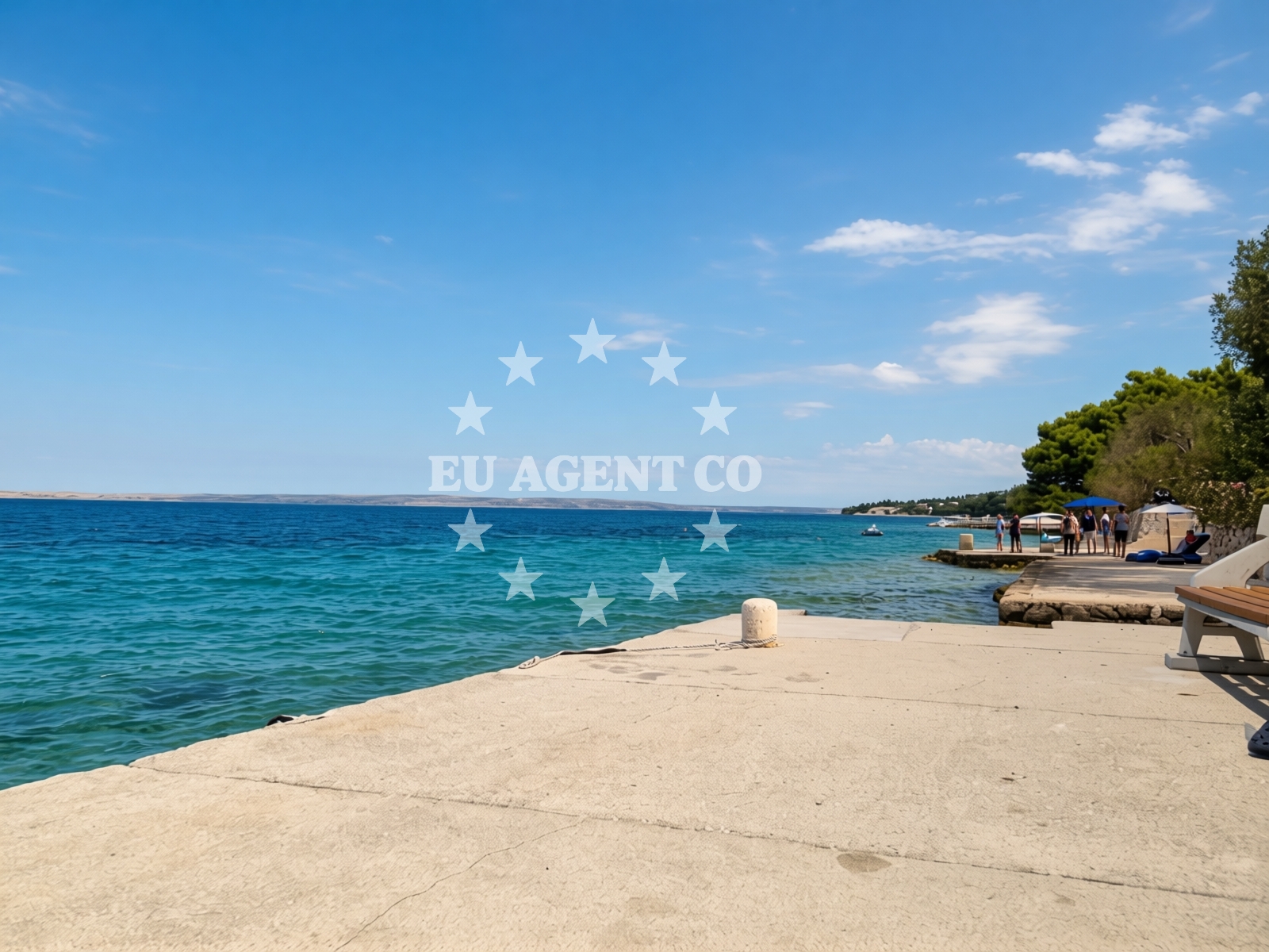
Beach character
The beach's linear shape and uniform width create a straightforward layout, suitable for group activities and casual relaxation. The concrete surface, while not sandy, provides a stable environment for sunbathing and equipment placement. Natural shade is available along parts of the shore, though visitors should note that this may be limited to specific areas. The beach's depth increases gradually, which aligns with its designation for water-based recreation.Swimming and shore
The moderate depth increase allows for safe swimming conditions, though the concrete surface may affect the overall experience of wading into the water. The beach's orientation and surrounding geography suggest exposure to open sea conditions, which could influence wave patterns during peak seasons. The absence of structured amenities means visitors should bring personal items for comfort.Facilities and activities
Ante Beach is equipped for camping travelers, with an explicitly mentioned 'equipped camping area' in the beach's audience notes. This suggests the presence of designated spaces for tents or caravans. The beach supports activities such as stand-up paddleboarding (SUP), surfing, and general water entertainment. These options align with the beach's recreational focus and the physical characteristics of its shoreline.Access and location
Situated at Kopovine 7 in Tribanj-Krušćica, the beach is positioned within a coastal settlement that serves as a gateway to the broader Dalmatian coast. The coordinates (44.34435°N, 15.32811°E) place it near key maritime routes, though specific transportation infrastructure details are not provided in the catalog. The beach's location implies proximity to local roads and potential connections to nearby towns such as Supetar or Bol on the island of Brač.What to expect
Ante Beach is explicitly recommended for camping travelers, leisure seekers, and those interested in water-based recreation. The equipped camping area suggests the beach accommodates overnight stays, though no details are provided about facilities such as electricity, waste disposal, or shelter. The beach's high season crowd index indicates it may become densely populated during peak months, requiring visitors to plan accordingly. The good cleanliness index suggests maintenance efforts are in place, though the absence of structured amenities means personal responsibility for hygiene.Practical tips
Visitors should consider the concrete surface when planning sunbathing or relaxation, as it may retain heat differently than sandy beaches. The equipped camping area implies basic infrastructure for overnight stays, but additional needs such as shade or seating should be brought personally. Given the beach's recreational focus, those participating in SUP or surfing should check local conditions for safety.Exploring the coast by yacht
Ante Beach's location in Tribanj-Krušćica places it within the sailing routes of the Dalmatian coast, a region known for its clear waters and scenic islands. Yacht charter guests exploring the area may find the beach a convenient stop for relaxation or as a base for day trips to nearby islands such as Brač or Hvar. The absence of specific marina details means visitors should consult Euro-Agent's yacht search page for available docking options in the region.Regional Context
Tribanj-Krušćica is part of the municipality of Supetar on the island of Brač, a region renowned for its limestone landscapes and historic villages. The beach's proximity to Supetar's main town suggests access to local services, restaurants, and cultural sites. The Dalmatian coast's sailing infrastructure, including marinas in Bol and Split, provides options for yacht charter guests seeking to explore the area.Anchorages in the surrounding area
Anchorages in the surrounding area, including Tribanj and Rtina, offer nearby options for mooring near Ante Beach.
- Anchorage — tribanj — 2.0 NM from beach
- Anchorage — rtina — 3.5 NM from beach
- Anchorage — rtina — 4.0 NM from beach
- Anchorage — vlasici — pag — 5.1 NM from beach
- Anchorage — ljubac — 5.5 NM from beach
- Dinjiška — dinjiska — pag — 5.7 NM from beach
- Anchorage — ljubac — 5.8 NM from beach
- Anchorage — smokvica — 6.2 NM from beach
Distances are straight-line geographic distances, not sailing routes.
Mooring buoys in the surrounding area
Mooring buoys in the surrounding area, such as Sibuljina Point, are located near Ante Beach.
- Šibuljina Point — sibuljina point — 0.7 NM from beach
- Jetty — ljubac — 5.3 NM from beach
- Vir — 10.8 NM from beach
- Punta Skala — petrcane — 12.0 NM from beach
- Jetty — zadar — 13.8 NM from beach
Distances are straight-line geographic distances, not sailing routes.
Marine fuel stations
Marine fuel stations in Zadar and other nearby locations provide refueling options for vessels traveling to Ante Beach.
- Ina — zadar — 14.3 NM from beach
- Ina — preko — ugljan — 17.1 NM from beach
- Fuel station — sukosan — 17.5 NM from beach
- Ina — biograd na moru — 24.8 NM from beach
Distances are straight-line geographic distances, not sailing routes.
Harbours in the surrounding area
- Ražanac — razanac — 3.7 NM from beach
- Miškovići — miskovici — pag — 4.4 NM from beach
- Starigrad Paklenica — 5.6 NM from beach
- Mulo — nin — 7.2 NM from beach
- Seline — 7.5 NM from beach
- Vinjerac — 7.8 NM from beach
Distances are straight-line geographic distances, not sailing routes.
Marinas in the surrounding area
- Marina Borik — zadar — 13.8 NM from beach
- Vitrenjak Zadar — 13.9 NM from beach
- Marina Zadar — 14.2 NM from beach
- Olive Island Marina — sutomiscica — ugljan — 16.4 NM from beach
- Marina Preko — ugljan — 16.9 NM from beach
Distances are straight-line geographic distances, not sailing routes.
Navigation guides for the surrounding area
Navigation guides for the surrounding area, including KrusCica and Starigrad-Paklenica, assist in planning routes to Ante Beach.
- KrusCica and Uvala KrusCica Duboka — 0.4 NM from beach
- VELESITSKI KANAL (S) — 2.2 NM from beach
- Starigrad-Paklenica {Velebitski Kanai) — 5.8 NM from beach
- OTOK PAG — 9.2 NM from beach
- Privlaka — 10.1 NM from beach
Distances are straight-line geographic distances, not sailing routes.
Yachts from nearby departure bases
Sailing yachts
- Bavaria C42 (Dna) — Zadar Marina Borik — 13.8 NM from departure base to beach
Catamarans
- Sunreef 60 (SINATA) — Zadar Marina Borik — 13.8 NM from departure base to beach
Motor yachts
- Prestige 550 Fly (Floria) — Zadar Marina Borik — 13.8 NM from departure base to beach
Motor boats
- Merry Fisher 895 — Povljana Marina — 9.6 NM from departure base to beach
- Rancraft RS Cinque.5 — Zadar Diklo Port — 12.7 NM from departure base to beach
- Rancraft RM21 (Dugi otok) — Zadar Diklo Port — 12.7 NM from departure base to beach
- Rancraft RM19 (Daycruiser) — Zadar Diklo Port — 12.7 NM from departure base to beach
- BWA Sport 22GT (BWA ) — Pag City Port — 13.2 NM from departure base to beach
- Merry Fisher 795 () — Novigrad Dalmatia — 13.6 NM from departure base to beach
- Merry Fisher 795 (Jura 3212ZD) — Zadar Marina Borik — 13.8 NM from departure base to beach
Distances are straight-line geographic distances, not sailing routes.